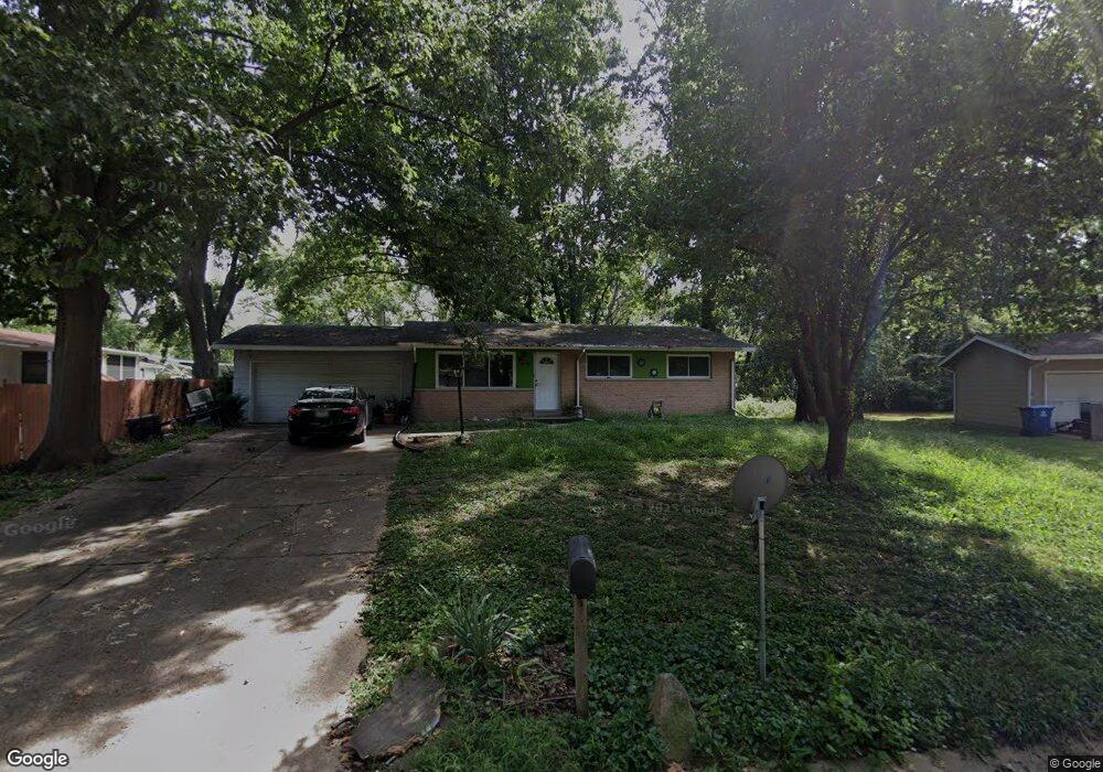
11607 Hannibal Dr Saint Louis, MO 63138
Estimated Value: $101,000 - $156,000
3
Beds
2
Baths
1,000
Sq Ft
$121/Sq Ft
Est. Value
About This Home
This home is located at 11607 Hannibal Dr, Saint Louis, MO 63138 and is currently estimated at $120,840, approximately $120 per square foot. 11607 Hannibal Dr is a home located in St. Louis County with nearby schools including Larimore Elementary School, Southeast Middle School, and Hazelwood East High School.
Ownership History
Date
Name
Owned For
Owner Type
Purchase Details
Closed on
Mar 17, 2008
Sold by
Wells Fargo Bank Na
Bought by
Smith Mary H
Current Estimated Value
Purchase Details
Closed on
Jan 4, 2008
Sold by
Jones William P
Bought by
Wells Fargo Bank Na and Mlmi Trust Series 2005-Ff6
Purchase Details
Closed on
Jul 15, 1997
Sold by
Bollinger Eleanor M and Bollinger Brenda
Bought by
Jones William P
Home Financials for this Owner
Home Financials are based on the most recent Mortgage that was taken out on this home.
Original Mortgage
$53,250
Interest Rate
7.72%
Create a Home Valuation Report for This Property
The Home Valuation Report is an in-depth analysis detailing your home's value as well as a comparison with similar homes in the area
Home Values in the Area
Average Home Value in this Area
Purchase History
| Date | Buyer | Sale Price | Title Company |
|---|---|---|---|
| Smith Mary H | $67,000 | Mokan Title | |
| Wells Fargo Bank Na | $52,500 | None Available | |
| Jones William P | -- | -- |
Source: Public Records
Mortgage History
| Date | Status | Borrower | Loan Amount |
|---|---|---|---|
| Previous Owner | Jones William P | $53,250 | |
| Closed | Jones William P | $10,725 |
Source: Public Records
Tax History Compared to Growth
Tax History
| Year | Tax Paid | Tax Assessment Tax Assessment Total Assessment is a certain percentage of the fair market value that is determined by local assessors to be the total taxable value of land and additions on the property. | Land | Improvement |
|---|---|---|---|---|
| 2025 | $1,556 | $23,080 | $2,960 | $20,120 |
| 2024 | $1,556 | $16,310 | $2,530 | $13,780 |
| 2023 | $1,556 | $16,310 | $2,530 | $13,780 |
| 2022 | $1,278 | $11,990 | $2,110 | $9,880 |
| 2021 | $1,259 | $11,990 | $2,110 | $9,880 |
| 2020 | $1,272 | $11,250 | $1,370 | $9,880 |
| 2019 | $1,219 | $11,250 | $1,370 | $9,880 |
| 2018 | $1,258 | $10,690 | $1,080 | $9,610 |
| 2017 | $1,253 | $10,690 | $1,080 | $9,610 |
| 2016 | $1,292 | $10,880 | $2,220 | $8,660 |
| 2015 | $1,266 | $10,880 | $2,220 | $8,660 |
| 2014 | $1,381 | $11,840 | $1,940 | $9,900 |
Source: Public Records
Map
Nearby Homes
- 11668 Herefordshire Dr
- 1139 Congress Ave
- 1201 Baron Ave
- 1162 Prigge Ave
- 931 Prigge Rd
- 1222 Scott Ave
- 1221 Scott Ave
- 1239 Congress Ave
- 1113 Walker Ave
- 1165 June Ave
- 1311 Claudine Dr
- 1149 Reale Ave
- 1136 Cove Ln
- 1219 Walker Ave
- 11642 Petite Chalet Dr
- 1223 Walker Ave
- 1135 Cove Ln
- 1209 Cove Ln
- 11823 Larimore Rd
- 1216 Redman Blvd
- 11571 Herefordshire Dr
- 11611 Hannibal Dr
- 11565 Herefordshire Dr
- 11559 Herefordshire Dr
- 11600 Hannibal Dr
- 11615 Hannibal Dr
- 11614 Hannibal Dr
- 11619 Hannibal Dr
- 11570 Herefordshire Dr
- 1039 Coal Bank Rd
- 1033 Coal Bank Rd
- 11576 Herefordshire Dr
- 11564 Herefordshire Dr
- 11551 Herefordshire Dr
- 11611 Herefordshire Dr
- 11600 Herefordshire Dr
- 1047 Coal Bank Rd
- 11626 Hannibal Dr
- 11558 Herefordshire Dr
- 11625 Hannibal Dr