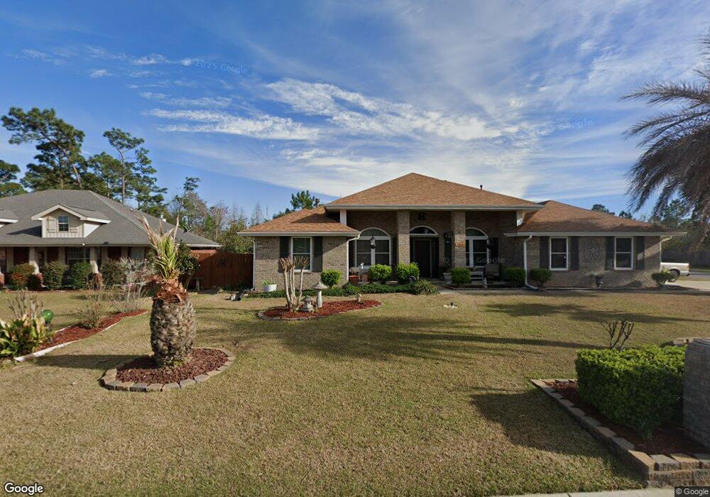
11616 Aruba Dr Pensacola, FL 32506
Southwest Pensacola NeighborhoodEstimated Value: $317,436 - $381,000
--
Bed
1
Bath
2,160
Sq Ft
$166/Sq Ft
Est. Value
About This Home
This home is located at 11616 Aruba Dr, Pensacola, FL 32506 and is currently estimated at $358,609, approximately $166 per square foot. 11616 Aruba Dr is a home located in Escambia County with nearby schools including Blue Angels Elementary School, Jim C. Bailey Middle School, and Escambia High School.
Ownership History
Date
Name
Owned For
Owner Type
Purchase Details
Closed on
Oct 19, 2007
Sold by
Adams Homes Of Northwest Florida Inc
Bought by
Hall Frederick H and Hall Jacquelyn F
Current Estimated Value
Home Financials for this Owner
Home Financials are based on the most recent Mortgage that was taken out on this home.
Original Mortgage
$229,480
Outstanding Balance
$144,459
Interest Rate
6.37%
Mortgage Type
VA
Estimated Equity
$214,150
Create a Home Valuation Report for This Property
The Home Valuation Report is an in-depth analysis detailing your home's value as well as a comparison with similar homes in the area
Home Values in the Area
Average Home Value in this Area
Purchase History
| Date | Buyer | Sale Price | Title Company |
|---|---|---|---|
| Hall Frederick H | $222,200 | None Available |
Source: Public Records
Mortgage History
| Date | Status | Borrower | Loan Amount |
|---|---|---|---|
| Open | Hall Frederick H | $229,480 |
Source: Public Records
Tax History Compared to Growth
Tax History
| Year | Tax Paid | Tax Assessment Tax Assessment Total Assessment is a certain percentage of the fair market value that is determined by local assessors to be the total taxable value of land and additions on the property. | Land | Improvement |
|---|---|---|---|---|
| 2024 | $1,660 | $154,605 | -- | -- |
| 2023 | $1,660 | $150,102 | $0 | $0 |
| 2022 | $1,621 | $145,731 | $0 | $0 |
| 2021 | $1,611 | $141,487 | $0 | $0 |
| 2020 | $1,563 | $139,534 | $0 | $0 |
| 2019 | $1,531 | $136,397 | $0 | $0 |
| 2018 | $1,527 | $133,854 | $0 | $0 |
| 2017 | $1,521 | $131,101 | $0 | $0 |
| 2016 | $1,502 | $128,405 | $0 | $0 |
| 2015 | $1,487 | $127,513 | $0 | $0 |
| 2014 | $1,478 | $126,501 | $0 | $0 |
Source: Public Records
Map
Nearby Homes
- 11605 Aruba Dr
- 11663 Aruba Dr
- 10703 Brook Bend Rd
- 1203 Brook Bend Rd
- 10703 Brook Bend Cir
- 11388 Aruba Dr
- 10860 Silver Creek Dr
- 730 Hanna's Terrace
- 7934 Castle Pointe Way
- 7934 Castle Pt Way
- 7985 Otis Way
- 9049 Bluebay Ln
- 10104 Clearsound Dr
- 709 Jester Ct
- 9013 Bluebay Ln
- 10728 Silver Creek Dr
- 10663 Silver Creek Dr
- 4007 Lochmoor Dr
- 10679 Heatherwood Dr
- 493 Herron Villa Ln
- 11622 Aruba Dr
- 11610 Aruba Dr
- 11617 Aruba Dr
- 11628 Aruba Dr
- 11623 Aruba Dr
- 11611 Aruba Dr
- 11604 Aruba Dr
- 1208 Benning Place
- 11634 Aruba Dr
- 11653 Aruba Dr
- 1305 Pine Hill Cir
- 1307 Pine Hill Cir
- 1220 Brook Bend Rd
- 11671 Aruba Dr
- 11675 Aruba Dr
- 1225 Brook Bend Rd
- 11597 Aruba Dr
- 11598 Aruba Dr
- 1212 Benning Place
- 11683 Aruba Dr