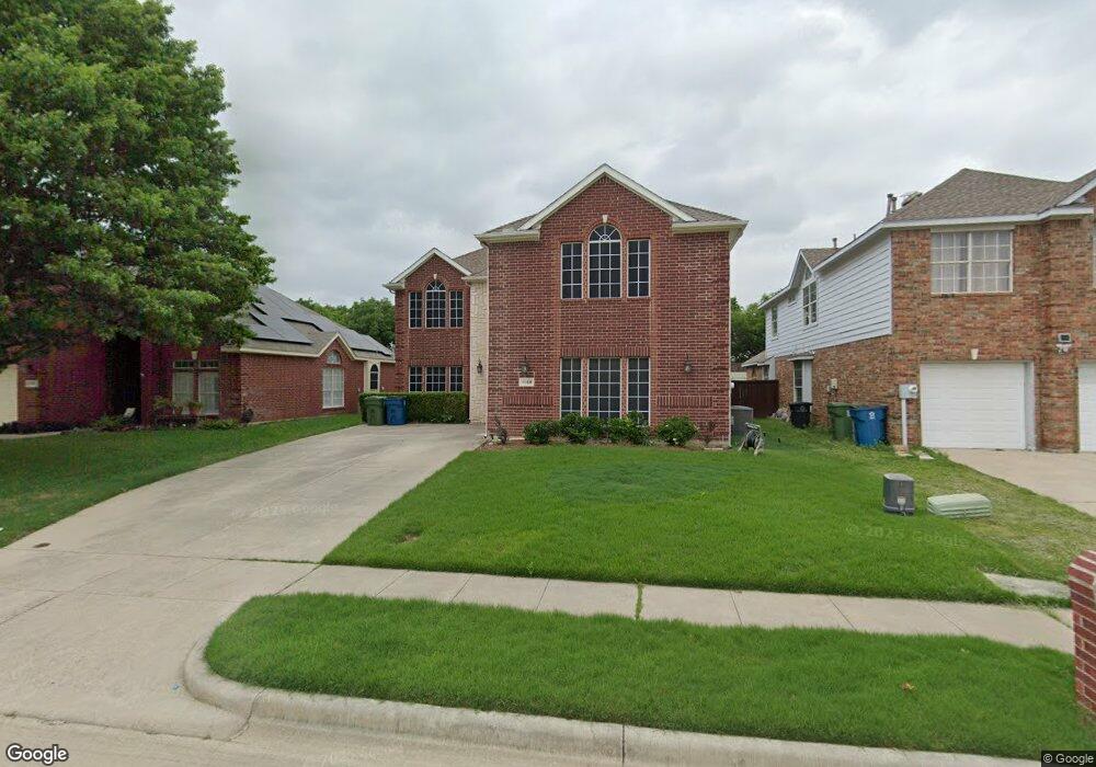
1169 Tanner Dr Lewisville, TX 75077
Valley Ridge NeighborhoodEstimated Value: $467,000 - $532,000
3
Beds
2
Baths
2,832
Sq Ft
$175/Sq Ft
Est. Value
About This Home
This home is located at 1169 Tanner Dr, Lewisville, TX 75077 and is currently estimated at $494,518, approximately $174 per square foot. 1169 Tanner Dr is a home located in Denton County with nearby schools including Degan Elementary School, Huffines Middle School, and Lewisville High School.
Ownership History
Date
Name
Owned For
Owner Type
Purchase Details
Closed on
Aug 30, 1999
Sold by
First Texas Homes Inc
Bought by
Stewart Bryan K
Current Estimated Value
Home Financials for this Owner
Home Financials are based on the most recent Mortgage that was taken out on this home.
Original Mortgage
$132,500
Outstanding Balance
$38,558
Interest Rate
7.58%
Estimated Equity
$455,960
Create a Home Valuation Report for This Property
The Home Valuation Report is an in-depth analysis detailing your home's value as well as a comparison with similar homes in the area
Home Values in the Area
Average Home Value in this Area
Purchase History
| Date | Buyer | Sale Price | Title Company |
|---|---|---|---|
| Stewart Bryan K | -- | -- |
Source: Public Records
Mortgage History
| Date | Status | Borrower | Loan Amount |
|---|---|---|---|
| Open | Stewart Bryan K | $132,500 | |
| Closed | Stewart Bryan K | $16,550 |
Source: Public Records
Tax History Compared to Growth
Tax History
| Year | Tax Paid | Tax Assessment Tax Assessment Total Assessment is a certain percentage of the fair market value that is determined by local assessors to be the total taxable value of land and additions on the property. | Land | Improvement |
|---|---|---|---|---|
| 2025 | $7,123 | $464,000 | $83,266 | $380,734 |
| 2024 | $8,251 | $477,443 | $0 | $0 |
| 2023 | $6,407 | $434,039 | $83,267 | $425,449 |
| 2022 | $7,488 | $394,581 | $83,267 | $361,366 |
| 2021 | $7,230 | $358,710 | $61,679 | $297,031 |
| 2020 | $6,774 | $337,662 | $61,679 | $275,983 |
| 2019 | $6,867 | $331,875 | $61,679 | $270,196 |
| 2018 | $6,518 | $313,149 | $61,679 | $251,470 |
| 2017 | $6,066 | $288,241 | $61,679 | $226,562 |
| 2016 | $5,687 | $270,239 | $41,650 | $229,100 |
| 2015 | $4,659 | $245,672 | $41,650 | $211,336 |
| 2013 | -- | $217,396 | $41,650 | $175,746 |
Source: Public Records
Map
Nearby Homes
- 1217 Tanner Dr
- 1125 Rusk Way
- 1129 Rusk Way
- 1160 Christopher Ln
- 1247 Jones Trail
- 1249 Jones Trail
- 1260 Jones Trail
- 1264 Jones Trail
- 1278 Lamar Dr
- 1101 Taylor Ln
- 1253 Hershey Ln
- 1208 Hershey Ln
- 905 Birkshire Dr
- 1164 Breezewood Dr
- 1136 Breezewood Dr
- 1325 Winnipeg Dr
- 1314 Jasmine Dr
- 1355 Jasmine Dr
- 1532 Barksdale Dr
- 745 Summit Ridge