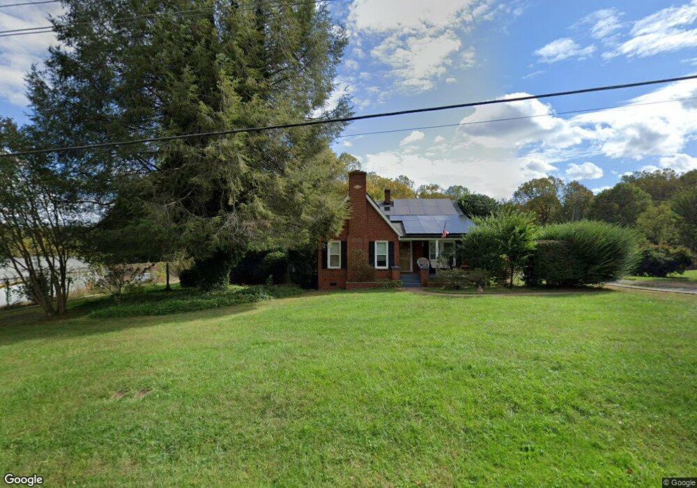
117 Airport Rd Statesville, NC 28677
Estimated Value: $234,436 - $327,000
3
Beds
1
Bath
1,526
Sq Ft
$182/Sq Ft
Est. Value
About This Home
This home is located at 117 Airport Rd, Statesville, NC 28677 and is currently estimated at $277,859, approximately $182 per square foot. 117 Airport Rd is a home located in Iredell County with nearby schools including Celeste Henkel Elementary School, West Iredell Middle School, and West Iredell High School.
Ownership History
Date
Name
Owned For
Owner Type
Purchase Details
Closed on
Jul 11, 2000
Sold by
Risk James David and Risk Darlene M
Bought by
Miller M Keith and Miller Linda R
Current Estimated Value
Home Financials for this Owner
Home Financials are based on the most recent Mortgage that was taken out on this home.
Original Mortgage
$82,800
Outstanding Balance
$30,279
Interest Rate
8.54%
Estimated Equity
$247,580
Purchase Details
Closed on
Nov 1, 1996
Purchase Details
Closed on
Nov 1, 1994
Purchase Details
Closed on
Nov 1, 1984
Purchase Details
Closed on
May 1, 1984
Create a Home Valuation Report for This Property
The Home Valuation Report is an in-depth analysis detailing your home's value as well as a comparison with similar homes in the area
Home Values in the Area
Average Home Value in this Area
Purchase History
| Date | Buyer | Sale Price | Title Company |
|---|---|---|---|
| Miller M Keith | $103,500 | -- | |
| -- | $82,000 | -- | |
| -- | $77,000 | -- | |
| -- | -- | -- | |
| -- | $42,000 | -- |
Source: Public Records
Mortgage History
| Date | Status | Borrower | Loan Amount |
|---|---|---|---|
| Open | Miller M Keith | $82,800 |
Source: Public Records
Tax History Compared to Growth
Tax History
| Year | Tax Paid | Tax Assessment Tax Assessment Total Assessment is a certain percentage of the fair market value that is determined by local assessors to be the total taxable value of land and additions on the property. | Land | Improvement |
|---|---|---|---|---|
| 2024 | $1,158 | $175,890 | $17,710 | $158,180 |
| 2023 | $1,158 | $175,890 | $17,710 | $158,180 |
| 2022 | $1,012 | $142,160 | $17,710 | $124,450 |
| 2021 | $1,004 | $142,160 | $17,710 | $124,450 |
| 2020 | $1,004 | $142,160 | $17,710 | $124,450 |
| 2019 | $990 | $142,230 | $17,780 | $124,450 |
| 2018 | $881 | $130,000 | $17,780 | $112,220 |
| 2017 | $881 | $130,000 | $17,780 | $112,220 |
| 2016 | $881 | $130,000 | $17,780 | $112,220 |
| 2015 | $750 | $108,140 | $17,780 | $90,360 |
| 2014 | $729 | $112,700 | $17,780 | $94,920 |
Source: Public Records
Map
Nearby Homes
- 00 Jamie Dr Unit 6
- 130 Aviation Dr
- 3004 Newton Dr
- 116 Bent Twig Dr
- 908 Westminster Dr
- 289 Mary Locke Way
- 827 Flint Dr
- Robie Plan at Bristol Terrace
- Penwell Plan at Bristol Terrace
- Hayden Plan at Bristol Terrace
- 119 Mary Locke Way
- Cali Plan at Bristol Terrace
- Aria Plan at Bristol Terrace
- Darwin Plan at Bristol Terrace
- Hamilton Plan at Bristol Terrace
- 131 Mary Locke Way
- Galen Plan at Bristol Terrace
- Aisle Plan at Bristol Terrace
- 178 Old Airport Rd
- 3606 Rose St Unit 55
- 123 Airport Rd
- 116 Airport Rd
- 110 Airport Rd
- 124 Airport Rd
- Lot 33 Airport Rd
- 34 Airport Rd
- 130 Airport Rd
- 10.35 acres Hickory Hwy
- 000 Hickory Hwy
- 2481 Hickory Hwy
- 2517 Hickory Hwy
- 136 Airport Rd
- 4477 Hickory Hwy
- 2492 Hickory Hwy
- 2519 Hickory Hwy
- 140 Airport Rd
- 2502 Hickory Hwy
- 2523 Hickory Hwy Unit 2531
- 2512 Hickory Hwy
- 2506 Hickory Hwy