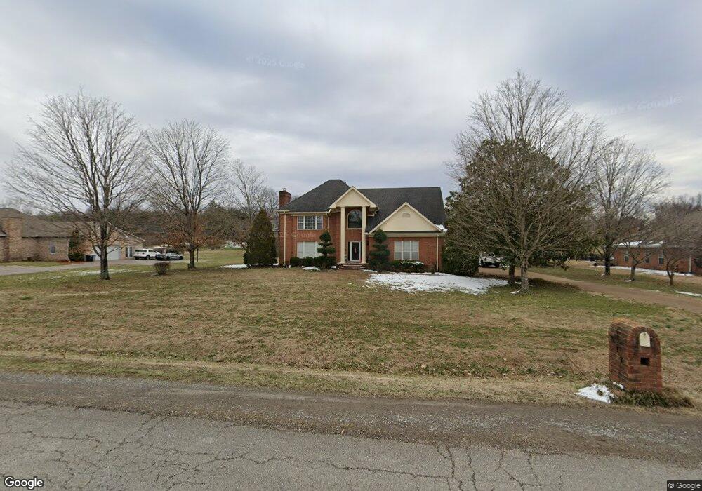
117 Buchanan Cir Hendersonville, TN 37075
Estimated Value: $680,779 - $795,000
--
Bed
4
Baths
2,959
Sq Ft
$253/Sq Ft
Est. Value
About This Home
This home is located at 117 Buchanan Cir, Hendersonville, TN 37075 and is currently estimated at $748,445, approximately $252 per square foot. 117 Buchanan Cir is a home located in Sumner County with nearby schools including Beech Elementary School, T.W. Hunter Middle School, and Beech High School.
Ownership History
Date
Name
Owned For
Owner Type
Purchase Details
Closed on
Sep 27, 2016
Sold by
Toon Mark and Toon Lana P
Bought by
Lancaster William A and Lancaster Christian Noelle
Current Estimated Value
Home Financials for this Owner
Home Financials are based on the most recent Mortgage that was taken out on this home.
Original Mortgage
$365,752
Outstanding Balance
$291,250
Interest Rate
3.25%
Mortgage Type
FHA
Estimated Equity
$457,195
Create a Home Valuation Report for This Property
The Home Valuation Report is an in-depth analysis detailing your home's value as well as a comparison with similar homes in the area
Home Values in the Area
Average Home Value in this Area
Purchase History
| Date | Buyer | Sale Price | Title Company |
|---|---|---|---|
| Lancaster William A | $372,500 | None Available |
Source: Public Records
Mortgage History
| Date | Status | Borrower | Loan Amount |
|---|---|---|---|
| Open | Lancaster William A | $365,752 |
Source: Public Records
Tax History Compared to Growth
Tax History
| Year | Tax Paid | Tax Assessment Tax Assessment Total Assessment is a certain percentage of the fair market value that is determined by local assessors to be the total taxable value of land and additions on the property. | Land | Improvement |
|---|---|---|---|---|
| 2024 | $2,222 | $156,350 | $31,250 | $125,100 |
| 2023 | $2,503 | $111,150 | $23,750 | $87,400 |
| 2022 | $2,514 | $111,150 | $23,750 | $87,400 |
| 2021 | $2,514 | $111,150 | $23,750 | $87,400 |
| 2020 | $2,514 | $111,150 | $23,750 | $87,400 |
| 2019 | $2,514 | $0 | $0 | $0 |
| 2018 | $2,113 | $0 | $0 | $0 |
| 2017 | $2,113 | $0 | $0 | $0 |
| 2016 | $2,113 | $0 | $0 | $0 |
| 2015 | -- | $0 | $0 | $0 |
| 2014 | -- | $0 | $0 | $0 |
Source: Public Records
Map
Nearby Homes
- 1002 W Stirling Ct
- 1063 Gadwall Cir
- 1111 Stirlingshire Dr
- 1003 Thistle Ct
- 106B Timber Hills Rd
- 1039 Parsons Way
- 1022 Tower Hill Ln
- 967 Luxborough Dr
- 0 New Hope Rd Unit RTC3000799
- 0 New Hope Rd Unit RTC2582441
- 588 Gingerwood Ln
- 420 Gingerwood Ln
- 1733 Old Drakes Creek Rd
- 133 Saddle Wood Ln
- 1016 Luxborough Dr
- 210 the Hollows Ct
- 250 Tanglewood Ln
- Kingfisher Plan at Durham Farms
- Saybrook Plan at Durham Farms
- Shearwater Plan at Durham Farms
- 115 Buchanan Cir
- 119 Buchanan Cir
- 113 Buchanan Cir
- 121 Buchanan Cir
- 114 Buchanan Cir
- 1026 Stirlingshire Dr
- 116 Buchanan Cir
- 112 Buchanan Cir
- 123 Buchanan Cir
- 1028 Stirlingshire Dr
- 120 Buchanan Cir
- 118 Buchanan Cir
- 1022 Stirlingshire Dr
- 111 Buchanan Cir
- 110 Buchanan Cir
- 125 Buchanan Cir
- 1030 Stirlingshire Dr
- 1020 Stirlingshire Dr
- 122 Buchanan Cir
- 108 Buchanan Cir