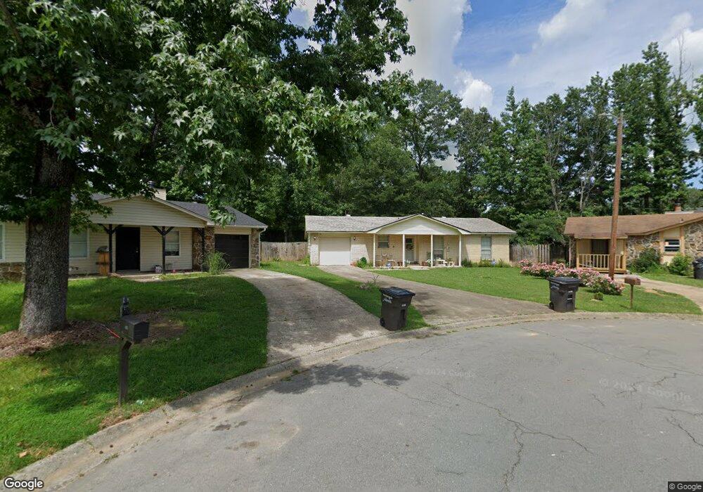
117 Darryl Ct Jacksonville, AR 72076
Estimated Value: $124,000 - $134,000
--
Bed
3
Baths
1,136
Sq Ft
$114/Sq Ft
Est. Value
About This Home
This home is located at 117 Darryl Ct, Jacksonville, AR 72076 and is currently estimated at $129,051, approximately $113 per square foot. 117 Darryl Ct is a home located in Pulaski County with nearby schools including Murrell Taylor Elementary School, Jacksonville Middle School, and Jacksonville High School.
Ownership History
Date
Name
Owned For
Owner Type
Purchase Details
Closed on
Aug 11, 2004
Sold by
Hammans June B and Duke Winnie P
Bought by
Brooks Joy A
Current Estimated Value
Home Financials for this Owner
Home Financials are based on the most recent Mortgage that was taken out on this home.
Original Mortgage
$56,900
Outstanding Balance
$28,216
Interest Rate
6%
Mortgage Type
Purchase Money Mortgage
Estimated Equity
$100,835
Purchase Details
Closed on
Aug 16, 2002
Sold by
Hammans June B
Bought by
Hammans June B and Duke Winnie P
Create a Home Valuation Report for This Property
The Home Valuation Report is an in-depth analysis detailing your home's value as well as a comparison with similar homes in the area
Home Values in the Area
Average Home Value in this Area
Purchase History
| Date | Buyer | Sale Price | Title Company |
|---|---|---|---|
| Brooks Joy A | $57,000 | United Abstract & Title Co | |
| Hammans June B | -- | -- |
Source: Public Records
Mortgage History
| Date | Status | Borrower | Loan Amount |
|---|---|---|---|
| Open | Brooks Joy A | $56,900 |
Source: Public Records
Tax History Compared to Growth
Tax History
| Year | Tax Paid | Tax Assessment Tax Assessment Total Assessment is a certain percentage of the fair market value that is determined by local assessors to be the total taxable value of land and additions on the property. | Land | Improvement |
|---|---|---|---|---|
| 2025 | $919 | $17,920 | $1,200 | $16,720 |
| 2024 | $738 | $17,920 | $1,200 | $16,720 |
| 2023 | $738 | $17,920 | $1,200 | $16,720 |
| 2022 | $429 | $17,920 | $1,200 | $16,720 |
| 2021 | $391 | $12,480 | $1,600 | $10,880 |
| 2020 | $391 | $12,480 | $1,600 | $10,880 |
| 2019 | $391 | $12,480 | $1,600 | $10,880 |
| 2018 | $416 | $12,480 | $1,600 | $10,880 |
| 2017 | $416 | $12,480 | $1,600 | $10,880 |
| 2016 | $473 | $13,410 | $2,400 | $11,010 |
| 2015 | $721 | $13,410 | $2,400 | $11,010 |
| 2014 | $721 | $13,410 | $2,400 | $11,010 |
Source: Public Records
Map
Nearby Homes
- 219 Lonsdale Cir
- 1404 Southeastern Ave
- 2003 Old Military Rd
- 13 Michelle Ln Unit A
- 2209 Old Military Rd
- 813 Lehman Dr
- 720 Southeastern Ave
- 1305 Glenn Rd
- 1302 King St
- 600 Sorrells Dr
- 1401 Tamara Park
- 0 S J P Wright Loop Rd
- 404 S J P Wright Loop Rd
- 32 Ross Cir
- 910 Ray Rd
- 26 Wright Cir
- 419 Church St
- 5821 Arkansas 294
- 1110 Wright St
- 602 Ray Rd
- 115 Darryl Ct
- 119 Darryl Ct
- 115 Darryl Ct
- 224 Lonsdale Cir
- 113 Darryl Ct
- 226 Lonsdale Cir
- 220 Lonsdale Cir
- 118 Darryl Ct
- 0 Lonsdale Cir
- 228 Lonsdale Cir
- 218 Lonsdale Cir
- 116 Darryl Ct
- 111 Darryl Ct
- 114 Darryl Ct
- 216 Lonsdale Cir
- 230 Lonsdale Cir
- 112 Darryl Ct
- 109 Darryl Ct
- 223 Lonsdale Cir
- 214 Lonsdale Cir