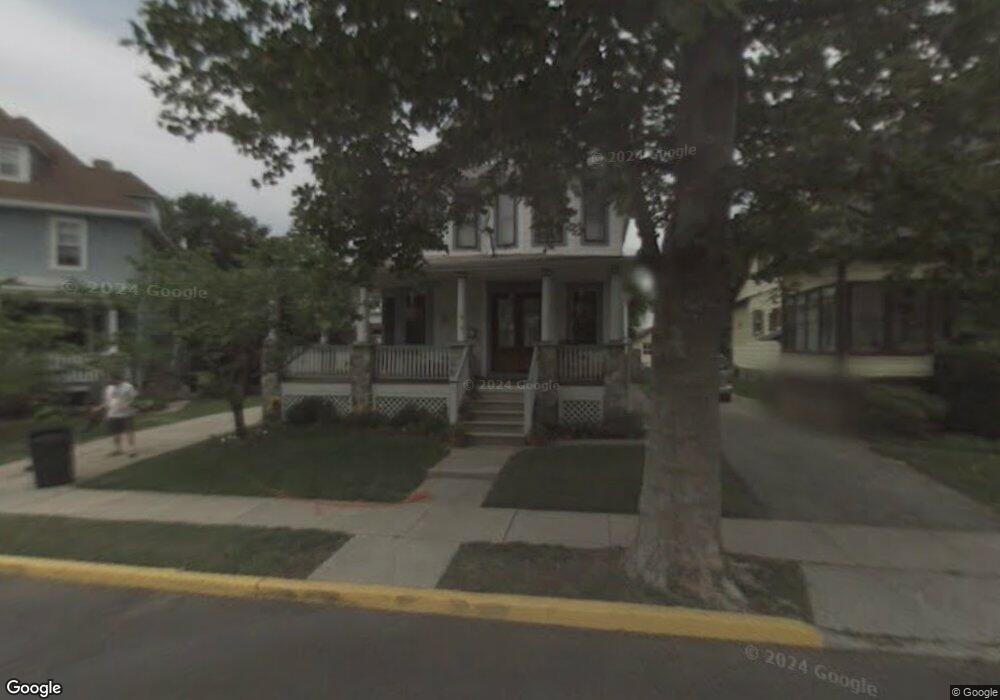
117 Fern Ave Collingswood, NJ 08108
Estimated Value: $609,707 - $709,000
--
Bed
--
Bath
2,113
Sq Ft
$314/Sq Ft
Est. Value
About This Home
This home is located at 117 Fern Ave, Collingswood, NJ 08108 and is currently estimated at $663,427, approximately $313 per square foot. 117 Fern Ave is a home located in Camden County with nearby schools including William P. Tatem Elementary School, Collingswood Middle School, and Collingswood High School.
Ownership History
Date
Name
Owned For
Owner Type
Purchase Details
Closed on
Aug 26, 1998
Sold by
Leonard Thomas P
Bought by
Johnson James
Current Estimated Value
Home Financials for this Owner
Home Financials are based on the most recent Mortgage that was taken out on this home.
Original Mortgage
$152,000
Outstanding Balance
$32,469
Interest Rate
6.9%
Estimated Equity
$630,958
Purchase Details
Closed on
Mar 25, 1998
Sold by
Estate Of Ellen C Ames
Bought by
Leonard Thomas P and Lunney Paul
Create a Home Valuation Report for This Property
The Home Valuation Report is an in-depth analysis detailing your home's value as well as a comparison with similar homes in the area
Home Values in the Area
Average Home Value in this Area
Purchase History
| Date | Buyer | Sale Price | Title Company |
|---|---|---|---|
| Johnson James | $160,000 | -- | |
| Leonard Thomas P | $89,000 | -- |
Source: Public Records
Mortgage History
| Date | Status | Borrower | Loan Amount |
|---|---|---|---|
| Open | Johnson James | $152,000 |
Source: Public Records
Tax History Compared to Growth
Tax History
| Year | Tax Paid | Tax Assessment Tax Assessment Total Assessment is a certain percentage of the fair market value that is determined by local assessors to be the total taxable value of land and additions on the property. | Land | Improvement |
|---|---|---|---|---|
| 2025 | $13,743 | $588,600 | $175,800 | $412,800 |
| 2024 | $13,541 | $354,300 | $85,100 | $269,200 |
| 2023 | $13,541 | $354,300 | $85,100 | $269,200 |
| 2022 | $13,205 | $354,300 | $85,100 | $269,200 |
| 2021 | $13,006 | $354,300 | $85,100 | $269,200 |
| 2020 | $12,705 | $354,300 | $85,100 | $269,200 |
| 2019 | $12,429 | $354,300 | $85,100 | $269,200 |
| 2018 | $12,308 | $354,300 | $85,100 | $269,200 |
| 2017 | $12,145 | $354,300 | $85,100 | $269,200 |
| 2016 | $11,516 | $344,900 | $85,100 | $259,800 |
| 2015 | $11,175 | $344,900 | $85,100 | $259,800 |
| 2014 | $10,864 | $344,900 | $85,100 | $259,800 |
Source: Public Records
Map
Nearby Homes
- 109 Frazer Ave
- 421 Lincoln Ave
- 869 Haddon Ave
- 75 E Collings Ave
- 30 Lincoln Ave
- 300 Woodlawn Terrace
- 4 W Homestead Ave
- 219 Woodlawn Terrace
- 994 Haddon Ave
- 108 Dayton Ave
- 231 Woodlawn Terrace
- 111 Cooper Ave
- 211 Harvard Ave
- 17 Harvard Ave
- 455 Conger Ave
- 267 Harvard Ave
- 600 N Atlantic Ave Unit 304
- 108 Conard Ave
- 213 Addison Ave
- 223 Guilford Ave