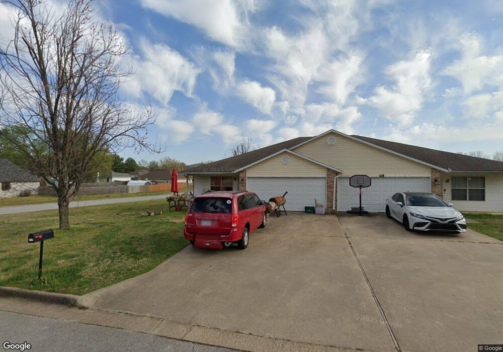
117 Northaven St Farmington, AR 72730
Estimated Value: $379,000 - $437,391
--
Bed
4
Baths
2,705
Sq Ft
$148/Sq Ft
Est. Value
About This Home
This home is located at 117 Northaven St, Farmington, AR 72730 and is currently estimated at $400,598, approximately $148 per square foot. 117 Northaven St is a home located in Washington County with nearby schools including Randall G. Lynch Middle School, Bob Folsom Elementary School, and Farmington Jr. High.
Ownership History
Date
Name
Owned For
Owner Type
Purchase Details
Closed on
Mar 3, 2021
Sold by
Neal Terry W and Neal Patty A
Bought by
Neal Alex W and Neal Cayce E
Current Estimated Value
Purchase Details
Closed on
Mar 27, 1995
Bought by
Neal Terry and Neal Patty
Purchase Details
Closed on
Feb 28, 1995
Bought by
Williams Douglas L
Purchase Details
Closed on
Jan 13, 1995
Bought by
Williams Donald L
Purchase Details
Closed on
Jan 1, 1995
Bought by
Commercial Properties, Inc
Create a Home Valuation Report for This Property
The Home Valuation Report is an in-depth analysis detailing your home's value as well as a comparison with similar homes in the area
Home Values in the Area
Average Home Value in this Area
Purchase History
| Date | Buyer | Sale Price | Title Company |
|---|---|---|---|
| Neal Alex W | -- | None Available | |
| Neal Terry | $21,000 | -- | |
| Williams Douglas L | -- | -- | |
| Williams Donald L | -- | -- | |
| Commercial Properties, Inc | -- | -- |
Source: Public Records
Tax History Compared to Growth
Tax History
| Year | Tax Paid | Tax Assessment Tax Assessment Total Assessment is a certain percentage of the fair market value that is determined by local assessors to be the total taxable value of land and additions on the property. | Land | Improvement |
|---|---|---|---|---|
| 2025 | $2,899 | $67,760 | $9,000 | $58,760 |
| 2024 | $2,702 | $67,760 | $9,000 | $58,760 |
| 2023 | $2,583 | $67,760 | $9,000 | $58,760 |
| 2022 | $2,348 | $43,810 | $6,600 | $37,210 |
| 2021 | $2,182 | $43,810 | $6,600 | $37,210 |
| 2020 | $2,000 | $43,810 | $6,600 | $37,210 |
| 2019 | $1,825 | $33,740 | $6,600 | $27,140 |
| 2018 | $1,825 | $33,740 | $6,600 | $27,140 |
| 2017 | $1,808 | $33,740 | $6,600 | $27,140 |
| 2016 | $1,808 | $33,740 | $6,600 | $27,140 |
| 2015 | $1,808 | $33,740 | $6,600 | $27,140 |
| 2014 | $1,942 | $36,230 | $6,600 | $29,630 |
Source: Public Records
Map
Nearby Homes
- 93 Old Depot Rd
- 201 Countryside Dr
- 9 Bois d Arc St
- 114 W Main St
- 179 Birchfield Ln
- TBD White St
- 237 Briarhill Dr
- 271 Greenfield Ave
- 48 Cedar St
- 285 Briarhill Dr
- Rye 1903 Plan at The Grove at Engles Mill
- Ouachita 1669 Plan at The Grove at Engles Mill
- Cache 1788 Plan at The Grove at Engles Mill
- Degray 1757 Plan at The Grove at Engles Mill
- Stella 1848 Plan at The Grove at Engles Mill
- Millwood 1862 Plan at The Grove at Engles Mill
- Magnolia 1556 Plan at The Grove at Engles Mill
- Eureka 1536 Plan at The Grove at Engles Mill
- Springs 1445 Plan at The Grove at Engles Mill
- Piper 2064 Plan at The Grove at Engles Mill
- 123 Northaven St
- 125 Northaven St
- 116 Northaven St
- 122 Northaven St
- 129 Northaven St
- 128 Northaven St
- 122 Briarmeadow St
- 111 Northaven St
- 118 Briarmeadow St
- 105 Northaven St
- 112 Briarmeadow St
- 104 Northaven St
- 135/137 Northaven St
- 137 Northaven St
- 135 & 137 Northaven St
- 117 Old Depot Rd
- 135 137 W Northaven St
- 135 N Haven St
- 125 Old Depot Rd
- 135 Northaven St