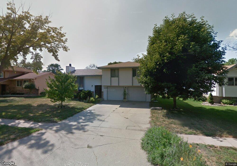
117 Parkview Dr South Sioux City, NE 68776
Estimated Value: $256,000 - $276,000
3
Beds
3
Baths
1,504
Sq Ft
$177/Sq Ft
Est. Value
About This Home
This home is located at 117 Parkview Dr, South Sioux City, NE 68776 and is currently estimated at $265,729, approximately $176 per square foot. 117 Parkview Dr is a home located in Dakota County with nearby schools including Covington Elementary School, South Sioux City Middle School, and South Sioux Senior High School.
Ownership History
Date
Name
Owned For
Owner Type
Purchase Details
Closed on
Jul 31, 2024
Sold by
Crary Huff Law Firm Pc and Iseminger Marci L
Bought by
Siouxland Federal Credit Union
Current Estimated Value
Purchase Details
Closed on
Apr 8, 2024
Sold by
Rasmy Phine and Rasmy Khanxay
Bought by
Saul Julie Aa
Purchase Details
Closed on
Aug 30, 2022
Sold by
Adams Saul Julie A
Bought by
Adams Saul Julie A and Phine Rasmy Phine
Purchase Details
Closed on
Nov 15, 2021
Sold by
Tony Mcrae
Bought by
Sayasone Nick and Sayasone Latmany
Purchase Details
Closed on
Nov 8, 2004
Sold by
Lindquist Pc Llo Eric H
Bought by
Bank Of New York The
Purchase Details
Closed on
Apr 8, 2001
Sold by
Wasinger Jerome L and Wasinger Gerilyn A
Bought by
Murphy Mark W and Murphy Gina R
Create a Home Valuation Report for This Property
The Home Valuation Report is an in-depth analysis detailing your home's value as well as a comparison with similar homes in the area
Home Values in the Area
Average Home Value in this Area
Purchase History
| Date | Buyer | Sale Price | Title Company |
|---|---|---|---|
| Siouxland Federal Credit Union | $221,924 | None Listed On Document | |
| Saul Julie Aa | $100,000 | None Listed On Document | |
| Adams Saul Julie A | $63,000 | -- | |
| Sayasone Nick | -- | Lewis & Clark Title | |
| Bank Of New York The | $81,400 | -- | |
| Murphy Mark W | $109,000 | -- |
Source: Public Records
Tax History Compared to Growth
Tax History
| Year | Tax Paid | Tax Assessment Tax Assessment Total Assessment is a certain percentage of the fair market value that is determined by local assessors to be the total taxable value of land and additions on the property. | Land | Improvement |
|---|---|---|---|---|
| 2024 | $2,691 | $207,550 | $21,450 | $186,100 |
| 2023 | $3,408 | $191,915 | $20,625 | $171,290 |
| 2022 | $2,395 | $125,220 | $20,625 | $104,595 |
| 2021 | $2,497 | $125,955 | $20,625 | $105,330 |
| 2020 | $2,477 | $123,910 | $20,625 | $103,285 |
| 2019 | $2,484 | $123,910 | $20,625 | $103,285 |
| 2018 | $2,520 | $124,635 | $20,625 | $104,010 |
| 2017 | $2,295 | $113,800 | $20,625 | $93,175 |
| 2016 | $2,271 | $114,550 | $20,625 | $93,925 |
| 2014 | $2,072 | $100,645 | $13,500 | $87,145 |
Source: Public Records
Map
Nearby Homes
- 114 Oakmont Dr
- 424 S Ridge Dr
- 214 W 31st St
- 2434 U S 77
- 389 Willow Gardens
- 3312 Cedar Mill Way
- 3200 Cider Mill Way
- 125 E 30th St
- 300 Kerri Ln
- 324 Regency Ct
- 202 E 23rd St
- 605 Stagecoach Rd
- 825 Ash St
- 3819 Crescent Ln
- 509 142nd St
- 405 W 17th St
- 2101 F St
- 1401 & 1402 5th Ave
- 423 Golf Rd
- 3722 Le Mesa Way
- 113 Parkview Dr
- 121 Parkview Dr
- 152 Oakmont Dr
- 156 Oakmont Dr
- 156 Oakmont Dr
- 109 Parkview Dr
- 116 Parkview Dr
- 315 S Ridge Dr Unit 315 S. Ridge B
- 315 S Ridge Dr Unit 315 S. Ridge D
- 315 S Ridge Dr Unit 315 S. Ridge A
- 112 Parkview Dr
- 144 Oakmont Dr
- 120 Parkview Dr
- 108 Parkview Dr
- 124 Parkview Dr
- 105 Parkview Dr
- 140 Oakmont Dr
- 104 Parkview Dr
- 153 Oakmont Dr
- 105 Burning Tree Cir