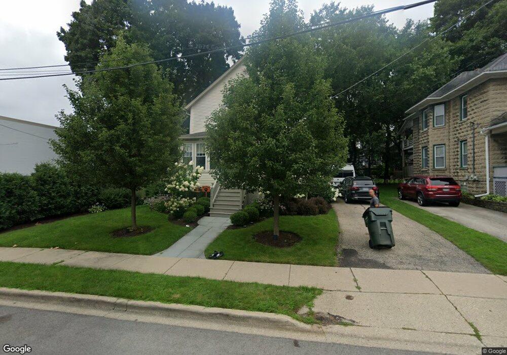
117 Sunnyside Place Libertyville, IL 60048
South Libertyville NeighborhoodEstimated Value: $430,000 - $521,000
4
Beds
2
Baths
1,840
Sq Ft
$268/Sq Ft
Est. Value
About This Home
This home is located at 117 Sunnyside Place, Libertyville, IL 60048 and is currently estimated at $492,684, approximately $267 per square foot. 117 Sunnyside Place is a home located in Lake County with nearby schools including Rockland Elementary School, Highland Middle School, and Libertyville High School.
Ownership History
Date
Name
Owned For
Owner Type
Purchase Details
Closed on
Jul 26, 2013
Sold by
Ferguson Adam and Haley Jessica
Bought by
Ferguson Adam and Ferguson Jessica
Current Estimated Value
Home Financials for this Owner
Home Financials are based on the most recent Mortgage that was taken out on this home.
Original Mortgage
$326,500
Outstanding Balance
$245,018
Interest Rate
4.62%
Mortgage Type
New Conventional
Estimated Equity
$247,666
Purchase Details
Closed on
Jul 11, 2007
Sold by
Henry Bridget Anne
Bought by
Ferguson Adam and Haley Jessica
Home Financials for this Owner
Home Financials are based on the most recent Mortgage that was taken out on this home.
Original Mortgage
$342,000
Interest Rate
6.54%
Mortgage Type
Purchase Money Mortgage
Purchase Details
Closed on
Dec 14, 2006
Sold by
Henry Julie Ann and Henry Bridget Anne
Bought by
Henry Bridget Anne
Home Financials for this Owner
Home Financials are based on the most recent Mortgage that was taken out on this home.
Original Mortgage
$297,000
Interest Rate
6.27%
Mortgage Type
New Conventional
Purchase Details
Closed on
Dec 4, 2002
Sold by
Paden Desmond S and Paden Suzanne M
Bought by
Henry Julie Ann and Henry Bridget Ann E
Home Financials for this Owner
Home Financials are based on the most recent Mortgage that was taken out on this home.
Original Mortgage
$240,000
Interest Rate
6.13%
Purchase Details
Closed on
Jul 13, 2001
Sold by
Paden Desmond S
Bought by
Paden Desmond S and Paden Suzanne M
Home Financials for this Owner
Home Financials are based on the most recent Mortgage that was taken out on this home.
Original Mortgage
$192,000
Interest Rate
6.37%
Purchase Details
Closed on
Sep 18, 2000
Sold by
Roth Rhea and Rhea Roth Living Trust
Bought by
Paden Desmond S
Home Financials for this Owner
Home Financials are based on the most recent Mortgage that was taken out on this home.
Original Mortgage
$187,200
Interest Rate
7.98%
Purchase Details
Closed on
Jan 29, 1999
Sold by
Mayer Floyce Louise
Bought by
Roth Rhea
Purchase Details
Closed on
Apr 10, 1996
Sold by
Mayer Floyce Louise
Bought by
Roth Rhea
Create a Home Valuation Report for This Property
The Home Valuation Report is an in-depth analysis detailing your home's value as well as a comparison with similar homes in the area
Home Values in the Area
Average Home Value in this Area
Purchase History
| Date | Buyer | Sale Price | Title Company |
|---|---|---|---|
| Ferguson Adam | -- | Prairie Title | |
| Ferguson Adam | $380,000 | Fort Dearborn Land Title | |
| Henry Bridget Anne | -- | Fort Dearborn Land Title | |
| Henry Julie Ann | $300,000 | Multiple | |
| Paden Desmond S | -- | Midwest Land Title Company | |
| Paden Desmond S | $208,000 | -- | |
| Roth Rhea | -- | -- | |
| Roth Rhea | -- | -- | |
| Roth Rhea | -- | -- |
Source: Public Records
Mortgage History
| Date | Status | Borrower | Loan Amount |
|---|---|---|---|
| Open | Ferguson Adam | $326,500 | |
| Closed | Ferguson Adam | $342,000 | |
| Previous Owner | Henry Bridget Anne | $297,000 | |
| Previous Owner | Henry Julie Ann | $240,000 | |
| Previous Owner | Paden Desmond S | $192,000 | |
| Previous Owner | Paden Desmond S | $187,200 |
Source: Public Records
Tax History Compared to Growth
Tax History
| Year | Tax Paid | Tax Assessment Tax Assessment Total Assessment is a certain percentage of the fair market value that is determined by local assessors to be the total taxable value of land and additions on the property. | Land | Improvement |
|---|---|---|---|---|
| 2024 | $8,944 | $129,088 | $65,436 | $63,652 |
| 2023 | $8,462 | $119,063 | $60,354 | $58,709 |
| 2022 | $8,462 | $111,806 | $58,010 | $53,796 |
| 2021 | $8,143 | $109,399 | $56,761 | $52,638 |
| 2020 | $8,364 | $114,425 | $59,369 | $55,056 |
| 2019 | $8,157 | $113,336 | $58,804 | $54,532 |
| 2018 | $7,030 | $101,738 | $58,317 | $43,421 |
| 2017 | $6,929 | $98,526 | $56,476 | $42,050 |
| 2016 | $6,690 | $93,416 | $53,547 | $39,869 |
| 2015 | $6,617 | $87,313 | $50,049 | $37,264 |
| 2014 | $6,259 | $80,505 | $46,147 | $34,358 |
| 2012 | $6,038 | $82,024 | $47,017 | $35,007 |
Source: Public Records
Map
Nearby Homes
- 1754 Glenmore Rd
- 308 Mckinley Ave
- 426 S Milwaukee Ave
- 212 Elm Ct
- 217 E Church St
- 112 3rd St
- 121 4th St
- 401 S 4th Ave
- 423 Ames St
- 551 W Park Ave Unit E
- 0 Ames St
- 601 Broadway St
- 505 Lange Ct
- 420 W Cook Ave
- 700 E Sunnyside Ave
- 224 Newberry Ave
- 785 Meadow Ln
- 533 Drake St
- 747 Garfield Ave Unit C
- 777 Garfield Ave Unit A
- 123 Sunnyside Place
- 118 Mckinley Ave Unit 118
- 118 Mckinley Ave
- 129 Sunnyside Place
- 120 Sunnyside Place
- 124 Sunnyside Place
- 112 Mckinley Ave
- 112 Mckinley Ave
- 128 Mckinley Ave
- 114 Mckinley Ave
- 130 Mckinley Ave
- 130 Sunnyside Place
- 130 Sunnyside Place
- 136 Mckinley Ave
- 122 Mckinley Ave
- 136 Sunnyside Place
- 136 Sunnyside Place Unit A
- 139 Sunnyside Place
- 140 Mckinley Ave
- 141 Sunnyside Place