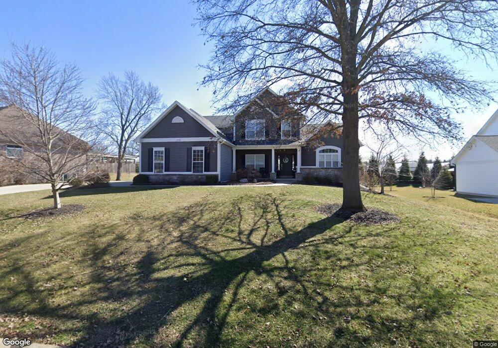
11710 Brookbend Dr Saint Louis, MO 63131
Estimated Value: $1,377,602 - $1,655,000
4
Beds
5
Baths
4,552
Sq Ft
$324/Sq Ft
Est. Value
About This Home
This home is located at 11710 Brookbend Dr, Saint Louis, MO 63131 and is currently estimated at $1,476,901, approximately $324 per square foot. 11710 Brookbend Dr is a home located in St. Louis County with nearby schools including Westchester Elementary School, North Kirkwood Middle School, and Kirkwood Senior High School.
Ownership History
Date
Name
Owned For
Owner Type
Purchase Details
Closed on
Jun 1, 2016
Sold by
Mckelvey Homes Llc
Bought by
Miller Joshua C and Miller Katherine A
Current Estimated Value
Home Financials for this Owner
Home Financials are based on the most recent Mortgage that was taken out on this home.
Original Mortgage
$509,817
Outstanding Balance
$403,818
Interest Rate
3.59%
Mortgage Type
New Conventional
Estimated Equity
$1,073,083
Purchase Details
Closed on
Apr 1, 2015
Sold by
Gwin Teresa A and Frain Janet
Bought by
Mckelvey Homes Llc
Purchase Details
Closed on
Dec 22, 2014
Sold by
Gwin Teresa A
Bought by
Gwin Teresa A and Frain Janet
Create a Home Valuation Report for This Property
The Home Valuation Report is an in-depth analysis detailing your home's value as well as a comparison with similar homes in the area
Home Values in the Area
Average Home Value in this Area
Purchase History
| Date | Buyer | Sale Price | Title Company |
|---|---|---|---|
| Miller Joshua C | $747,399 | Arch City Title Cm | |
| Mckelvey Homes Llc | -- | Arch City Title | |
| Gwin Teresa A | -- | None Available |
Source: Public Records
Mortgage History
| Date | Status | Borrower | Loan Amount |
|---|---|---|---|
| Open | Miller Joshua C | $509,817 |
Source: Public Records
Tax History Compared to Growth
Tax History
| Year | Tax Paid | Tax Assessment Tax Assessment Total Assessment is a certain percentage of the fair market value that is determined by local assessors to be the total taxable value of land and additions on the property. | Land | Improvement |
|---|---|---|---|---|
| 2025 | $12,416 | $257,240 | $70,930 | $186,310 |
| 2024 | $12,416 | $215,120 | $53,540 | $161,580 |
| 2023 | $12,416 | $215,120 | $53,540 | $161,580 |
| 2022 | $12,498 | $205,050 | $53,540 | $151,510 |
| 2021 | $12,364 | $205,050 | $53,540 | $151,510 |
| 2020 | $10,806 | $172,260 | $49,440 | $122,820 |
| 2019 | $9,516 | $151,450 | $49,440 | $102,010 |
| 2018 | $10,163 | $145,160 | $27,340 | $117,820 |
| 2017 | $10,190 | $145,160 | $27,340 | $117,820 |
| 2016 | $5,641 | $23,520 | $23,520 | $0 |
| 2015 | $2,504 | $35,780 | $23,520 | $12,260 |
| 2014 | $2,449 | $34,200 | $10,870 | $23,330 |
Source: Public Records
Map
Nearby Homes
- 1345 Woodgate Dr
- 811 Cherry St
- 1126 Bopp Rd
- 11358 Manchester Rd
- 1001 Dovergate Dr
- 723 Oak Valley Dr
- 1090 Kinstern Dr
- 11909 Lillian Ave
- 11913 Lillian Ave
- 8 Briarbrook Trail
- 1029 Kinstern Dr
- 1728 Folkstone Dr
- 1741 Pine Hill Dr
- 12006 Montour Dr
- 1120 Simmons Ave
- 936 Poinsetta Ln
- 966 N Geyer Rd
- 1137 N Harrison Ave
- 1133 N Harrison Ave
- 976 Cleveland Ave
- 02BBLT 11710 Brookbend
- 117102BBLT Brookbend Dr
- 11718 Brookbend Dr
- 11700 Brookbend Dr
- 11709 Brookbend Dr
- 11701 Brookbend Dr
- 11726 Brookbend Dr
- 11717 Brookbend Dr
- 1300 Breezeridge Dr
- 1300 Breezeridge Dr Unit TO BE BUILT
- 11725 Brookbend Dr
- 1304 Breezeridge Dr
- 11712 Middleview Dr
- 11734 Brookbend Dr
- 11720 Middleview Dr
- 11736 Brookbend Dr
- 11733 Brookbend Dr
- 11728 Middleview Dr
- 1339 Woodgate Dr
- 1333 Woodgate Dr