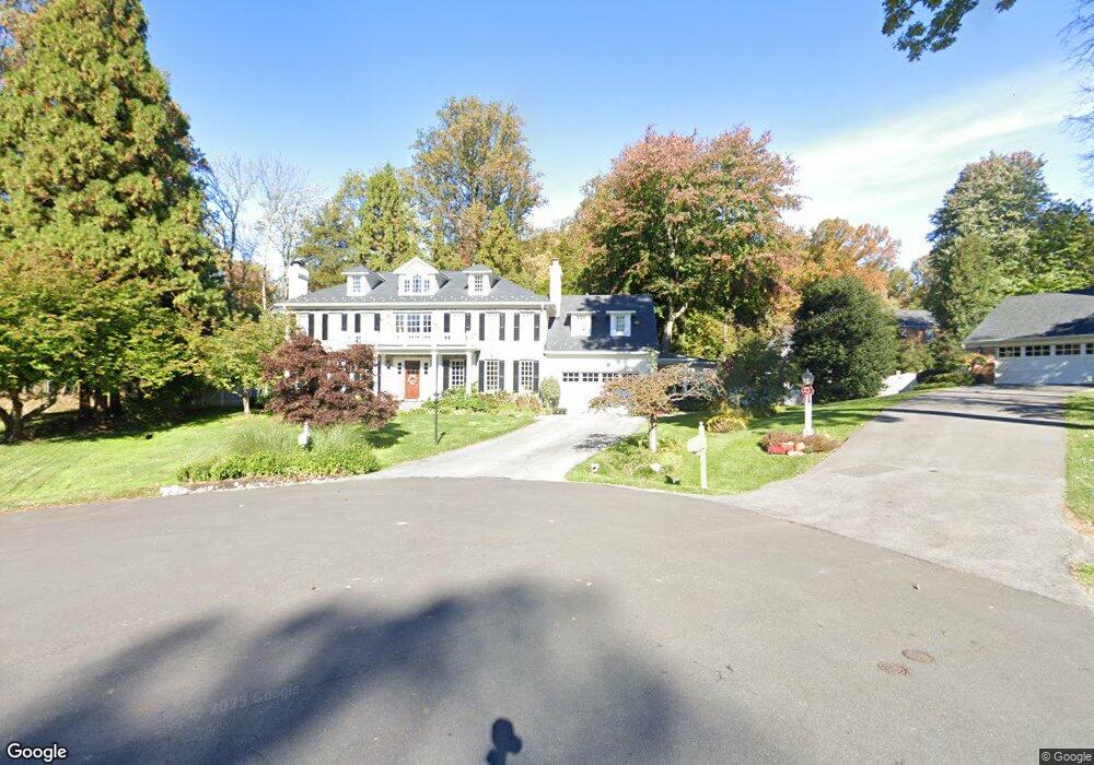
1172 Huntover Ct McLean, VA 22102
Estimated Value: $3,081,000 - $3,919,000
5
Beds
8
Baths
5,735
Sq Ft
$586/Sq Ft
Est. Value
About This Home
This home is located at 1172 Huntover Ct, McLean, VA 22102 and is currently estimated at $3,362,833, approximately $586 per square foot. 1172 Huntover Ct is a home located in Fairfax County with nearby schools including Spring Hill Elementary School, Cooper Middle School, and Langley High School.
Ownership History
Date
Name
Owned For
Owner Type
Purchase Details
Closed on
Dec 1, 1995
Sold by
Mather Mary L
Bought by
Whipkey Mary B
Current Estimated Value
Home Financials for this Owner
Home Financials are based on the most recent Mortgage that was taken out on this home.
Original Mortgage
$514,250
Outstanding Balance
$10,521
Interest Rate
7.37%
Mortgage Type
Purchase Money Mortgage
Estimated Equity
$3,352,312
Create a Home Valuation Report for This Property
The Home Valuation Report is an in-depth analysis detailing your home's value as well as a comparison with similar homes in the area
Home Values in the Area
Average Home Value in this Area
Purchase History
| Date | Buyer | Sale Price | Title Company |
|---|---|---|---|
| Whipkey Mary B | $605,000 | -- |
Source: Public Records
Mortgage History
| Date | Status | Borrower | Loan Amount |
|---|---|---|---|
| Open | Whipkey Mary B | $514,250 |
Source: Public Records
Tax History Compared to Growth
Tax History
| Year | Tax Paid | Tax Assessment Tax Assessment Total Assessment is a certain percentage of the fair market value that is determined by local assessors to be the total taxable value of land and additions on the property. | Land | Improvement |
|---|---|---|---|---|
| 2025 | $40,369 | $3,416,740 | $565,000 | $2,851,740 |
| 2024 | $40,369 | $3,416,740 | $565,000 | $2,851,740 |
| 2023 | $33,426 | $2,902,790 | $559,000 | $2,343,790 |
| 2022 | $31,272 | $2,680,810 | $559,000 | $2,121,810 |
| 2021 | $30,753 | $2,570,210 | $490,000 | $2,080,210 |
| 2020 | $29,589 | $2,452,460 | $490,000 | $1,962,460 |
| 2019 | $29,589 | $2,452,460 | $490,000 | $1,962,460 |
| 2018 | $28,203 | $2,452,460 | $490,000 | $1,962,460 |
| 2017 | $29,037 | $2,452,460 | $490,000 | $1,962,460 |
| 2016 | $28,976 | $2,452,460 | $490,000 | $1,962,460 |
| 2015 | $28,939 | $2,540,750 | $490,000 | $2,050,750 |
| 2014 | $30,062 | $2,645,170 | $490,000 | $2,155,170 |
Source: Public Records
Map
Nearby Homes
- 1212 Old Stable Rd
- 7806 Birnam Wood Dr
- 1003 Gelston Cir
- 7701 Lewinsville Rd
- 7724 Desdemona Ct
- 919 Dominion Reserve Dr
- 1197 Winter Hunt Rd
- 7727 Falstaff Rd
- 7400 Churchill Rd
- 1314 Macbeth St
- 1324 Titania Ln
- 8023 Lewinsville Rd
- 1221 Mottrom Dr
- 7925 Falstaff Rd
- 1112 Balls Hill Rd
- 1052 Balls Hill Rd
- 1200 Chadsworth Ct
- 7315 Georgetown Pike
- 7351 Nicole Marie Ct
- 8013 Greenwich Woods Dr
- 1170 Huntover Ct
- 1174 Huntover Ct
- 1162 Old Stage Ct
- 1171 Huntover Ct
- 1164 Old Stage Ct
- 1173 Huntover Ct
- 1160 Old Stage Ct
- 1176 Huntover Ct
- 1166 Old Stage Ct
- 1175 Huntover Ct
- 1157 Swinks Mill Rd Unit LOG CABIN
- 1157 Swinks Mill Rd Unit COTTAGE
- 1157 Swinks Mill Rd
- 1168 Old Stage Ct
- 7706 Crossover Dr
- 1161 Old Stage Ct
- 1163 Old Stage Ct
- 7708 Crossover Dr
- 7716 Crossover Dr
- 1178 Huntover Ct