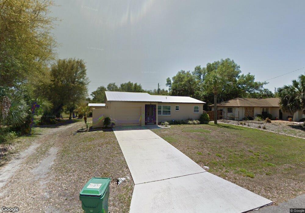
1173 Barbour Ave Port Charlotte, FL 33948
Estimated Value: $193,000 - $201,000
2
Beds
2
Baths
944
Sq Ft
$210/Sq Ft
Est. Value
About This Home
This home is located at 1173 Barbour Ave, Port Charlotte, FL 33948 and is currently estimated at $198,156, approximately $209 per square foot. 1173 Barbour Ave is a home located in Charlotte County with nearby schools including Meadow Park Elementary School, Murdock Middle School, and Port Charlotte High School.
Ownership History
Date
Name
Owned For
Owner Type
Purchase Details
Closed on
Apr 7, 2015
Sold by
Karalfa Keith A
Bought by
Karalfa Tammie M
Current Estimated Value
Purchase Details
Closed on
Feb 19, 2002
Sold by
Bank William
Bought by
Karalfa Keith and Karalfa Tammie
Purchase Details
Closed on
Aug 29, 1997
Sold by
Craig Kevin P and Craig Ellen M
Bought by
Karalfa Keith A and Karalfa Tammie M
Home Financials for this Owner
Home Financials are based on the most recent Mortgage that was taken out on this home.
Original Mortgage
$53,972
Interest Rate
7.43%
Mortgage Type
FHA
Create a Home Valuation Report for This Property
The Home Valuation Report is an in-depth analysis detailing your home's value as well as a comparison with similar homes in the area
Home Values in the Area
Average Home Value in this Area
Purchase History
| Date | Buyer | Sale Price | Title Company |
|---|---|---|---|
| Karalfa Tammie M | -- | None Available | |
| Karalfa Keith | $3,500 | -- | |
| Karalfa Keith A | $54,000 | -- |
Source: Public Records
Mortgage History
| Date | Status | Borrower | Loan Amount |
|---|---|---|---|
| Previous Owner | Karalfa Keith A | $53,972 |
Source: Public Records
Tax History Compared to Growth
Tax History
| Year | Tax Paid | Tax Assessment Tax Assessment Total Assessment is a certain percentage of the fair market value that is determined by local assessors to be the total taxable value of land and additions on the property. | Land | Improvement |
|---|---|---|---|---|
| 2023 | $1,460 | $58,160 | $0 | $0 |
| 2022 | $1,397 | $56,466 | $0 | $0 |
| 2021 | $1,394 | $54,821 | $0 | $0 |
| 2020 | $1,351 | $54,064 | $0 | $0 |
| 2019 | $1,282 | $52,848 | $0 | $0 |
| 2018 | $1,201 | $51,863 | $0 | $0 |
| 2017 | $1,192 | $50,796 | $0 | $0 |
| 2016 | $1,182 | $49,751 | $0 | $0 |
| 2015 | $1,160 | $49,405 | $0 | $0 |
| 2014 | -- | $49,013 | $0 | $0 |
Source: Public Records
Map
Nearby Homes
- 1174 Victoria Ave
- 1193 Victoria Ave
- 1256 Eden Ave
- 1272 Eden Ave
- 1280 Eden Ave
- 3261 Rock Creek Dr
- 18512 Blair Ave
- 18510 Ellen Ave
- 1189 Belmar Ave
- 1181 Belmar Ave
- 18503 Ellen Ave
- 1188 Vernon Ave
- 1190 Vernon Ave
- 1133 Victoria Ave
- 3197 Pellam Blvd
- 1190 Victoria Ave NW
- 1285 Barton Ave
- 1085 Belmar Ave
- 512 Donora St
- 537 Verona St
- 1179 Barbour Ave
- 1172 Belkton Ave
- 1166 Belkton Ave
- 1161 Barbour Ave
- 1184 Barbour Ave
- 1190 Barbour Ave
- 1154 Belkton Ave
- 1160 Barbour Ave
- 19063 Helena Ave
- 19038 Helena Ave
- 19071 Helena Ave
- 1101 Belkton Ave
- 19055 Helena Ave
- 1178 Belkton Ave
- 1149 Barbour Ave
- 19079 Helena Ave
- 1148 Belkton Ave
- 3189 Rock Creek Dr
- 19087 Helena Ave
- 3197 Rock Creek Dr