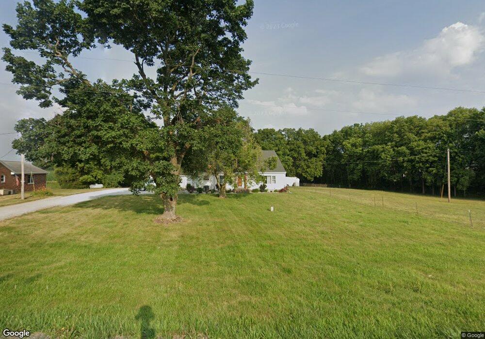
11757 Springfield Rd Tremont, IL 61568
Estimated Value: $276,000 - $360,000
3
Beds
1
Bath
1,952
Sq Ft
$161/Sq Ft
Est. Value
About This Home
This home is located at 11757 Springfield Rd, Tremont, IL 61568 and is currently estimated at $314,357, approximately $161 per square foot. 11757 Springfield Rd is a home located in Tazewell County with nearby schools including Tremont Elementary School, Tremont Middle School, and Tremont High School.
Ownership History
Date
Name
Owned For
Owner Type
Purchase Details
Closed on
Jun 4, 2024
Sold by
Papenhause John C and Papenhause Mary A
Bought by
Miller Mitch A and Miller Amanda M
Current Estimated Value
Home Financials for this Owner
Home Financials are based on the most recent Mortgage that was taken out on this home.
Original Mortgage
$270,750
Outstanding Balance
$267,347
Interest Rate
7.1%
Mortgage Type
New Conventional
Estimated Equity
$47,010
Create a Home Valuation Report for This Property
The Home Valuation Report is an in-depth analysis detailing your home's value as well as a comparison with similar homes in the area
Home Values in the Area
Average Home Value in this Area
Purchase History
| Date | Buyer | Sale Price | Title Company |
|---|---|---|---|
| Miller Mitch A | $285,000 | None Listed On Document |
Source: Public Records
Mortgage History
| Date | Status | Borrower | Loan Amount |
|---|---|---|---|
| Open | Miller Mitch A | $270,750 |
Source: Public Records
Tax History Compared to Growth
Tax History
| Year | Tax Paid | Tax Assessment Tax Assessment Total Assessment is a certain percentage of the fair market value that is determined by local assessors to be the total taxable value of land and additions on the property. | Land | Improvement |
|---|---|---|---|---|
| 2024 | $3,293 | $57,440 | $12,360 | $45,080 |
| 2023 | $3,293 | $52,740 | $11,350 | $41,390 |
| 2022 | $3,168 | $49,100 | $10,570 | $38,530 |
| 2021 | $3,064 | $47,210 | $10,160 | $37,050 |
| 2020 | $3,020 | $46,280 | $9,960 | $36,320 |
| 2019 | $3,023 | $46,280 | $9,960 | $36,320 |
| 2018 | $2,971 | $46,280 | $9,960 | $36,320 |
| 2017 | $2,920 | $45,360 | $9,760 | $35,600 |
| 2016 | $2,756 | $45,360 | $9,760 | $35,600 |
| 2015 | $2,680 | $0 | $0 | $0 |
| 2013 | $2,644 | $45,360 | $9,760 | $35,600 |
Source: Public Records
Map
Nearby Homes
- 17902 Red Shale Hill Rd
- 3858 Sunset Dr
- 313 W South St
- 1920-1922 Mayflower Dr
- 1960-1962 Mayflower Dr
- 105 Royal Point Ct
- 107 Lost Creek Ct
- 116 Lost Creek Ct
- 316 N Locust St
- 0 Illinois 9
- 13694 Egg Ranch Rd
- 10109 Arrow Rd
- 7711 Linden Ln
- 7266 Granada Dr
- 0 Furrow Rd
- 16810 Springfield Rd
- 1922 Highwood Ave
- 5859 Broadway Rd
- 5559 Broadway Rd
- 1824 Valencia Place
- 11845 Springfield Rd
- 11703 Springfield Rd
- 11893 Springfield Rd
- 11664 Springfield Rd
- 12290 Watson Rd
- 20119 Red Shale Hill Rd
- 11250 Springfield Rd
- 11501 Antioch Rd
- 20101 Red Shale Hill Rd
- 12505 Springfield Rd
- 11503 Antioch Rd
- 12562 Springfield Rd
- 21651 Red Shale Hill Rd
- 11040 Springfield Rd
- 12653 Springfield Rd
- 20173 Bennett Rd
- 11020 Springfield Rd
- 20864 Townline Rd
- 20534 Townline Rd
- 10723 Springfield Rd