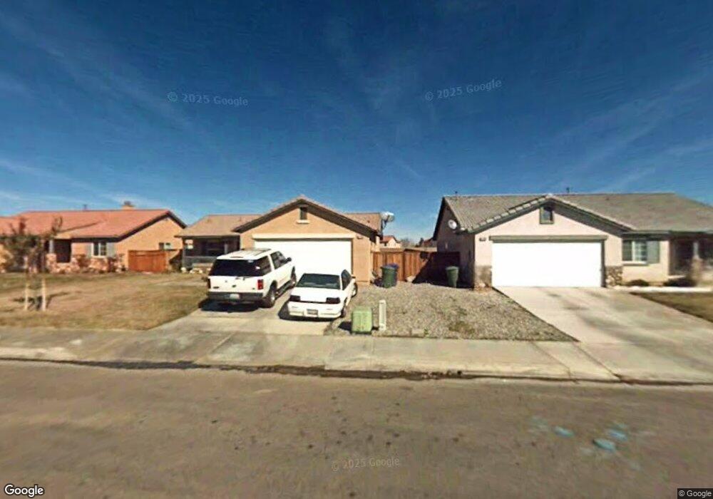
11785 Taylor St Adelanto, CA 92301
Mesa Linda NeighborhoodEstimated Value: $307,000 - $374,000
3
Beds
2
Baths
1,110
Sq Ft
$314/Sq Ft
Est. Value
About This Home
This home is located at 11785 Taylor St, Adelanto, CA 92301 and is currently estimated at $348,916, approximately $314 per square foot. 11785 Taylor St is a home with nearby schools including Victoria Magathan Elementary School, Columbia Middle School, and Adelanto High School.
Ownership History
Date
Name
Owned For
Owner Type
Purchase Details
Closed on
Apr 20, 2012
Sold by
Thompson Allen
Bought by
Broadway Dominic J and Broadway Teresa A
Current Estimated Value
Purchase Details
Closed on
Oct 19, 2003
Sold by
Norris Karney One Llc
Bought by
Thompson Allen and Thompson Katherine L
Home Financials for this Owner
Home Financials are based on the most recent Mortgage that was taken out on this home.
Original Mortgage
$126,103
Interest Rate
5.85%
Mortgage Type
FHA
Create a Home Valuation Report for This Property
The Home Valuation Report is an in-depth analysis detailing your home's value as well as a comparison with similar homes in the area
Home Values in the Area
Average Home Value in this Area
Purchase History
| Date | Buyer | Sale Price | Title Company |
|---|---|---|---|
| Broadway Dominic J | $55,500 | None Available | |
| Thompson Allen | $128,500 | Orange Coast Title |
Source: Public Records
Mortgage History
| Date | Status | Borrower | Loan Amount |
|---|---|---|---|
| Previous Owner | Thompson Allen | $126,103 | |
| Closed | Thompson Allen | $7,684 |
Source: Public Records
Tax History Compared to Growth
Tax History
| Year | Tax Paid | Tax Assessment Tax Assessment Total Assessment is a certain percentage of the fair market value that is determined by local assessors to be the total taxable value of land and additions on the property. | Land | Improvement |
|---|---|---|---|---|
| 2025 | $1,329 | $81,647 | $16,329 | $65,318 |
| 2024 | $1,329 | $80,046 | $16,009 | $64,037 |
| 2023 | $1,369 | $78,476 | $15,695 | $62,781 |
| 2022 | $1,265 | $76,937 | $15,387 | $61,550 |
| 2021 | $1,317 | $75,428 | $15,085 | $60,343 |
| 2020 | $1,279 | $74,654 | $14,930 | $59,724 |
| 2019 | $1,265 | $73,190 | $14,637 | $58,553 |
| 2018 | $1,256 | $71,755 | $14,350 | $57,405 |
| 2017 | $1,213 | $70,348 | $14,069 | $56,279 |
| 2016 | $1,189 | $68,968 | $13,793 | $55,175 |
| 2015 | $1,138 | $67,932 | $13,586 | $54,346 |
| 2014 | $1,166 | $66,601 | $13,320 | $53,281 |
Source: Public Records
Map
Nearby Homes
- 11800 Wolcott St
- 15386 Fremont Dr
- 15177 Braxton St
- 15416 Kearny Dr
- 11882 Star St
- 11613 Autumn St
- 32 Pearmain St
- 15036 Carrolton St
- 11728 Drake Ct
- 11504 Star St
- 15023 Henderson St
- 11417 Star St
- 11411 Arlington St
- 15747 Ox Hill Ct
- 14803 Bo Ct
- 11483 Russet Place
- 0 Pahute - Huerta Unit HD25039461
- 14211 14211
- 14025 Bonanza
- 0 Cajon 0396-154-07 Ave Unit HD24093177
- 11790 Taylor St
- 11774 Taylor St
- 0 Taylor St
- 11800 Taylor St
- 11766 Taylor St
- 15260 Lynch Ct
- 11816 Taylor St
- 11760 Taylor St
- 15265 Lynch Ct
- 15254 Lynch Ct
- 15267 Ellery St
- 15318 Fremont Dr
- 11828 Taylor St
- 15319 Fremont Dr
- 11750 Taylor St
- 15257 Lynch Ct
- 11788 Taylor St
- 15255 Ellery St
- 15326 Fremont Dr
- 15248 Lynch Ct