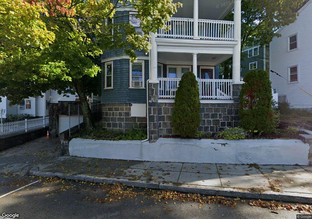
118 Cummins Hwy Unit 3 Roslindale, MA 02131
Roslindale NeighborhoodEstimated Value: $543,000 - $589,000
3
Beds
1
Bath
988
Sq Ft
$568/Sq Ft
Est. Value
About This Home
This home is located at 118 Cummins Hwy Unit 3, Roslindale, MA 02131 and is currently estimated at $560,976, approximately $567 per square foot. 118 Cummins Hwy Unit 3 is a home located in Suffolk County with nearby schools including Brooke Charter School Roslindale, Sacred Heart STEM School, and St. Clare High School.
Ownership History
Date
Name
Owned For
Owner Type
Purchase Details
Closed on
Dec 27, 2010
Sold by
Kerfoot Sheyla N
Bought by
Kerfoot Brian H and Negron-Kerfoot Sheyla
Current Estimated Value
Home Financials for this Owner
Home Financials are based on the most recent Mortgage that was taken out on this home.
Original Mortgage
$220,000
Outstanding Balance
$146,110
Interest Rate
4.17%
Mortgage Type
Purchase Money Mortgage
Estimated Equity
$414,866
Purchase Details
Closed on
Aug 22, 2006
Sold by
Chin Dale F
Bought by
Negron Sheyla
Home Financials for this Owner
Home Financials are based on the most recent Mortgage that was taken out on this home.
Original Mortgage
$178,500
Interest Rate
6.88%
Mortgage Type
Purchase Money Mortgage
Create a Home Valuation Report for This Property
The Home Valuation Report is an in-depth analysis detailing your home's value as well as a comparison with similar homes in the area
Home Values in the Area
Average Home Value in this Area
Purchase History
| Date | Buyer | Sale Price | Title Company |
|---|---|---|---|
| Kerfoot Brian H | -- | -- | |
| Negron Sheyla | $255,000 | -- |
Source: Public Records
Mortgage History
| Date | Status | Borrower | Loan Amount |
|---|---|---|---|
| Open | Kerfoot Brian H | $40,000 | |
| Open | Kerfoot Brian H | $220,000 | |
| Previous Owner | Negron Sheyla | $178,500 |
Source: Public Records
Tax History Compared to Growth
Tax History
| Year | Tax Paid | Tax Assessment Tax Assessment Total Assessment is a certain percentage of the fair market value that is determined by local assessors to be the total taxable value of land and additions on the property. | Land | Improvement |
|---|---|---|---|---|
| 2025 | $5,546 | $478,900 | $0 | $478,900 |
| 2024 | $4,634 | $425,100 | $0 | $425,100 |
| 2023 | $4,345 | $404,600 | $0 | $404,600 |
| 2022 | $4,114 | $378,100 | $0 | $378,100 |
| 2021 | $3,770 | $353,300 | $0 | $353,300 |
| 2020 | $3,394 | $321,400 | $0 | $321,400 |
| 2019 | $3,226 | $306,100 | $0 | $306,100 |
| 2018 | $3,208 | $306,100 | $0 | $306,100 |
| 2017 | $3,087 | $291,500 | $0 | $291,500 |
| 2016 | $2,915 | $265,000 | $0 | $265,000 |
| 2015 | $2,721 | $224,700 | $0 | $224,700 |
| 2014 | $2,639 | $209,800 | $0 | $209,800 |
Source: Public Records
Map
Nearby Homes
- 67 Cummins Hwy Unit 101
- 27 Rowe St
- 250 Poplar St Unit 1
- 108 Florence St Unit 3
- 108 Florence St Unit 1
- 108 Florence St Unit 4
- 16 Hilburn Place
- 25 Crandall St
- 187 Florence St Unit 2L
- 543 Hyde Park Ave Unit 1
- 32 Jewett St
- 142 Metropolitan Ave Unit A
- 65 Birch St Unit 3
- 36 Neponset Ave Unit 1
- 71 Wyvern St
- 25 Pinedale Rd Unit 1
- 69 Metropolitan Ave
- 348-350 Hyde Park Ave Unit 2
- 15 S Fairview St Unit 3
- 415 Poplar St
- 118 Cummins Hwy Unit 2
- 118 Cummins Hwy Unit 1
- 118 Cummins Hwy
- 22 Sheldon St
- 120 Cummins Hwy
- 16 Sherwood St
- 10 Sherwood St
- 18 Sheldon St
- 14 Sherwood St Unit 14
- 20 Sherwood St
- 121 Cummins Hwy Unit 2
- 121 Cummins Hwy Unit 1
- 123 Cummins Hwy
- 123 Cummins Hwy Unit 3
- 123 Cummins Hwy Unit 1
- 123 Cummins Hwy Unit 2
- 130 Cummins Hwy Unit 1
- 130 Cummins Hwy Unit 3
- 8 Sherwood St
- 24 Sherwood St