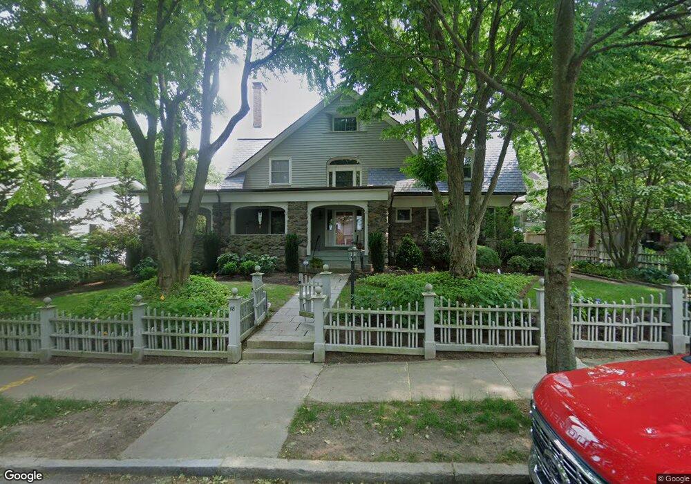
118 Dean Rd Brookline, MA 02445
Cleveland Circle NeighborhoodEstimated Value: $4,146,000 - $4,859,724
8
Beds
7
Baths
6,109
Sq Ft
$750/Sq Ft
Est. Value
About This Home
This home is located at 118 Dean Rd, Brookline, MA 02445 and is currently estimated at $4,582,575, approximately $750 per square foot. 118 Dean Rd is a home located in Norfolk County with nearby schools including John D. Runkle School, Torah Academy, and Maimonides School.
Ownership History
Date
Name
Owned For
Owner Type
Purchase Details
Closed on
Jan 27, 1986
Bought by
Saris Patti B
Current Estimated Value
Create a Home Valuation Report for This Property
The Home Valuation Report is an in-depth analysis detailing your home's value as well as a comparison with similar homes in the area
Home Values in the Area
Average Home Value in this Area
Purchase History
| Date | Buyer | Sale Price | Title Company |
|---|---|---|---|
| Saris Patti B | $492,000 | -- |
Source: Public Records
Mortgage History
| Date | Status | Borrower | Loan Amount |
|---|---|---|---|
| Closed | Saris Patti B | $500,000 | |
| Closed | Saris Patti B | $400,000 |
Source: Public Records
Tax History Compared to Growth
Tax History
| Year | Tax Paid | Tax Assessment Tax Assessment Total Assessment is a certain percentage of the fair market value that is determined by local assessors to be the total taxable value of land and additions on the property. | Land | Improvement |
|---|---|---|---|---|
| 2025 | $43,710 | $4,428,600 | $1,546,800 | $2,881,800 |
| 2024 | $41,659 | $4,264,000 | $1,487,300 | $2,776,700 |
| 2023 | $37,177 | $3,728,900 | $1,062,600 | $2,666,300 |
| 2022 | $36,187 | $3,551,200 | $1,011,900 | $2,539,300 |
| 2021 | $33,464 | $3,414,700 | $973,000 | $2,441,700 |
| 2020 | $31,123 | $3,293,400 | $884,600 | $2,408,800 |
| 2019 | $29,390 | $3,136,600 | $842,500 | $2,294,100 |
| 2018 | $29,083 | $3,074,300 | $851,900 | $2,222,400 |
| 2017 | $28,655 | $2,900,300 | $803,700 | $2,096,600 |
| 2016 | $28,243 | $2,710,500 | $751,100 | $1,959,400 |
| 2015 | $27,055 | $2,533,200 | $702,000 | $1,831,200 |
| 2014 | $28,376 | $2,491,300 | $638,200 | $1,853,100 |
Source: Public Records
Map
Nearby Homes
- 9 Willard Rd
- 8 Strathmore Rd Unit G
- 17 Strathmore Rd Unit 2
- 540 Chestnut Hill Ave
- 333 Clark Rd
- 135 Beaconsfield Rd Unit 1
- 141 Beaconsfield Rd Unit 6
- 3 Englewood Ave Unit 9
- 1856 Beacon St Unit 2C
- 1880 Beacon St Unit 6
- 1763 Beacon St Unit A
- 94 Beaconsfield Rd Unit 201
- 1778 Beacon St Unit 302
- 1731 Beacon St Unit 717
- 1731 Beacon St Unit 1502
- 120 Seaver St Unit A103
- 120 Seaver St Unit C-102
- 37 Englewood Ave Unit 3
- 324 Tappan St Unit 1
- 324 Tappan St Unit 2
- 124 Dean Rd
- 110 Dean Rd
- 305 Buckminster Rd
- 305 Buckminster Rd Unit 1
- 115 Dean Rd
- 123 Dean Rd
- 297 Buckminster Rd
- 130 Dean Rd
- 102 Dean Rd
- 309 Buckminster Rd
- 107 Dean Rd
- 315 Buckminster Rd
- 291 Buckminster Rd
- 291 Buckminster Rd Unit 291
- 129 Dean Rd
- 219 Fisher Ave
- 43 Druce St
- 5 Druce St
- 101 Dean Rd
- 283 Buckminster Rd