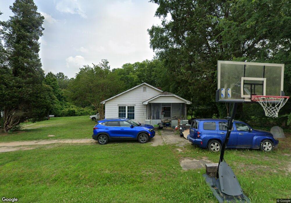
118 Timms St Kings Mountain, NC 28086
Estimated Value: $24,893 - $222,000
--
Bed
--
Bath
1,060
Sq Ft
$128/Sq Ft
Est. Value
About This Home
This home is located at 118 Timms St, Kings Mountain, NC 28086 and is currently estimated at $135,723, approximately $128 per square foot. 118 Timms St is a home located in Cleveland County with nearby schools including Grover Elementary School, Kings Mountain Middle, and Kings Mountain Intermediate School.
Ownership History
Date
Name
Owned For
Owner Type
Purchase Details
Closed on
May 19, 2021
Sold by
Franklin Lynn Nanney
Bought by
Hall Kourtney
Current Estimated Value
Purchase Details
Closed on
Apr 8, 2021
Sold by
Allen Grover Rodney and Brock Grover Terry
Bought by
Riddle Stephanie Marie
Purchase Details
Closed on
Apr 2, 2018
Sold by
Sexton Wayne
Bought by
Grover Rodney A
Create a Home Valuation Report for This Property
The Home Valuation Report is an in-depth analysis detailing your home's value as well as a comparison with similar homes in the area
Home Values in the Area
Average Home Value in this Area
Purchase History
| Date | Buyer | Sale Price | Title Company |
|---|---|---|---|
| Hall Kourtney | $130,000 | None Available | |
| Riddle Stephanie Marie | -- | None Listed On Document | |
| Riddle Stephanie Marie | -- | None Available | |
| Riddle Stephanie Marie | -- | None Listed On Document | |
| Grover Rodney A | $12,000 | Bestitle |
Source: Public Records
Tax History Compared to Growth
Tax History
| Year | Tax Paid | Tax Assessment Tax Assessment Total Assessment is a certain percentage of the fair market value that is determined by local assessors to be the total taxable value of land and additions on the property. | Land | Improvement |
|---|---|---|---|---|
| 2025 | $100 | $16,277 | $14,550 | $1,727 |
| 2024 | $319 | $30,749 | $7,275 | $23,474 |
| 2023 | $316 | $30,749 | $7,275 | $23,474 |
| 2022 | $317 | $30,749 | $7,275 | $23,474 |
| 2021 | $316 | $30,749 | $7,275 | $23,474 |
| 2020 | $286 | $26,319 | $6,402 | $19,917 |
| 2019 | $286 | $26,319 | $6,402 | $19,917 |
| 2018 | $282 | $26,319 | $6,402 | $19,917 |
| 2017 | $281 | $26,319 | $6,402 | $19,917 |
| 2016 | $265 | $26,319 | $6,402 | $19,917 |
| 2015 | $302 | $31,134 | $5,820 | $25,314 |
| 2014 | $302 | $31,134 | $5,820 | $25,314 |
Source: Public Records
Map
Nearby Homes
- 610 Margrace Rd
- 419 Brinkley Dr
- 143 Parker Claire Ln
- 137 Parker Claire Ln
- 157 Parker Claire Ln
- 104 Parker Claire Ln
- 207 Parker Claire Ln
- 149 Parker Claire Ln
- 412 Brinkley Dr
- 112 Fulton Dr
- 219 Parker Claire Ln
- 0 Southridge Dr Unit CAR4298120
- 123 Parker Claire Ln
- 230 Paige Rd
- 212 Paige Rd
- 804 Lee St
- 218 Paige Rd
- 231 Brinkley Dr
- Belhaven Plan at Brinkley Ridge
- Freeport Plan at Brinkley Ridge