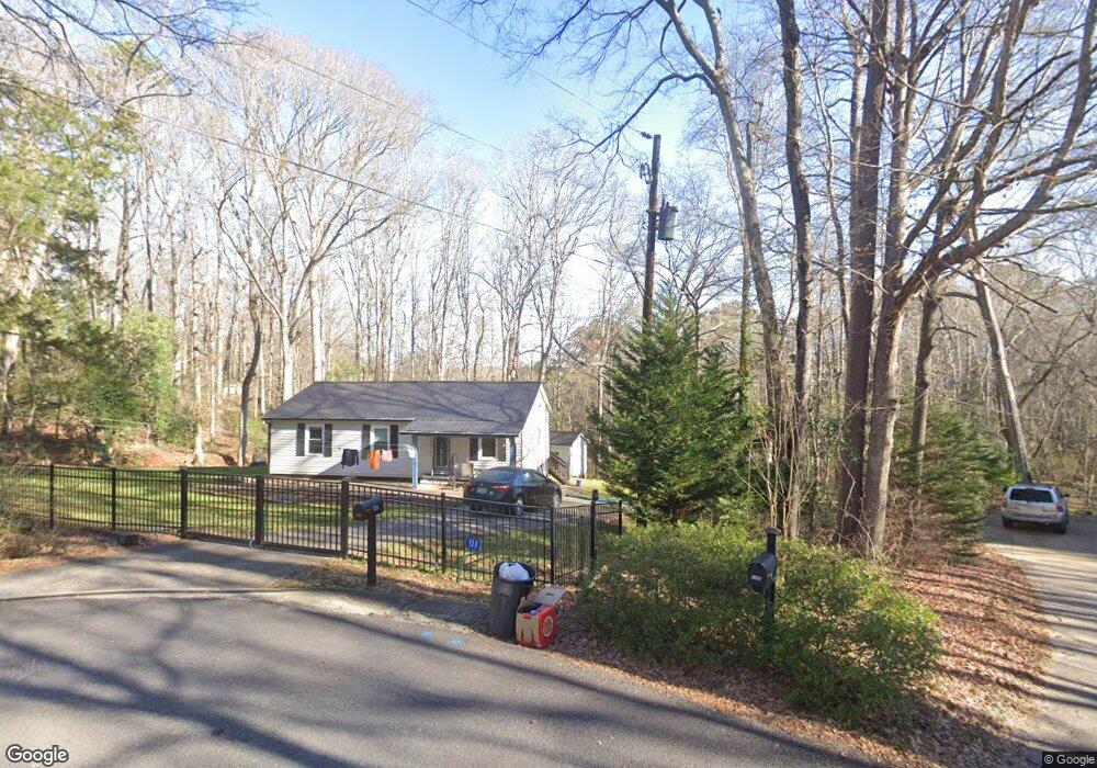
119 Bond Dr Watkinsville, GA 30677
Estimated Value: $311,000 - $346,000
--
Bed
2
Baths
1,040
Sq Ft
$318/Sq Ft
Est. Value
About This Home
This home is located at 119 Bond Dr, Watkinsville, GA 30677 and is currently estimated at $330,923, approximately $318 per square foot. 119 Bond Dr is a home located in Oconee County with nearby schools including Oconee County Elementary School, Oconee County Primary School, and Oconee County Middle School.
Ownership History
Date
Name
Owned For
Owner Type
Purchase Details
Closed on
Aug 20, 2019
Sold by
Murphy John H
Bought by
Biehl Detlev
Current Estimated Value
Home Financials for this Owner
Home Financials are based on the most recent Mortgage that was taken out on this home.
Original Mortgage
$164,825
Outstanding Balance
$144,356
Interest Rate
3.7%
Mortgage Type
New Conventional
Estimated Equity
$186,567
Purchase Details
Closed on
Sep 7, 2016
Sold by
Tammy G
Bought by
Elizabeth Price Dolvin Foundat
Purchase Details
Closed on
May 25, 1999
Sold by
Joiner Bruce and Joiner Cind
Bought by
Cotton Tammy G
Create a Home Valuation Report for This Property
The Home Valuation Report is an in-depth analysis detailing your home's value as well as a comparison with similar homes in the area
Home Values in the Area
Average Home Value in this Area
Purchase History
| Date | Buyer | Sale Price | Title Company |
|---|---|---|---|
| Biehl Detlev | $173,500 | -- | |
| Elizabeth Price Dolvin Foundat | $115,000 | -- | |
| Cotton Tammy G | $89,000 | -- |
Source: Public Records
Mortgage History
| Date | Status | Borrower | Loan Amount |
|---|---|---|---|
| Open | Biehl Detlev | $164,825 |
Source: Public Records
Tax History Compared to Growth
Tax History
| Year | Tax Paid | Tax Assessment Tax Assessment Total Assessment is a certain percentage of the fair market value that is determined by local assessors to be the total taxable value of land and additions on the property. | Land | Improvement |
|---|---|---|---|---|
| 2024 | $2,571 | $107,256 | $26,000 | $81,256 |
| 2023 | $2,401 | $104,114 | $22,000 | $82,114 |
| 2022 | $2,217 | $90,932 | $22,000 | $68,932 |
| 2021 | $1,980 | $75,669 | $16,000 | $59,669 |
| 2020 | $1,838 | $69,615 | $16,000 | $53,615 |
| 2019 | $1,647 | $61,832 | $16,000 | $45,832 |
| 2018 | $1,459 | $53,741 | $16,000 | $37,741 |
| 2017 | $1,257 | $48,545 | $14,000 | $34,545 |
| 2016 | $1,173 | $44,528 | $14,000 | $30,528 |
| 2015 | $1,092 | $41,438 | $14,000 | $27,438 |
| 2014 | $1,080 | $40,133 | $14,000 | $26,133 |
| 2013 | -- | $43,010 | $15,000 | $28,010 |
Source: Public Records
Map
Nearby Homes
- 86 Cedar Dr
- 88 Cedar Dr
- 1036 Falling Leaf Ct Unit 2
- 1036 Falling Leaf Ct
- 1200 Paxton Ct
- 1511 Paxton Ct
- 1810 Paxton Ct
- 170 Elliot Cir
- 96 Morrison St Unit 53
- 92 Morrison St Unit 54
- 90 Morrison St Unit 55
- 96 Morrison St
- 90 Morrison St
- 70, 72 Colham Ferry Extension
- 157 S Main St
- 1010 Jeremy Dr
- 194 New High Shoals Rd
- 2051 Simonton Bridge Rd
- 1345 Harmony Bend
- 1385 Harmony Bend
- 0 Bond Dr Unit CM471107
- 0 Bond Dr Unit 3244787
- 0 Bond Dr
- 111 Bond Dr
- 113 Bond Dr
- 110 Bond Dr
- 131 Hight Dr
- 146 V f w Dr
- 146 Vfw Dr
- 135 Hight Dr
- 0 Vfw Dr Unit 3242087
- 0 Vfw Dr Unit 8247329
- 0 Vfw Dr Unit 8298494
- 0 Vfw Dr Unit 8154075
- 0 Vfw Dr Unit 8065843
- 0 Vfw Dr
- V Vfw Dr
- 140 V f w Dr
- 129 Hight Dr
- 148 V f w Dr