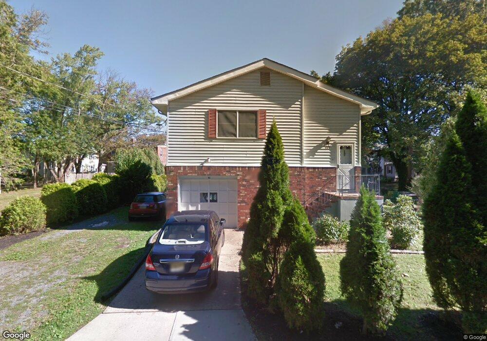
119 Clinton St Hightstown, NJ 08520
Estimated Value: $559,000 - $640,000
--
Bed
--
Bath
2,700
Sq Ft
$217/Sq Ft
Est. Value
About This Home
This home is located at 119 Clinton St, Hightstown, NJ 08520 and is currently estimated at $584,785, approximately $216 per square foot. 119 Clinton St is a home located in Mercer County with nearby schools including Melvin H. Kreps Middle School, Hightstown High School, and SciCore Academy.
Ownership History
Date
Name
Owned For
Owner Type
Purchase Details
Closed on
Sep 1, 2023
Sold by
Nisar Anjum and Nisar Farzana
Bought by
Nisar Farzana and Anjum Umar
Current Estimated Value
Purchase Details
Closed on
Nov 21, 1991
Sold by
Standrews So Bb Fed Credit Union
Bought by
Nisar Anjum and Nisar Farzana
Purchase Details
Closed on
Apr 9, 1990
Sold by
Bujnarowski Juan R and Bujnarowski Gladys
Bought by
St Andrews So Bound Brook Fed Cr Un
Create a Home Valuation Report for This Property
The Home Valuation Report is an in-depth analysis detailing your home's value as well as a comparison with similar homes in the area
Home Values in the Area
Average Home Value in this Area
Purchase History
| Date | Buyer | Sale Price | Title Company |
|---|---|---|---|
| Nisar Farzana | -- | None Listed On Document | |
| Nisar Anjum | $120,000 | -- | |
| Nisar Anjum | $120,000 | -- | |
| St Andrews So Bound Brook Fed Cr Un | -- | -- |
Source: Public Records
Tax History Compared to Growth
Tax History
| Year | Tax Paid | Tax Assessment Tax Assessment Total Assessment is a certain percentage of the fair market value that is determined by local assessors to be the total taxable value of land and additions on the property. | Land | Improvement |
|---|---|---|---|---|
| 2025 | $10,458 | $213,300 | $97,400 | $115,900 |
| 2024 | $10,351 | $213,300 | $97,400 | $115,900 |
| 2023 | $10,351 | $213,300 | $97,400 | $115,900 |
| 2022 | $9,993 | $213,300 | $97,400 | $115,900 |
| 2021 | $9,633 | $213,300 | $97,400 | $115,900 |
| 2020 | $9,413 | $213,300 | $97,400 | $115,900 |
| 2019 | $9,151 | $213,300 | $97,400 | $115,900 |
| 2018 | $8,884 | $213,300 | $97,400 | $115,900 |
| 2017 | $8,792 | $213,300 | $97,400 | $115,900 |
| 2016 | $8,715 | $213,300 | $97,400 | $115,900 |
| 2015 | $8,660 | $213,300 | $97,400 | $115,900 |
| 2014 | $8,715 | $213,300 | $97,400 | $115,900 |
Source: Public Records
Map
Nearby Homes
- 219 Maxwell Ave
- 344 Monmouth St
- 128 Monmouth St
- 23 Barton Dr
- 302 S Main St
- 336 Monmouth St
- 104 1st Ave
- 4 Brakeman Ct
- 43 Norton Ave
- 158 Mill Run E
- 164 Mill Run E Unit 141
- 108 Orchard Ave
- 201 Morrison Ave
- 5 Mill Run W
- 23 Powell Ct
- 309 Lincoln Ave
- 126 Mill Run E
- 126 Mill Run E Unit 84
- 124 Mill Run E Unit 85
- 336 Stockton St
- 244 Franklin St
- 0 Clinton St
- 117 Clinton St
- 242 Franklin St
- 144 Clinton St
- 228 Franklin St Unit 230
- 228 230 Franklin
- 228-230 Franklin St
- 228 Franklin St Unit 28/30
- 246 Franklin St
- 248 Franklin St
- 154 Clinton St
- 134 Clinton St
- 134 Clinton St Unit 2ND FLOOR APARTMENT
- 122 Clinton St
- 224-226 Franklin St
- 250 Franklin St
- 224 Franklin St
- 164 Clinton St
- 120 Clinton St