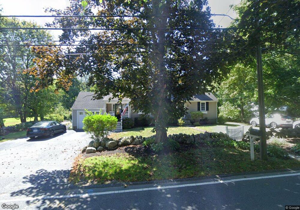
119 Elm St Scituate, MA 02066
Estimated Value: $860,000 - $898,892
4
Beds
2
Baths
1,960
Sq Ft
$447/Sq Ft
Est. Value
About This Home
This home is located at 119 Elm St, Scituate, MA 02066 and is currently estimated at $875,223, approximately $446 per square foot. 119 Elm St is a home located in Plymouth County with nearby schools including Cushing Elementary School, Lester J. Gates Middle School, and Scituate High School.
Ownership History
Date
Name
Owned For
Owner Type
Purchase Details
Closed on
May 26, 2000
Sold by
Navin Mark L and Navin Carol A
Bought by
Pasini Michael M and Pasini Amy M
Current Estimated Value
Purchase Details
Closed on
Jan 12, 1996
Sold by
Lee Bernard T and Lee Phyllis J
Bought by
Navin Mark L and Navin Carol A
Create a Home Valuation Report for This Property
The Home Valuation Report is an in-depth analysis detailing your home's value as well as a comparison with similar homes in the area
Home Values in the Area
Average Home Value in this Area
Purchase History
| Date | Buyer | Sale Price | Title Company |
|---|---|---|---|
| Pasini Michael M | $350,000 | -- | |
| Navin Mark L | $185,000 | -- |
Source: Public Records
Mortgage History
| Date | Status | Borrower | Loan Amount |
|---|---|---|---|
| Closed | Navin Mark L | $135,000 | |
| Closed | Navin Mark L | $30,000 | |
| Closed | Navin Mark L | $205,000 |
Source: Public Records
Tax History Compared to Growth
Tax History
| Year | Tax Paid | Tax Assessment Tax Assessment Total Assessment is a certain percentage of the fair market value that is determined by local assessors to be the total taxable value of land and additions on the property. | Land | Improvement |
|---|---|---|---|---|
| 2025 | $7,889 | $789,700 | $386,900 | $402,800 |
| 2024 | $7,792 | $752,100 | $351,700 | $400,400 |
| 2023 | $7,665 | $693,600 | $337,500 | $356,100 |
| 2022 | $7,665 | $607,400 | $308,900 | $298,500 |
| 2021 | $7,330 | $549,900 | $294,200 | $255,700 |
| 2020 | $7,108 | $526,500 | $282,800 | $243,700 |
| 2019 | $6,969 | $507,200 | $277,300 | $229,900 |
| 2018 | $6,872 | $492,600 | $275,800 | $216,800 |
| 2017 | $6,779 | $481,100 | $264,300 | $216,800 |
| 2016 | $6,478 | $458,100 | $241,300 | $216,800 |
| 2015 | $5,850 | $446,600 | $229,800 | $216,800 |
Source: Public Records
Map
Nearby Homes
- 115 Elm St
- 3 Grace Way Unit 3
- 1 Grace Way Unit 1
- 111 Elm St
- 32 Fairview Ave
- 74 Tilden Rd
- 116 Old Forge Rd
- 76 A Brook St
- 76 A Brook St Unit 1
- 22 Kings Way
- 14 Aberdeen Dr
- 54 Woodland Rd
- 50 First Parish Rd
- 19 Ford Place Unit 3
- 19 Ford Place Unit 1
- 17 Old Oaken Bucket Rd
- 10 Benjamin Ln Unit 10
- 2 Windward Ln
- 59 Captain Peirce Rd
- 49 Cornet Stetson Rd
- 127 Elm St
- 122 Elm St
- 118 Elm St
- 126 Elm St
- 133 Elm St
- 109 Elm St
- 112 Elm St
- 32 Daedalus Cir
- lot 40 Walnut Tree Hill Dr
- LOT 7 Tanglewood
- LOT 8 Persimmon Rd
- LOT 12 Fox Vine Lane 18
- LOT 10 Heritage Trail
- LOT4 Heritage Trail
- LOT 20 Cushing Estates
- 6 Meadow Ln
- 6 Meadow Ln
- 34 Daedalus Cir
- 6 Grace Way Unit 6
- 0 Branch