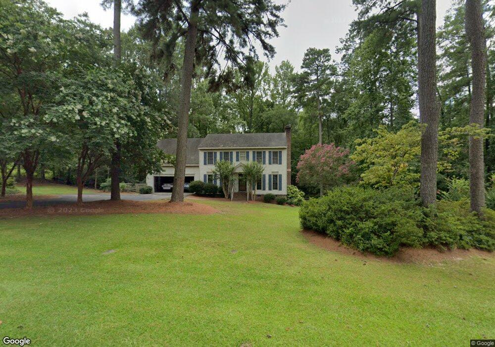
119 Munford Dr Louisburg, NC 27549
Estimated Value: $285,000 - $334,000
4
Beds
3
Baths
2,300
Sq Ft
$135/Sq Ft
Est. Value
About This Home
This home is located at 119 Munford Dr, Louisburg, NC 27549 and is currently estimated at $310,173, approximately $134 per square foot. 119 Munford Dr is a home located in Franklin County with nearby schools including Louisburg Elementary School, Terrell Lane Middle School, and Louisburg High School.
Ownership History
Date
Name
Owned For
Owner Type
Purchase Details
Closed on
Sep 16, 2016
Sold by
Munford Lane Nc Llc
Bought by
Jrc Management Llc
Current Estimated Value
Purchase Details
Closed on
Apr 9, 2008
Sold by
Hanna John Edward
Bought by
Munford Lane Nc Llc
Purchase Details
Closed on
Oct 6, 1992
Bought by
Hanna John E
Create a Home Valuation Report for This Property
The Home Valuation Report is an in-depth analysis detailing your home's value as well as a comparison with similar homes in the area
Home Values in the Area
Average Home Value in this Area
Purchase History
| Date | Buyer | Sale Price | Title Company |
|---|---|---|---|
| Jrc Management Llc | $135,000 | Attorney | |
| Munford Lane Nc Llc | -- | None Available | |
| Hanna John E | $120,000 | -- |
Source: Public Records
Tax History Compared to Growth
Tax History
| Year | Tax Paid | Tax Assessment Tax Assessment Total Assessment is a certain percentage of the fair market value that is determined by local assessors to be the total taxable value of land and additions on the property. | Land | Improvement |
|---|---|---|---|---|
| 2025 | $1,788 | $278,470 | $60,370 | $218,100 |
| 2024 | $1,788 | $278,470 | $60,370 | $218,100 |
| 2023 | $1,665 | $176,220 | $28,560 | $147,660 |
| 2022 | $1,655 | $176,220 | $28,560 | $147,660 |
| 2021 | $1,673 | $176,220 | $28,560 | $147,660 |
| 2020 | $1,665 | $176,220 | $28,560 | $147,660 |
| 2019 | $1,651 | $176,220 | $28,560 | $147,660 |
| 2018 | $1,650 | $176,220 | $28,560 | $147,660 |
| 2017 | $1,518 | $147,110 | $25,960 | $121,150 |
| 2016 | $1,569 | $147,110 | $25,960 | $121,150 |
| 2015 | $1,562 | $147,110 | $25,960 | $121,150 |
| 2014 | $1,460 | $147,110 | $25,960 | $121,150 |
Source: Public Records
Map
Nearby Homes
- 101 Briarwood Ct
- 615 Woodland Trail
- 126 Person St
- 0-0 Halifax Rd
- 612 N Main St
- 604 N Main St
- 301 W College St
- 7.69 Acres N Carolina 561
- 23.20 Acre N Carolina 561
- 10.26 Acre N Carolina 561
- 414 W Noble St
- 313 W Noble St
- 125 Davis St
- 321 W Noble St
- 305 N Elm St
- 401 N Main St
- 109 Drew St
- 101 S Elm St
- 105 S Elm St
- 205 Williamson St