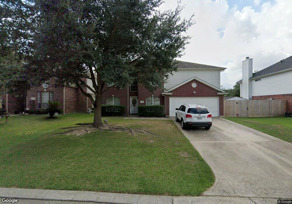
11927 Lois Ln Pinehurst, TX 77362
Estimated Value: $297,361 - $325,000
--
Bed
3
Baths
2,362
Sq Ft
$130/Sq Ft
Est. Value
About This Home
This home is located at 11927 Lois Ln, Pinehurst, TX 77362 and is currently estimated at $307,090, approximately $130 per square foot. 11927 Lois Ln is a home located in Montgomery County with nearby schools including Decker Prairie Elementary School, Tomball Intermediate School, and Tomball Junior High School.
Ownership History
Date
Name
Owned For
Owner Type
Purchase Details
Closed on
Feb 25, 2003
Sold by
Richland Homes Inc
Bought by
Kimble Charles and Kimble Terri
Current Estimated Value
Home Financials for this Owner
Home Financials are based on the most recent Mortgage that was taken out on this home.
Original Mortgage
$133,850
Outstanding Balance
$56,727
Interest Rate
5.93%
Estimated Equity
$250,363
Purchase Details
Closed on
Sep 6, 2002
Sold by
Decker Oaks Land Co Ltd
Bought by
Kimble Charles and Kimble Terri
Create a Home Valuation Report for This Property
The Home Valuation Report is an in-depth analysis detailing your home's value as well as a comparison with similar homes in the area
Home Values in the Area
Average Home Value in this Area
Purchase History
| Date | Buyer | Sale Price | Title Company |
|---|---|---|---|
| Kimble Charles | -- | -- | |
| Kimble Charles | -- | -- |
Source: Public Records
Mortgage History
| Date | Status | Borrower | Loan Amount |
|---|---|---|---|
| Open | Kimble Charles | $133,850 |
Source: Public Records
Tax History Compared to Growth
Tax History
| Year | Tax Paid | Tax Assessment Tax Assessment Total Assessment is a certain percentage of the fair market value that is determined by local assessors to be the total taxable value of land and additions on the property. | Land | Improvement |
|---|---|---|---|---|
| 2025 | $3,882 | $320,907 | $14,710 | $306,197 |
| 2024 | $4,852 | $310,600 | $14,710 | $295,890 |
| 2023 | $4,852 | $288,800 | $14,710 | $274,090 |
| 2022 | $5,447 | $294,820 | $14,710 | $280,110 |
| 2021 | $4,590 | $238,850 | $14,710 | $224,140 |
| 2020 | $4,331 | $216,090 | $14,710 | $201,380 |
| 2019 | $4,258 | $215,670 | $14,710 | $200,960 |
| 2018 | $3,764 | $208,430 | $14,710 | $193,720 |
| 2017 | $4,158 | $199,800 | $22,000 | $177,800 |
| 2016 | $3,857 | $185,340 | $22,000 | $163,340 |
| 2015 | $3,066 | $170,310 | $22,000 | $154,670 |
| 2014 | $3,066 | $154,830 | $22,000 | $132,830 |
Source: Public Records
Map
Nearby Homes
- 12015 Helene Ct
- 12102 Carol Ln
- 12038 Powderhorn Ln
- 32214 Annice Ln
- 32126 Annice Ln
- 11726 Elizabeth Ct
- 32015 Sue Ln
- 32035 Annice Ln
- 32002 Sue Ln
- 32006 Annice Ln
- 11919 Hickory Wood St
- 25429 Hardin Store Rd
- 317 Louvenia Ct
- 331 Louvenia Ct
- 322 Louvenia Ct
- 25432 Hardin Store Rd
- 358 Louvenia Ct
- 223 Gonsoulin Ln
- 316 Louvenia Ct
- 0 TBD Cripple Creek Dr