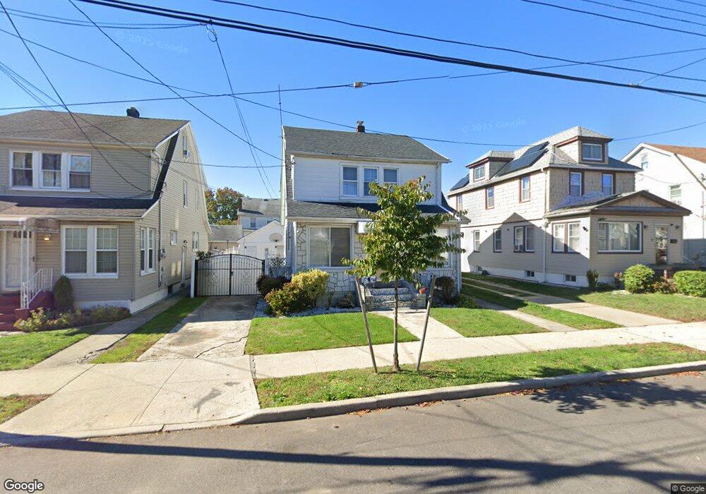
11932 191st St Saint Albans, NY 11412
Saint Albans NeighborhoodEstimated Value: $688,008 - $822,000
--
Bed
--
Bath
1,634
Sq Ft
$465/Sq Ft
Est. Value
About This Home
This home is located at 11932 191st St, Saint Albans, NY 11412 and is currently estimated at $760,502, approximately $465 per square foot. 11932 191st St is a home located in Queens County with nearby schools including P.S. 15 Jackie Robinson, Is 59 Springfield Gardens, and Riverton Street Charter School.
Ownership History
Date
Name
Owned For
Owner Type
Purchase Details
Closed on
Mar 8, 2022
Sold by
Frederick Wendy and Vincent Glenroy
Bought by
Frederick Wendy
Current Estimated Value
Home Financials for this Owner
Home Financials are based on the most recent Mortgage that was taken out on this home.
Original Mortgage
$400,000
Outstanding Balance
$373,049
Interest Rate
3.76%
Mortgage Type
Purchase Money Mortgage
Estimated Equity
$387,453
Purchase Details
Closed on
Feb 11, 1997
Sold by
Beverly Raymond and Daniels Stephanie
Bought by
Vincent Glenroy and Frederick Wendy
Home Financials for this Owner
Home Financials are based on the most recent Mortgage that was taken out on this home.
Original Mortgage
$139,900
Interest Rate
7.55%
Mortgage Type
FHA
Create a Home Valuation Report for This Property
The Home Valuation Report is an in-depth analysis detailing your home's value as well as a comparison with similar homes in the area
Home Values in the Area
Average Home Value in this Area
Purchase History
| Date | Buyer | Sale Price | Title Company |
|---|---|---|---|
| Frederick Wendy | -- | -- | |
| Vincent Glenroy | $140,000 | First American Title Ins Co |
Source: Public Records
Mortgage History
| Date | Status | Borrower | Loan Amount |
|---|---|---|---|
| Open | Frederick Wendy | $400,000 | |
| Previous Owner | Vincent Glenroy | $139,900 |
Source: Public Records
Tax History Compared to Growth
Tax History
| Year | Tax Paid | Tax Assessment Tax Assessment Total Assessment is a certain percentage of the fair market value that is determined by local assessors to be the total taxable value of land and additions on the property. | Land | Improvement |
|---|---|---|---|---|
| 2025 | $6,145 | $32,428 | $9,475 | $22,953 |
| 2024 | $6,145 | $30,594 | $9,191 | $21,403 |
| 2023 | $5,797 | $28,862 | $7,425 | $21,437 |
| 2022 | $4,537 | $41,400 | $12,780 | $28,620 |
| 2021 | $4,841 | $34,320 | $12,780 | $21,540 |
| 2020 | $4,654 | $29,520 | $12,780 | $16,740 |
| 2019 | $4,267 | $30,600 | $12,780 | $17,820 |
| 2018 | $4,903 | $24,052 | $11,859 | $12,193 |
| 2017 | $4,768 | $23,389 | $10,188 | $13,201 |
| 2016 | $4,676 | $23,389 | $10,188 | $13,201 |
| 2015 | $2,441 | $22,519 | $10,610 | $11,909 |
| 2014 | $2,441 | $21,246 | $12,017 | $9,229 |
Source: Public Records
Map
Nearby Homes
- 18822 119th Ave
- 188-51 120th Rd
- 119-44 193rd St
- 118-29 191st St
- 118-18 190th St
- 11915 193rd St
- 193-06 119th Ave
- 191-07 121st Ave
- 120-44 192nd St
- 18821 118th Ave
- 120-20 194th St
- 18922 117th Rd
- 19415 120th Ave
- 189-20 117th Rd
- 12133 Grayson St
- 189-21 117th Rd
- 12054 194th St
- 12043 194th St
- 19009 122nd Ave
- 191-01 122nd Ave
- 11936 191st St
- 11928 191st St
- 119-28 191st St
- 119-40 191st St
- 11940 191st St
- 11924 191st St
- 11933 190th St
- 11929 190th St
- 119-29 190th St
- 11937 190th St
- 11925 190th St
- 11944 191st St
- 11920 191st St
- 11937 190th St
- 11943 190th St
- 11921 190th St
- 11945 190th St
- 119-45 190th St Unit 2
- 119-35 191st St
- 11931 191st St