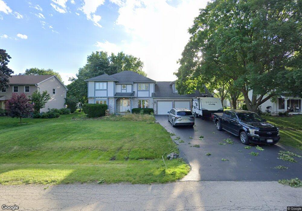
11S478 Mcgrath Ln Naperville, IL 60564
Wheatland South NeighborhoodEstimated Value: $621,000 - $696,000
5
Beds
3
Baths
2,881
Sq Ft
$224/Sq Ft
Est. Value
About This Home
This home is located at 11S478 Mcgrath Ln, Naperville, IL 60564 and is currently estimated at $645,451, approximately $224 per square foot. 11S478 Mcgrath Ln is a home located in Will County with nearby schools including Ellsworth Elementary School, Clifford Crone Middle School, and Neuqua Valley High School.
Ownership History
Date
Name
Owned For
Owner Type
Purchase Details
Closed on
Jul 17, 2024
Sold by
Derer Raymond Brian and Derer Kristin Manning
Bought by
Raymond Brian Derer Trust and Kristin Manning Derer Trust
Current Estimated Value
Purchase Details
Closed on
Apr 10, 2023
Sold by
Tamazian Simik and Tamazian Klaris
Bought by
Derer Raymond Brian and Derer Kristin Manning
Home Financials for this Owner
Home Financials are based on the most recent Mortgage that was taken out on this home.
Original Mortgage
$435,000
Interest Rate
6%
Mortgage Type
New Conventional
Purchase Details
Closed on
Dec 1, 2016
Sold by
Hjelm Christine D
Bought by
Tamazian Simik and Tamazian Klaris
Home Financials for this Owner
Home Financials are based on the most recent Mortgage that was taken out on this home.
Original Mortgage
$272,000
Interest Rate
3.47%
Mortgage Type
New Conventional
Create a Home Valuation Report for This Property
The Home Valuation Report is an in-depth analysis detailing your home's value as well as a comparison with similar homes in the area
Home Values in the Area
Average Home Value in this Area
Purchase History
| Date | Buyer | Sale Price | Title Company |
|---|---|---|---|
| Raymond Brian Derer Trust | -- | None Listed On Document | |
| Derer Raymond Brian | $545,000 | First American Title | |
| Tamazian Simik | $340,000 | Attorneys Title Guaranty Fun |
Source: Public Records
Mortgage History
| Date | Status | Borrower | Loan Amount |
|---|---|---|---|
| Previous Owner | Derer Raymond Brian | $435,000 | |
| Previous Owner | Tamazian Simik | $272,000 |
Source: Public Records
Tax History Compared to Growth
Tax History
| Year | Tax Paid | Tax Assessment Tax Assessment Total Assessment is a certain percentage of the fair market value that is determined by local assessors to be the total taxable value of land and additions on the property. | Land | Improvement |
|---|---|---|---|---|
| 2024 | $9,593 | $168,453 | $25,941 | $142,512 |
| 2023 | $9,593 | $148,810 | $22,916 | $125,894 |
| 2022 | $9,656 | $137,417 | $21,679 | $115,738 |
| 2021 | $8,672 | $130,874 | $20,647 | $110,227 |
| 2020 | $8,121 | $128,800 | $20,320 | $108,480 |
| 2019 | $7,982 | $125,170 | $19,747 | $105,423 |
| 2018 | $8,510 | $130,433 | $19,312 | $111,121 |
| 2017 | $8,397 | $127,065 | $18,813 | $108,252 |
| 2016 | $8,022 | $124,330 | $18,408 | $105,922 |
| 2015 | $7,347 | $119,548 | $17,700 | $101,848 |
| 2014 | $7,347 | $107,680 | $17,700 | $89,980 |
| 2013 | $7,347 | $107,680 | $17,700 | $89,980 |
Source: Public Records
Map
Nearby Homes
- 29W316 Andermann Dr
- 2255 Wendt Cir
- 3105 Saganashkee Ln
- 3707 Junebreeze Ln
- 2207 Sisters Ave
- 2866 Stonewater Dr Unit 102
- 3616 Eliot Ln
- 1804 Princess Cir
- 2949 Brossman St
- 1736 Robert Ln
- 3003 Kingbird Ct Unit IV
- 3432 Redwing Dr Unit 2
- 3349 Rosecroft Ln Unit 2
- 2736 Bluewater Cir
- 3432 Caine Dr
- 3408 Parliament Ln Unit 1
- 3420 Sunnyside Ct
- 2543 Dewes Ln
- 2611 Cedar Glade Dr Unit 204
- 3311 Fairmont Ave
- 11S504 Mcgrath Ln
- 11S464 Mcgrath Ln
- 11S471 Mcgrath Ln
- 11S481 Mcgrath Ln
- 11S516 Mcgrath Ln
- 11S452 Mcgrath Ln
- 2455 Corn Lily Rd
- 2459 Corn Lily Rd
- 2451 Corn Lily Rd
- 2447 Corn Lily Rd
- 2463 Corn Lily Rd
- 11S461 Mcgrath Ln
- 2503 Accolade Ave
- 29W345 Staffeldt Dr
- 2443 Corn Lily Rd
- 11S436 Mcgrath Ln
- 11s Mcgrath Ln
- 11S530 Mcgrath Ln
- 274 Mcgrath Ln
- 2507 Accolade Ave