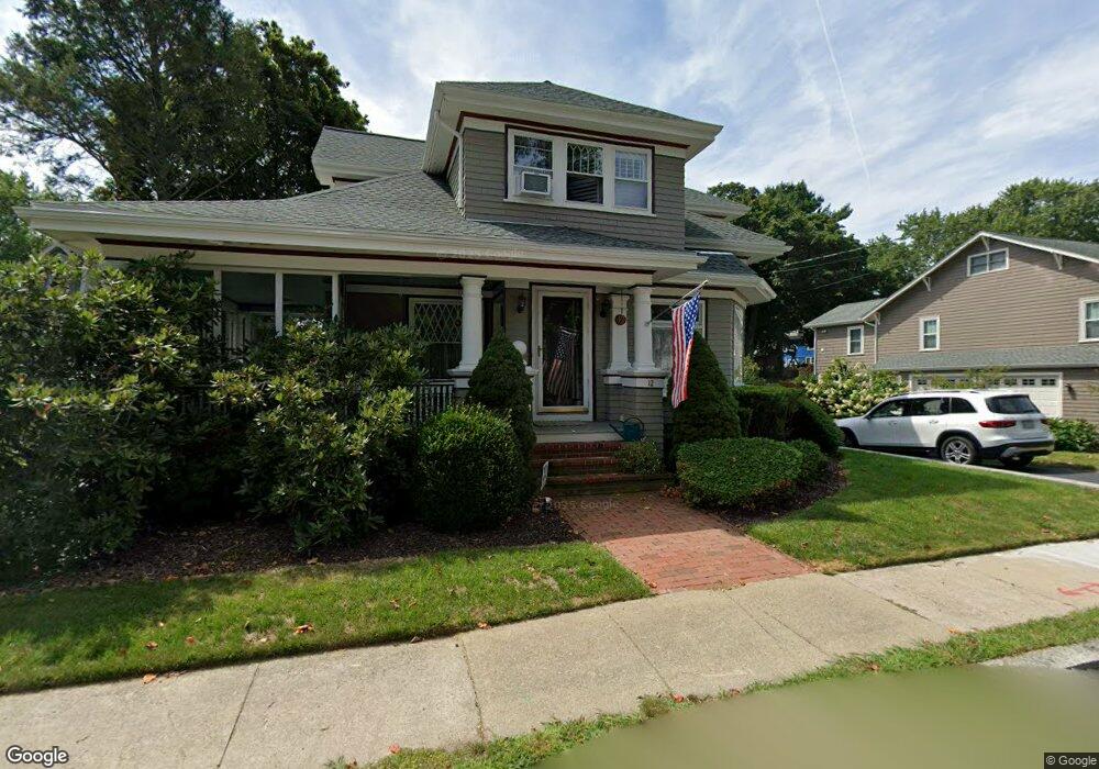
12 Ash St North Attleboro, MA 02760
North Attleboro NeighborhoodEstimated Value: $588,000 - $671,000
3
Beds
3
Baths
2,016
Sq Ft
$312/Sq Ft
Est. Value
About This Home
This home is located at 12 Ash St, North Attleboro, MA 02760 and is currently estimated at $629,992, approximately $312 per square foot. 12 Ash St is a home located in Bristol County with nearby schools including North Attleboro High School, Cadence Academy Preschool - North Attleborough, and Bishop Feehan High School.
Ownership History
Date
Name
Owned For
Owner Type
Purchase Details
Closed on
Jan 2, 2024
Sold by
Sandland Ernest E and Sandland Anne M
Bought by
Sandland Ft and Sandland
Current Estimated Value
Purchase Details
Closed on
Jan 1, 1985
Bought by
Sandland Ernest E and Sandland Anne M
Create a Home Valuation Report for This Property
The Home Valuation Report is an in-depth analysis detailing your home's value as well as a comparison with similar homes in the area
Home Values in the Area
Average Home Value in this Area
Purchase History
| Date | Buyer | Sale Price | Title Company |
|---|---|---|---|
| Sandland Ft | -- | None Available | |
| Sandland Ernest E | -- | -- |
Source: Public Records
Mortgage History
| Date | Status | Borrower | Loan Amount |
|---|---|---|---|
| Previous Owner | Sandland Ernest E | $110,000 | |
| Previous Owner | Sandland Ernest E | $14,000 |
Source: Public Records
Tax History Compared to Growth
Tax History
| Year | Tax Paid | Tax Assessment Tax Assessment Total Assessment is a certain percentage of the fair market value that is determined by local assessors to be the total taxable value of land and additions on the property. | Land | Improvement |
|---|---|---|---|---|
| 2025 | $7,595 | $644,200 | $138,000 | $506,200 |
| 2024 | $7,434 | $644,200 | $138,000 | $506,200 |
| 2023 | $6,882 | $538,100 | $144,000 | $394,100 |
| 2022 | $6,696 | $480,700 | $138,000 | $342,700 |
| 2021 | $5,652 | $396,100 | $138,000 | $258,100 |
| 2020 | $5,597 | $390,000 | $138,000 | $252,000 |
| 2019 | $5,232 | $367,400 | $125,500 | $241,900 |
| 2018 | $4,630 | $347,100 | $125,500 | $221,600 |
| 2017 | $4,320 | $326,800 | $125,500 | $201,300 |
| 2016 | $4,127 | $312,200 | $145,500 | $166,700 |
| 2015 | $3,914 | $297,900 | $151,500 | $146,400 |
| 2014 | $3,887 | $293,600 | $133,000 | $160,600 |
Source: Public Records
Map
Nearby Homes
- 80 Broadway Unit 9
- 50 Metcalf Rd
- 300 E Washington St Unit 54R
- 130 E Washington St Unit 57
- 130 E Washington St Unit 71
- 130 E Washington St Unit 36
- 130 E Washington St Unit 9
- 137 Sumner St
- 93 Bank St
- 16 Richards Ave Unit 106
- 160 Crescent Ave
- 40 Roosevelt Ave
- 19 Church St Unit C9
- 12 Roosevelt Ave
- 16 Johnson St
- 27 Taylor St
- 46 Westside Ave
- 0 Anawan Rd
- 30 Sperry Ln Unit Lot 15
- 121 E Washington St Unit 8
- 195 S Washington St
- 20 Ash St
- 28/30 Ash St Unit Garage
- 28/30 Ash St
- 185 S Washington St
- 28 Ash St Unit 30
- 28 Ash St Unit 2
- 205 S Washington St
- 15 Ash St
- 15 Colburn St
- 21 Ash St
- 211 S Washington St
- 0 Ash St
- 27 Ash St
- 179 S Washington St
- 25 Colburn St
- 202 S Washington St
- 36 Ash St
- 206 S Washington St
- 33 Ash St