Estimated Value: $122,000 - $168,000
3
Beds
1
Bath
1,152
Sq Ft
$128/Sq Ft
Est. Value
About This Home
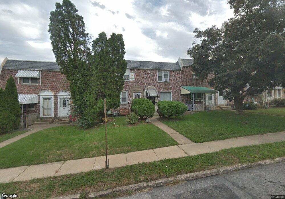
This home is located at 12 Clarendon Dr, Darby, PA 19023 and is currently estimated at $147,700, approximately $128 per square foot. 12 Clarendon Dr is a home located in Delaware County with nearby schools including Ardmore Avenue School, Penn Wood Middle School, and Penn Wood High School - Cypress Street Campus.
Ownership History
Date
Name
Owned For
Owner Type
Purchase Details
Closed on
May 31, 2022
Sold by
Carl Seitz
Bought by
Rex Latonyia
Current Estimated Value
Home Financials for this Owner
Home Financials are based on the most recent Mortgage that was taken out on this home.
Original Mortgage
$98,188
Outstanding Balance
$93,287
Interest Rate
5.1%
Mortgage Type
FHA
Estimated Equity
$54,413
Purchase Details
Closed on
Mar 21, 2001
Sold by
Delco Realty Assoc Llc
Bought by
Hincken Edward J
Home Financials for this Owner
Home Financials are based on the most recent Mortgage that was taken out on this home.
Original Mortgage
$27,000
Interest Rate
6.96%
Mortgage Type
Seller Take Back
Purchase Details
Closed on
Dec 28, 1999
Sold by
Tax Claim Bureau
Bought by
Davis and Davis Klein
Purchase Details
Closed on
May 12, 1997
Sold by
Osborne Ann
Bought by
Rousseau Mtg Corp
Create a Home Valuation Report for This Property
The Home Valuation Report is an in-depth analysis detailing your home's value as well as a comparison with similar homes in the area
Home Values in the Area
Average Home Value in this Area
Purchase History
| Date | Buyer | Sale Price | Title Company |
|---|---|---|---|
| Rex Latonyia | $100,000 | None Listed On Document | |
| Hincken Edward J | $30,000 | Commonwealth Land Title Ins | |
| Davis | $6,052 | -- | |
| Rousseau Mtg Corp | -- | -- |
Source: Public Records
Mortgage History
| Date | Status | Borrower | Loan Amount |
|---|---|---|---|
| Open | Rex Latonyia | $98,188 | |
| Previous Owner | Hincken Edward J | $27,000 |
Source: Public Records
Tax History Compared to Growth
Tax History
| Year | Tax Paid | Tax Assessment Tax Assessment Total Assessment is a certain percentage of the fair market value that is determined by local assessors to be the total taxable value of land and additions on the property. | Land | Improvement |
|---|---|---|---|---|
| 2025 | $3,177 | $64,150 | $18,470 | $45,680 |
| 2024 | $3,177 | $64,150 | $18,470 | $45,680 |
| 2023 | $2,989 | $64,150 | $18,470 | $45,680 |
| 2022 | $2,907 | $64,150 | $18,470 | $45,680 |
| 2021 | $4,057 | $64,150 | $18,470 | $45,680 |
| 2020 | $1,726 | $23,625 | $14,960 | $8,665 |
| 2019 | $1,653 | $23,625 | $14,960 | $8,665 |
| 2018 | $1,633 | $23,625 | $0 | $0 |
| 2017 | $1,603 | $23,625 | $0 | $0 |
| 2016 | $130 | $23,625 | $0 | $0 |
| 2015 | $132 | $23,625 | $0 | $0 |
| 2014 | $132 | $23,625 | $0 | $0 |
Source: Public Records
Map
Nearby Homes
- 1007 Tyler Ave
- 4 Creek Ave
- 1008 Springfield Rd
- 134 S Macdade Blvd
- 1115 Chestnut St
- 28 S 12th St
- 1143 Chestnut St
- 1125 Main St
- 113 Hillside Ave
- 14 N Macdade Blvd
- 112 Pusey Ave
- 212 Pusey Ave
- 439 Beechwood Ave
- 17 Kern St
- 221 Highland Ave
- 1210 Berkley Rd
- 1044 Pine St
- 1017 Lawrence Ave
- 416 Jackson Ave
- 33 Mermont Cir
- 14 Clarendon Dr
- 10 Clarendon Dr
- 16 Clarendon Dr
- 8 Clarendon Dr
- 18 Clarendon Dr
- 6 Clarendon Dr
- 20 Clarendon Dr
- 4 Clarendon Dr
- 22 Clarendon Dr
- 11 Southridge Rd
- 13 Southridge Rd
- 9 Southridge Rd
- 15 Southridge Rd
- 24 Clarendon Dr
- 7 Southridge Rd
- 2 Clarendon Dr
- 17 Southridge Rd
- 5 Southridge Rd
- 19 Southridge Rd
- 26 Clarendon Dr