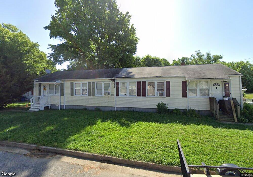
12 Defense Dr Aberdeen, MD 21001
Estimated Value: $150,000 - $197,000
3
Beds
1
Bath
816
Sq Ft
$215/Sq Ft
Est. Value
About This Home
This home is located at 12 Defense Dr, Aberdeen, MD 21001 and is currently estimated at $175,487, approximately $215 per square foot. 12 Defense Dr is a home located in Harford County with nearby schools including Halls Cross Roads Elementary School, Aberdeen Middle School, and Aberdeen High School.
Ownership History
Date
Name
Owned For
Owner Type
Purchase Details
Closed on
Sep 6, 2013
Sold by
Abshire Brian
Bought by
Bda Properties Llc
Current Estimated Value
Purchase Details
Closed on
Nov 10, 2009
Sold by
Henkel Angela G
Bought by
Us Bank National Association
Purchase Details
Closed on
Sep 27, 2001
Sold by
Baldwin Manor Inc
Bought by
Henkel Angela G
Create a Home Valuation Report for This Property
The Home Valuation Report is an in-depth analysis detailing your home's value as well as a comparison with similar homes in the area
Home Values in the Area
Average Home Value in this Area
Purchase History
| Date | Buyer | Sale Price | Title Company |
|---|---|---|---|
| Bda Properties Llc | -- | Dulaney Title & Escrow Llc | |
| Us Bank National Association | $59,500 | -- | |
| Abshire Brian | $50,575 | -- | |
| Henkel Angela G | $74,200 | -- |
Source: Public Records
Mortgage History
| Date | Status | Borrower | Loan Amount |
|---|---|---|---|
| Closed | Henkel Angela G | -- |
Source: Public Records
Tax History Compared to Growth
Tax History
| Year | Tax Paid | Tax Assessment Tax Assessment Total Assessment is a certain percentage of the fair market value that is determined by local assessors to be the total taxable value of land and additions on the property. | Land | Improvement |
|---|---|---|---|---|
| 2025 | $942 | $109,333 | $0 | $0 |
| 2024 | $942 | $98,767 | $0 | $0 |
| 2023 | $841 | $88,200 | $24,000 | $64,200 |
| 2022 | $830 | $87,033 | $0 | $0 |
| 2021 | $852 | $85,867 | $0 | $0 |
| 2020 | $852 | $84,700 | $24,000 | $60,700 |
| 2019 | $847 | $84,200 | $0 | $0 |
| 2018 | $834 | $83,700 | $0 | $0 |
| 2017 | $829 | $83,200 | $0 | $0 |
| 2016 | -- | $83,200 | $0 | $0 |
| 2015 | $1,206 | $83,200 | $0 | $0 |
| 2014 | $1,206 | $85,600 | $0 | $0 |
Source: Public Records
Map
Nearby Homes
- 13 Liberty St
- 46 Aberdeen Ave
- 24 Liberty St
- 25 Mitchell Ave
- 121 Brannan Rd
- 112 Osborne Rd
- 6 New County Rd
- 74 Smith Ave
- 176 Darlington Ave
- 43 Liberty St
- 180 Old Post Rd
- 143 Rigdon Rd
- 0 S Philadelphia Blvd
- 414 S Parke St
- 519 S Parke St
- 609 S Rogers St
- 515 S Law St
- 406 Ford St
- 648 S Rogers St
- 435 Edmund St