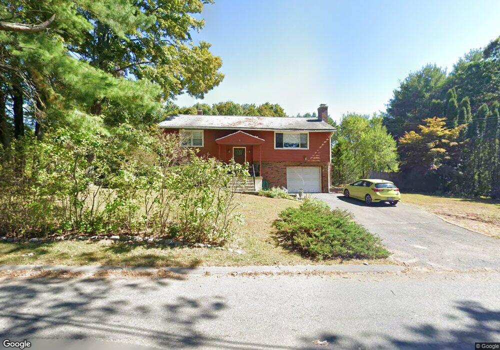
12 Glendale Rd Florence, MA 01062
Florence NeighborhoodEstimated Value: $325,000 - $453,000
2
Beds
1
Bath
966
Sq Ft
$377/Sq Ft
Est. Value
About This Home
This home is located at 12 Glendale Rd, Florence, MA 01062 and is currently estimated at $364,408, approximately $377 per square foot. 12 Glendale Rd is a home located in Hampshire County with nearby schools including Northampton High School, Hilltown Cooperative Charter Public School, and Calvary Baptist Christian School.
Ownership History
Date
Name
Owned For
Owner Type
Purchase Details
Closed on
Aug 31, 1998
Sold by
Romerleau Susan P and Robinson Lee
Bought by
Brown-Ludwig Marisaa and Ludwig Peter J
Current Estimated Value
Home Financials for this Owner
Home Financials are based on the most recent Mortgage that was taken out on this home.
Original Mortgage
$102,500
Outstanding Balance
$21,895
Interest Rate
6.9%
Mortgage Type
Purchase Money Mortgage
Estimated Equity
$342,513
Purchase Details
Closed on
Dec 28, 1992
Sold by
Allen Susan P
Bought by
Robinson Lee and Pomerleau Susan P
Home Financials for this Owner
Home Financials are based on the most recent Mortgage that was taken out on this home.
Original Mortgage
$96,300
Interest Rate
8.31%
Mortgage Type
Purchase Money Mortgage
Create a Home Valuation Report for This Property
The Home Valuation Report is an in-depth analysis detailing your home's value as well as a comparison with similar homes in the area
Home Values in the Area
Average Home Value in this Area
Purchase History
| Date | Buyer | Sale Price | Title Company |
|---|---|---|---|
| Brown-Ludwig Marisaa | $117,500 | -- | |
| Robinson Lee | $107,000 | -- |
Source: Public Records
Mortgage History
| Date | Status | Borrower | Loan Amount |
|---|---|---|---|
| Open | Robinson Lee | $102,500 | |
| Previous Owner | Robinson Lee | $96,300 |
Source: Public Records
Tax History Compared to Growth
Tax History
| Year | Tax Paid | Tax Assessment Tax Assessment Total Assessment is a certain percentage of the fair market value that is determined by local assessors to be the total taxable value of land and additions on the property. | Land | Improvement |
|---|---|---|---|---|
| 2025 | $4,158 | $298,500 | $90,700 | $207,800 |
| 2024 | $4,215 | $277,500 | $86,500 | $191,000 |
| 2023 | $3,645 | $230,100 | $78,500 | $151,600 |
| 2022 | $3,496 | $195,400 | $73,500 | $121,900 |
| 2021 | $2,998 | $172,600 | $70,100 | $102,500 |
| 2020 | $2,900 | $172,600 | $70,100 | $102,500 |
| 2019 | $3,125 | $179,900 | $82,600 | $97,300 |
| 2018 | $3,054 | $179,200 | $82,600 | $96,600 |
| 2017 | $2,991 | $179,200 | $82,600 | $96,600 |
| 2016 | $2,896 | $179,200 | $82,600 | $96,600 |
| 2015 | $2,942 | $186,200 | $87,600 | $98,600 |
| 2014 | $2,866 | $186,200 | $87,600 | $98,600 |
Source: Public Records
Map
Nearby Homes
- 832 Westhampton Rd
- 0 W Farms Rd
- 1260 Westhampton Rd
- 200 Easthampton Rd
- 262 Loudville Rd
- 36 Torrey St
- 12 Nicols Way Unit 12
- 6 Nicols Way Unit 6
- 18 Nicols Way Unit 18
- 98 Park Hill Rd
- 2 Mine Rd
- 404 Sylvester Rd
- 5 Laurin Ln
- 75 Lead Mine Rd
- 20-11 Sylvester Rd
- 138 Overlook Dr
- 39 Matthew Dr
- 815 Burts Pit Rd
- 167 Emerson Way
- 100 Emerson Way
- 00 Glendale Rd
- 960 Westhampton Rd
- 0-1 Glendale Rd
- 15 Glendale Rd
- 17 Glendale Rd
- 24 Glendale Rd
- 946 Westhampton Rd
- 305 W Farms Rd
- 959 Westhampton Rd
- 998 Westhampton Rd
- 36 Glendale Rd
- 938 Westhampton Rd
- 987 Westhampton Rd
- 27 Glendale Rd
- 35 Glendale Rd
- 38 Glendale Rd
- 1008 Westhampton Rd
- 930 Westhampton Rd
- 288 W Farms Rd
- 45 Glendale Rd