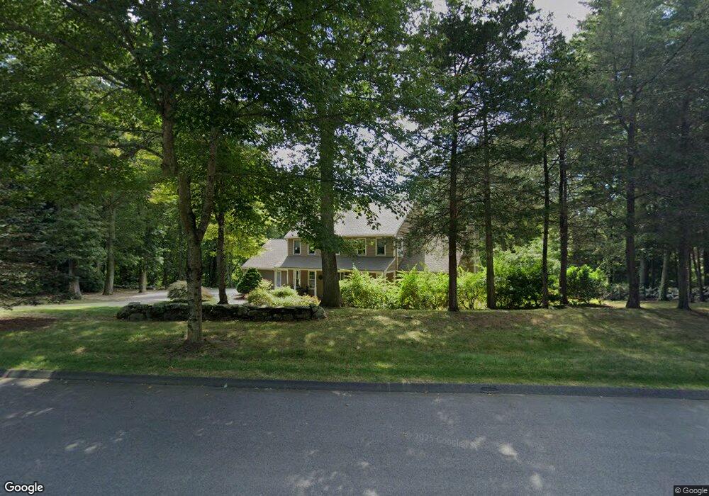
12 High Ridge Dr Pawcatuck, CT 06379
Estimated Value: $479,000 - $832,000
3
Beds
3
Baths
2,208
Sq Ft
$321/Sq Ft
Est. Value
About This Home
This home is located at 12 High Ridge Dr, Pawcatuck, CT 06379 and is currently estimated at $709,755, approximately $321 per square foot. 12 High Ridge Dr is a home located in New London County with nearby schools including Stonington Middle School, Stonington High School, and Pine Point School.
Ownership History
Date
Name
Owned For
Owner Type
Purchase Details
Closed on
Nov 6, 2015
Sold by
Becker Donald J and Becker Lisa A
Bought by
Gracie Richard A
Current Estimated Value
Purchase Details
Closed on
Apr 1, 1998
Sold by
Brown Robert and Brown Sharon L
Bought by
Tsagarakis Thomas J and Tsagarakis Lynn C
Purchase Details
Closed on
Oct 6, 1995
Sold by
Stonington High Rdg
Bought by
Palmerone Eileen M
Create a Home Valuation Report for This Property
The Home Valuation Report is an in-depth analysis detailing your home's value as well as a comparison with similar homes in the area
Home Values in the Area
Average Home Value in this Area
Purchase History
| Date | Buyer | Sale Price | Title Company |
|---|---|---|---|
| Gracie Richard A | $210,000 | -- | |
| Gracie Richard A | $210,000 | -- | |
| Tsagarakis Thomas J | $258,500 | -- | |
| Tsagarakis Thomas J | $258,500 | -- | |
| Palmerone Eileen M | $65,000 | -- | |
| Palmerone Eileen M | $65,000 | -- |
Source: Public Records
Mortgage History
| Date | Status | Borrower | Loan Amount |
|---|---|---|---|
| Open | Palmerone Eileen M | $80,000 |
Source: Public Records
Tax History Compared to Growth
Tax History
| Year | Tax Paid | Tax Assessment Tax Assessment Total Assessment is a certain percentage of the fair market value that is determined by local assessors to be the total taxable value of land and additions on the property. | Land | Improvement |
|---|---|---|---|---|
| 2025 | $8,173 | $411,100 | $157,400 | $253,700 |
| 2024 | $7,831 | $411,100 | $157,400 | $253,700 |
| 2023 | $7,832 | $411,100 | $157,400 | $253,700 |
| 2022 | $8,200 | $320,200 | $129,000 | $191,200 |
| 2021 | $8,213 | $320,200 | $129,000 | $191,200 |
| 2020 | $8,056 | $320,200 | $129,000 | $191,200 |
| 2019 | $8,040 | $320,200 | $129,000 | $191,200 |
| 2018 | $7,768 | $320,200 | $129,000 | $191,200 |
| 2017 | $7,228 | $293,600 | $129,000 | $164,600 |
| 2016 | $7,168 | $299,300 | $129,000 | $170,300 |
| 2015 | $6,728 | $299,300 | $129,000 | $170,300 |
| 2014 | $6,582 | $299,300 | $129,000 | $170,300 |
Source: Public Records
Map
Nearby Homes
- Lot 2, 770 Pequot Trail
- 3 Fairview Dr
- 168 S Anguilla Rd
- 106 S Anguilla Rd
- 15 Faulise Ave
- 12 Avery St
- 87 Elmridge Rd
- 0 River Unit 24129909
- 321 N Anguilla Rd
- 414 Liberty St
- 49 Lathrop Ave
- 1 Millan Terrace
- 13 Palmer St
- 27 Liberty St
- 8 Alice Ct
- 52 William St
- 102 White Rock Rd Unit B
- 93A S Broad St
- 14 Springbrook Rd
- 77 Mechanic St
- 16 High Ridge Dr
- 3 High Ridge Dr
- 0 High Ridge Dr Unit E219852
- 15 High Ridge Dr
- 17 High Ridge Dr Unit 150
- 270 Pequot Trail
- 258 Pequot Trail
- 290 Pequot Trail
- 18 High Ridge Dr
- 21 High Ridge Dr
- 41 High Ridge Dr
- 5 High Ridge Dr
- 39 High Ridge Dr
- 49 High Ridge Dr
- 9 High Ridge Dr
- 287 Pequot Trail
- 248 Pequot Trail
- 35 High Ridge Dr
- 2 Arbor Ct
- 29 High Ridge Dr