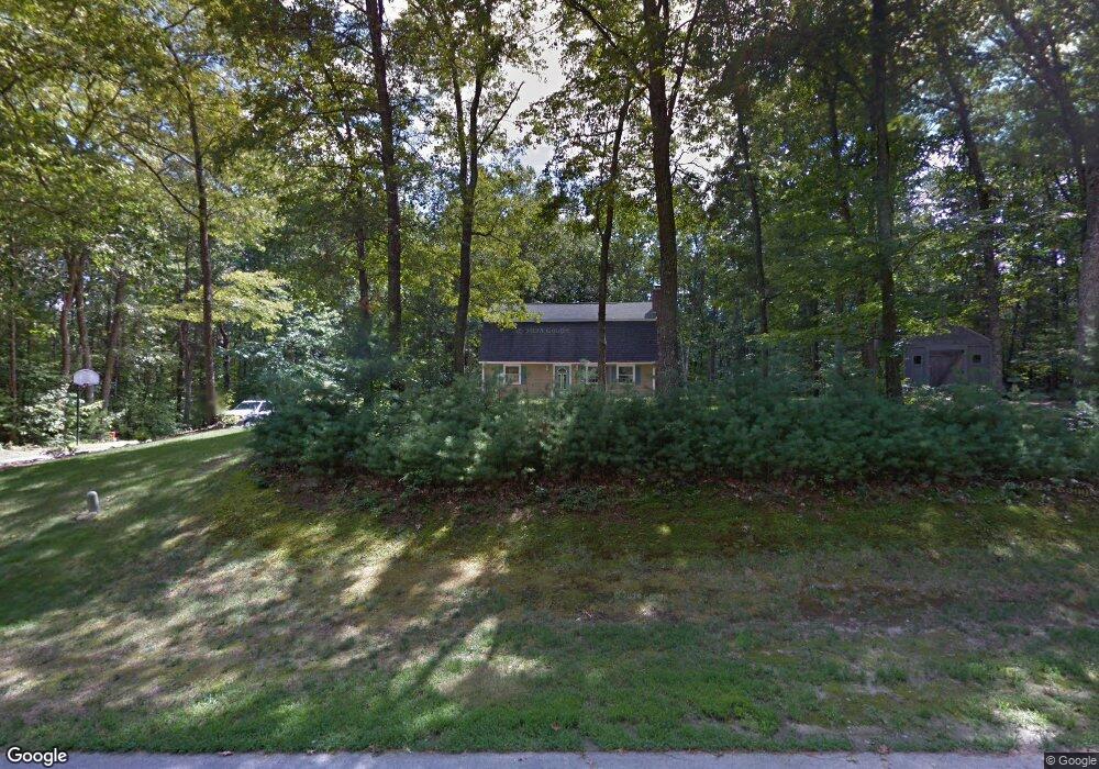
12 Jade Rd MerriMacK, NH 03054
Estimated Value: $540,801 - $621,000
3
Beds
2
Baths
1,916
Sq Ft
$305/Sq Ft
Est. Value
About This Home
This home is located at 12 Jade Rd, MerriMacK, NH 03054 and is currently estimated at $583,950, approximately $304 per square foot. 12 Jade Rd is a home located in Hillsborough County with nearby schools including Thorntons Ferry School, Merrimack Middle School, and James Mastricola Upper Elementary School.
Ownership History
Date
Name
Owned For
Owner Type
Purchase Details
Closed on
Feb 26, 1997
Sold by
Closs William R and Closs Monique D M
Bought by
Close Donald L and Close Kathleen A
Current Estimated Value
Home Financials for this Owner
Home Financials are based on the most recent Mortgage that was taken out on this home.
Original Mortgage
$111,810
Interest Rate
7.78%
Create a Home Valuation Report for This Property
The Home Valuation Report is an in-depth analysis detailing your home's value as well as a comparison with similar homes in the area
Home Values in the Area
Average Home Value in this Area
Purchase History
| Date | Buyer | Sale Price | Title Company |
|---|---|---|---|
| Close Donald L | $111,900 | -- |
Source: Public Records
Mortgage History
| Date | Status | Borrower | Loan Amount |
|---|---|---|---|
| Open | Close Donald L | $109,445 | |
| Closed | Close Donald L | $100,000 | |
| Closed | Close Donald L | $111,810 |
Source: Public Records
Tax History Compared to Growth
Tax History
| Year | Tax Paid | Tax Assessment Tax Assessment Total Assessment is a certain percentage of the fair market value that is determined by local assessors to be the total taxable value of land and additions on the property. | Land | Improvement |
|---|---|---|---|---|
| 2024 | $7,860 | $379,900 | $208,900 | $171,000 |
| 2023 | $7,389 | $379,900 | $208,900 | $171,000 |
| 2022 | $6,603 | $379,900 | $208,900 | $171,000 |
| 2021 | $6,523 | $379,900 | $208,900 | $171,000 |
| 2020 | $6,778 | $281,700 | $153,600 | $128,100 |
| 2019 | $6,797 | $281,700 | $153,600 | $128,100 |
| 2018 | $6,795 | $281,700 | $153,600 | $128,100 |
| 2017 | $6,583 | $281,700 | $153,600 | $128,100 |
| 2016 | $6,420 | $281,700 | $153,600 | $128,100 |
| 2015 | $6,116 | $247,400 | $135,800 | $111,600 |
| 2014 | $5,960 | $247,400 | $135,800 | $111,600 |
| 2013 | $5,781 | $241,800 | $135,800 | $106,000 |
Source: Public Records
Map
Nearby Homes
- 27 Sarah Dr
- 40 Turkey Hill Rd
- 7 Beacon Dr
- 14 Mayflower Dr
- 5 Lynn Dr
- 3 Independence Dr
- 8 Highland Green Ln
- 7 Hadley Rd
- 5 Fernwood Dr
- 23 Colonial Dr
- 98 Indian Rock Rd
- 23 Pondview Dr
- 14 Silver Doe Ln
- 40 Captain Bannon Cir
- 22 Clay St
- 1 Longwood Ln
- 5 Jennifer Dr Unit B
- 5 Jennifer Dr
- 5 Jennifer Dr Unit A
- 14 Turnbuckle Ln Unit 38
- 10 Jade Rd
- 9 Sarah Dr
- 9 Penrose Ln
- Lot 9-1-15 Windy Hollow Cir
- 75 Crown Pointe Cir
- 11 Sarah Dr
- 7 Sarah Dr
- 2 Scituate Place Unit 3
- 2 Scituate Place
- 2 Theodore Dr
- 12 Acre Ln Unit 56
- 13 Acre Ln
- 1 Acre Dr Unit 54
- 2 Acre Dr Unit 46-1
- 10 Acre Dr Unit 50
- 8 Theodore Dr Unit 51-1
- 3 Claire St Unit 78
- 1 Claire St Unit 79
- 9 Theodore Dr Unit 55
- 2 Claire St Unit 63