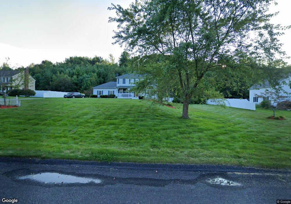
12 Laurie Ln Charlton, MA 01507
Estimated Value: $584,000 - $644,000
3
Beds
3
Baths
2,310
Sq Ft
$270/Sq Ft
Est. Value
About This Home
This home is located at 12 Laurie Ln, Charlton, MA 01507 and is currently estimated at $622,650, approximately $269 per square foot. 12 Laurie Ln is a home located in Worcester County with nearby schools including Shepherd Hill Regional High School.
Ownership History
Date
Name
Owned For
Owner Type
Purchase Details
Closed on
Oct 8, 2021
Sold by
Patel Bhikhabhai M and Patel Gomatiben B
Bought by
Laurie Lane 2021 Rt and Patel
Current Estimated Value
Purchase Details
Closed on
Sep 22, 2010
Sold by
Ziobro Michael J and Ziobro Karen E
Bought by
Patel Bhikhabhai M and Patel Gomatiben B
Home Financials for this Owner
Home Financials are based on the most recent Mortgage that was taken out on this home.
Original Mortgage
$283,050
Interest Rate
4.48%
Mortgage Type
Purchase Money Mortgage
Purchase Details
Closed on
Nov 20, 1997
Sold by
Burlingame Elliott P and Burlingame Joan A
Bought by
Ziobro Michael J and Ziobro Karen E
Create a Home Valuation Report for This Property
The Home Valuation Report is an in-depth analysis detailing your home's value as well as a comparison with similar homes in the area
Home Values in the Area
Average Home Value in this Area
Purchase History
| Date | Buyer | Sale Price | Title Company |
|---|---|---|---|
| Laurie Lane 2021 Rt | -- | None Available | |
| Laurie Lane 2021 Rt | -- | None Available | |
| Patel Bhikhabhai M | $314,500 | -- | |
| Patel Bhikhabhai M | $314,500 | -- | |
| Ziobro Michael J | $132,000 | -- | |
| Ziobro Michael J | $132,000 | -- |
Source: Public Records
Mortgage History
| Date | Status | Borrower | Loan Amount |
|---|---|---|---|
| Previous Owner | Patel Bhikhabhai M | $283,050 | |
| Previous Owner | Ziobro Michael J | $135,000 |
Source: Public Records
Tax History Compared to Growth
Tax History
| Year | Tax Paid | Tax Assessment Tax Assessment Total Assessment is a certain percentage of the fair market value that is determined by local assessors to be the total taxable value of land and additions on the property. | Land | Improvement |
|---|---|---|---|---|
| 2025 | $5,930 | $532,800 | $86,000 | $446,800 |
| 2024 | $5,147 | $453,900 | $86,000 | $367,900 |
| 2023 | $5,037 | $413,900 | $83,100 | $330,800 |
| 2022 | $4,848 | $364,800 | $77,400 | $287,400 |
| 2021 | $4,985 | $332,100 | $74,500 | $257,600 |
| 2020 | $4,918 | $329,200 | $71,600 | $257,600 |
| 2019 | $4,862 | $329,200 | $71,600 | $257,600 |
| 2018 | $4,444 | $329,200 | $71,600 | $257,600 |
| 2017 | $4,339 | $307,700 | $71,600 | $236,100 |
| 2016 | $4,240 | $307,700 | $71,600 | $236,100 |
| 2015 | $4,129 | $307,700 | $71,600 | $236,100 |
| 2014 | $3,937 | $311,000 | $72,300 | $238,700 |
Source: Public Records
Map
Nearby Homes
- 38 Stevens Park Rd
- 199 Center Depot Rd
- 208 Sunset Dr
- 7 Little Muggett Rd
- 102 Worcester Rd
- 0 Trolley Crossing Rd
- 9 Knollwood Dr
- 5 Carpenter Hill Rd
- 25 N Main St Unit A
- 65 Old Spencer Rd
- 0 Worcester Rd
- 5 Northside Rd
- 8 Northside Rd
- Lot 0 N Sturbridge Rd
- Lot 3 0 N Sullivan Rd
- Lot 6 0 N Sullivan Rd
- Lot 5 0 N Sullivan Rd
- Lot 4 0 N Sullivan Rd
- 7 L Stevens Rd Unit A
- 7 L Stevens Rd Unit B