Estimated Value: $1,002,526 - $1,265,000
4
Beds
3
Baths
2,284
Sq Ft
$495/Sq Ft
Est. Value
About This Home
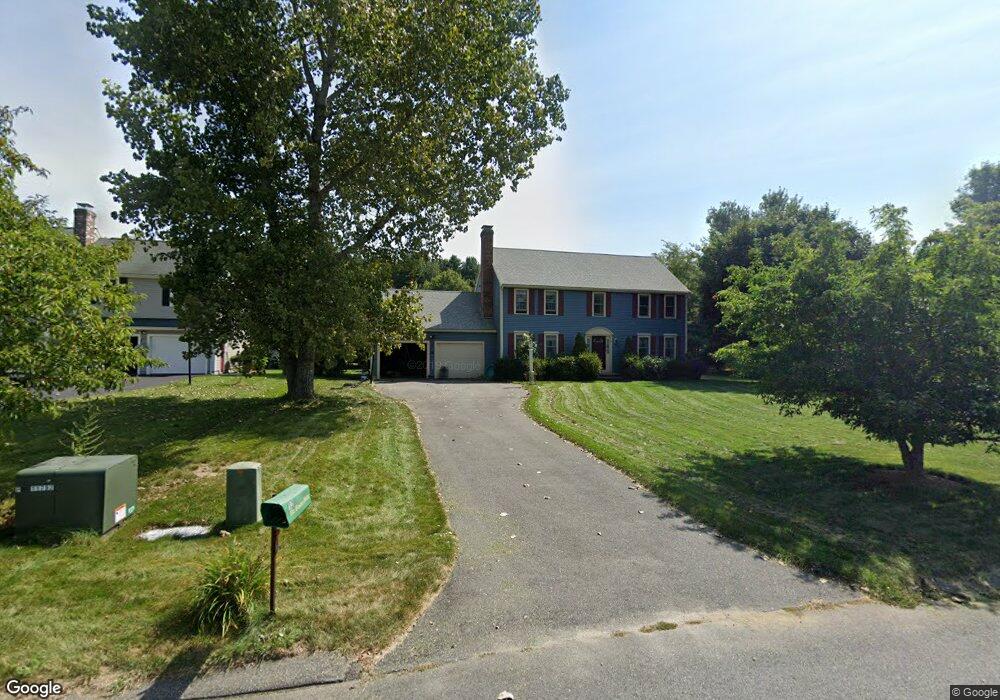
This home is located at 12 Lexington Dr, Acton, MA 01720 and is currently estimated at $1,131,132, approximately $495 per square foot. 12 Lexington Dr is a home located in Middlesex County with nearby schools including Acton-Boxborough Regional High School and Concord Academy.
Ownership History
Date
Name
Owned For
Owner Type
Purchase Details
Closed on
Dec 15, 1995
Sold by
Lawsbrook Inc
Bought by
Bircsak John A and Bircsak Karen L
Current Estimated Value
Home Financials for this Owner
Home Financials are based on the most recent Mortgage that was taken out on this home.
Original Mortgage
$200,000
Outstanding Balance
$4,116
Interest Rate
7.43%
Mortgage Type
Purchase Money Mortgage
Estimated Equity
$1,127,017
Create a Home Valuation Report for This Property
The Home Valuation Report is an in-depth analysis detailing your home's value as well as a comparison with similar homes in the area
Home Values in the Area
Average Home Value in this Area
Purchase History
| Date | Buyer | Sale Price | Title Company |
|---|---|---|---|
| Bircsak John A | $300,700 | -- |
Source: Public Records
Mortgage History
| Date | Status | Borrower | Loan Amount |
|---|---|---|---|
| Open | Bircsak John A | $200,000 |
Source: Public Records
Tax History Compared to Growth
Tax History
| Year | Tax Paid | Tax Assessment Tax Assessment Total Assessment is a certain percentage of the fair market value that is determined by local assessors to be the total taxable value of land and additions on the property. | Land | Improvement |
|---|---|---|---|---|
| 2025 | $15,035 | $876,700 | $308,300 | $568,400 |
| 2024 | $14,011 | $840,500 | $308,300 | $532,200 |
| 2023 | $13,681 | $779,100 | $280,400 | $498,700 |
| 2022 | $13,337 | $685,700 | $243,700 | $442,000 |
| 2021 | $12,998 | $642,500 | $225,600 | $416,900 |
| 2020 | $12,250 | $636,700 | $225,600 | $411,100 |
| 2019 | $11,599 | $598,800 | $225,600 | $373,200 |
| 2018 | $11,545 | $595,700 | $225,600 | $370,100 |
| 2017 | $11,240 | $589,700 | $225,600 | $364,100 |
| 2016 | $10,992 | $571,600 | $225,600 | $346,000 |
| 2015 | $10,775 | $565,600 | $225,600 | $340,000 |
| 2014 | $10,567 | $543,300 | $225,600 | $317,700 |
Source: Public Records
Map
Nearby Homes
- 65 Summit St
- 2 Clover Hill Rd
- 70 Hillside Ave
- 88 Wright Rd
- 10 Wright Rd
- 118 Parker St Unit 16
- 128 Parker St Unit 3B
- 37 Water St
- 27 Water St
- 132 Parker St Unit G5
- 1828 Main St
- 1844 Main St Unit 1844
- 1687 Main St
- 80 N Branch Rd
- 5 Oakwood Rd
- 8 Laurel Ct
- 70 River St
- 11 Horseshoe Dr
- 54 Maple St
- 128 Audubon Dr
- 10 Lexington Dr
- 54 Lexington Dr
- 54 Lexington Dr Unit 54
- 56 Lexington Dr
- 8 Lexington Dr
- 16 Lexington Dr
- 50 Lexington Dr
- 58 Lexington Dr
- 53 Lexington Dr
- 55 Lexington Dr
- 51 Lexington Dr
- 51 Lexington Dr Unit 51
- 18 Lexington Dr
- 6 Lexington Dr
- 57 Lexington Dr
- 13 Lexington Dr
- 49 Lexington Dr
- 60 Lexington Dr
- 20 Lexington Dr
- 2 Lexington Dr