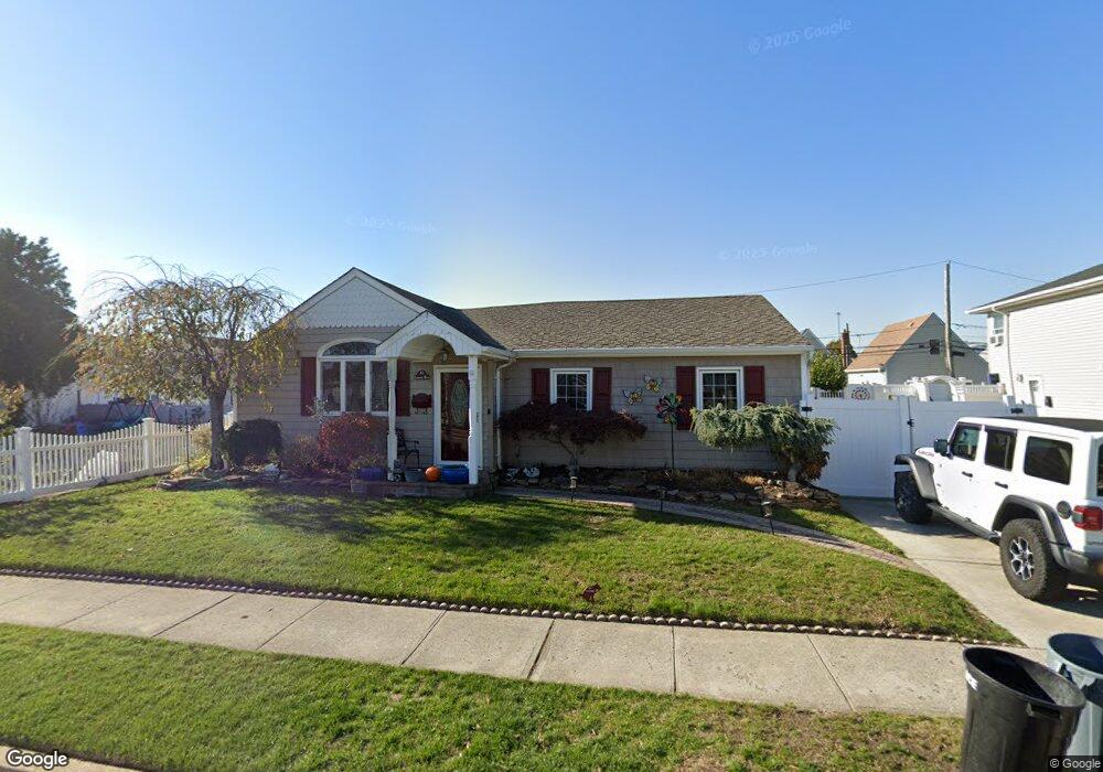
12 Lorraine Rd Island Park, NY 11558
Estimated Value: $611,103 - $750,000
--
Bed
1
Bath
1,706
Sq Ft
$399/Sq Ft
Est. Value
About This Home
This home is located at 12 Lorraine Rd, Island Park, NY 11558 and is currently estimated at $680,552, approximately $398 per square foot. 12 Lorraine Rd is a home located in Nassau County with nearby schools including Francis X Hegarty Elementary School, Lincoln Orens Middle School, and Torah High School Long Beach.
Ownership History
Date
Name
Owned For
Owner Type
Purchase Details
Closed on
Sep 17, 1999
Sold by
Eva William and Eva Dawn
Bought by
Rivero Susan
Current Estimated Value
Home Financials for this Owner
Home Financials are based on the most recent Mortgage that was taken out on this home.
Original Mortgage
$205,157
Outstanding Balance
$60,962
Interest Rate
7.85%
Mortgage Type
Purchase Money Mortgage
Estimated Equity
$619,590
Purchase Details
Closed on
Dec 11, 1996
Sold by
Kreidell Walter and Kreidell Mary
Bought by
Eva William Dawn
Create a Home Valuation Report for This Property
The Home Valuation Report is an in-depth analysis detailing your home's value as well as a comparison with similar homes in the area
Home Values in the Area
Average Home Value in this Area
Purchase History
| Date | Buyer | Sale Price | Title Company |
|---|---|---|---|
| Rivero Susan | $212,000 | Fidelity National Title Ins | |
| Eva William Dawn | $177,500 | -- |
Source: Public Records
Mortgage History
| Date | Status | Borrower | Loan Amount |
|---|---|---|---|
| Open | Rivero Susan | $205,157 |
Source: Public Records
Tax History Compared to Growth
Tax History
| Year | Tax Paid | Tax Assessment Tax Assessment Total Assessment is a certain percentage of the fair market value that is determined by local assessors to be the total taxable value of land and additions on the property. | Land | Improvement |
|---|---|---|---|---|
| 2025 | $8,650 | $443 | $195 | $248 |
| 2024 | $1,848 | $442 | $195 | $247 |
| 2023 | $7,720 | $442 | $195 | $247 |
| 2022 | $7,720 | $442 | $195 | $247 |
| 2021 | $10,342 | $419 | $185 | $234 |
| 2020 | $7,742 | $855 | $578 | $277 |
| 2019 | $7,900 | $855 | $578 | $277 |
| 2018 | $7,436 | $855 | $0 | $0 |
| 2017 | $5,029 | $855 | $578 | $277 |
| 2016 | $6,981 | $855 | $578 | $277 |
| 2015 | $1,915 | $855 | $578 | $277 |
| 2014 | $1,915 | $855 | $578 | $277 |
| 2013 | $1,782 | $855 | $578 | $277 |
Source: Public Records
Map
Nearby Homes
- 187 Nassau Ln
- 67 Newport Rd
- 41 Newport Rd
- 31 Parente Ln N
- 33 Newport Rd
- 29 Newport Rd
- 541 Long Beach Rd
- 120 Parma Rd
- 34 Waterford Rd
- 66 Parma Rd
- 4081 Massachusetts Ave
- 189 Pennsylvania Ave
- 19 Parma Rd
- 65 Florida Ave
- 185 Quebec Rd
- 210 Saratoga Blvd
- 9 Hamilton Ave
- 12 Pershing Place
- 64 Kent Rd
- 163 Vanderbilt Ave