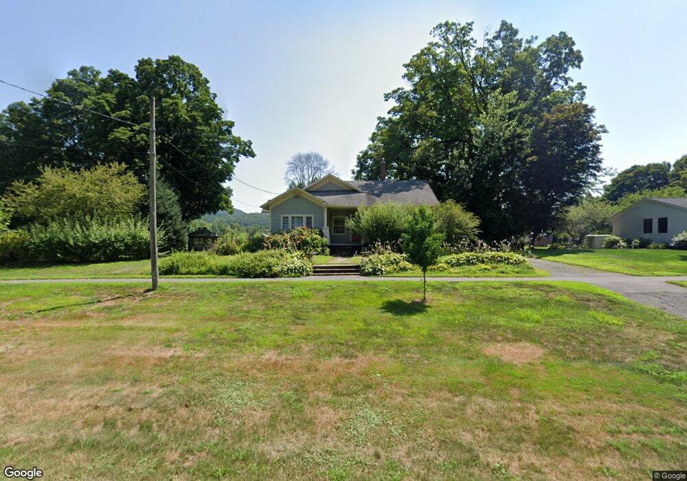
12 S Main St Sunderland, MA 01375
Estimated Value: $433,985 - $527,000
3
Beds
3
Baths
1,806
Sq Ft
$261/Sq Ft
Est. Value
About This Home
This home is located at 12 S Main St, Sunderland, MA 01375 and is currently estimated at $470,996, approximately $260 per square foot. 12 S Main St is a home located in Franklin County with nearby schools including Sunderland Elementary School and Frontier Regional School.
Ownership History
Date
Name
Owned For
Owner Type
Purchase Details
Closed on
Jul 27, 1995
Sold by
Gatland Judith Anne
Bought by
Lacey Peter T and Gundersen Mary Ann
Current Estimated Value
Create a Home Valuation Report for This Property
The Home Valuation Report is an in-depth analysis detailing your home's value as well as a comparison with similar homes in the area
Home Values in the Area
Average Home Value in this Area
Purchase History
| Date | Buyer | Sale Price | Title Company |
|---|---|---|---|
| Lacey Peter T | $145,000 | -- |
Source: Public Records
Mortgage History
| Date | Status | Borrower | Loan Amount |
|---|---|---|---|
| Open | Lacey Peter T | $85,000 | |
| Closed | Lacey Peter T | $60,000 | |
| Closed | Lacey Peter T | $91,000 |
Source: Public Records
Tax History Compared to Growth
Tax History
| Year | Tax Paid | Tax Assessment Tax Assessment Total Assessment is a certain percentage of the fair market value that is determined by local assessors to be the total taxable value of land and additions on the property. | Land | Improvement |
|---|---|---|---|---|
| 2025 | $45 | $347,700 | $117,600 | $230,100 |
| 2024 | $4,569 | $347,700 | $117,600 | $230,100 |
| 2023 | $3,912 | $305,600 | $106,900 | $198,700 |
| 2022 | $3,940 | $268,000 | $91,700 | $176,300 |
| 2021 | $4,942 | $240,200 | $84,900 | $155,300 |
| 2020 | $3,712 | $240,400 | $84,900 | $155,500 |
| 2019 | $3,606 | $235,200 | $82,500 | $152,700 |
| 2018 | $3,456 | $230,400 | $79,100 | $151,300 |
| 2017 | $3,264 | $227,600 | $79,100 | $148,500 |
| 2016 | $3,416 | $233,000 | $81,100 | $151,900 |
| 2015 | $3,360 | $234,800 | $81,100 | $153,700 |
| 2014 | $3,283 | $234,800 | $81,100 | $153,700 |
Source: Public Records
Map
Nearby Homes
- 24 Old Amherst Rd
- 146 Old Amherst Rd
- 188 N Main St
- 238 N Main St
- 4 Gray Lock Ln Unit A
- 0 Mountain Rd
- 2 Robs Way
- 15 Crestview Dr
- 40 Eastern Ave
- 24 Elm St
- 116 Christian Ln
- 134 Montague Rd
- 139 Plumtree Rd
- 7 Stage Rd
- 15 S Plain Rd
- 0 Pocumtuck Dr Unit 73379330
- 32 Swamp Rd
- 23 Plumtree Rd
- 119 Long Plain Rd
- 0 North St Unit 73407299
- 8 S Main St
- 18 S Main St
- 4 S Main St
- 11 S Main St
- 12 Old Amherst Rd
- 7 S Main St
- 17 S Main St
- 24 S Main St
- 7 Old Amherst Rd
- 22 S Main St
- 4 River Rd
- 0 Old Amherst Rd
- 1 S Main St
- 1 Old Amherst Rd
- 16 Old Amherst Rd
- 0 Hadley & Plumtree Rds Sunderland Ma
- 3 River Rd
- 23 S Main St
- 3 River Rd
- 13 Old Amherst Rd