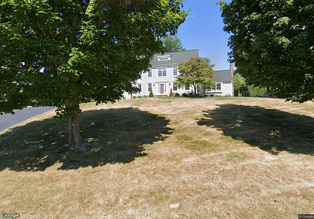
12 Samuel Harrington Rd Westborough, MA 01581
Estimated Value: $1,254,605 - $1,353,000
4
Beds
3
Baths
3,317
Sq Ft
$395/Sq Ft
Est. Value
About This Home
This home is located at 12 Samuel Harrington Rd, Westborough, MA 01581 and is currently estimated at $1,309,868, approximately $394 per square foot. 12 Samuel Harrington Rd is a home located in Worcester County with nearby schools including Westborough High School, Advanced Math & Science Academy, and Westboro Knowledge Beginnings.
Ownership History
Date
Name
Owned For
Owner Type
Purchase Details
Closed on
Oct 8, 1993
Sold by
Carrageen Dev Corp
Bought by
Geller Jonathan S and Geller Julia
Current Estimated Value
Create a Home Valuation Report for This Property
The Home Valuation Report is an in-depth analysis detailing your home's value as well as a comparison with similar homes in the area
Home Values in the Area
Average Home Value in this Area
Purchase History
| Date | Buyer | Sale Price | Title Company |
|---|---|---|---|
| Geller Jonathan S | $320,700 | -- |
Source: Public Records
Mortgage History
| Date | Status | Borrower | Loan Amount |
|---|---|---|---|
| Closed | Geller Jonathan S | $159,915 | |
| Open | Geller Jonathan S | $296,000 | |
| Closed | Geller Jonathan S | $200,000 |
Source: Public Records
Tax History Compared to Growth
Tax History
| Year | Tax Paid | Tax Assessment Tax Assessment Total Assessment is a certain percentage of the fair market value that is determined by local assessors to be the total taxable value of land and additions on the property. | Land | Improvement |
|---|---|---|---|---|
| 2025 | $16,907 | $1,037,900 | $362,400 | $675,500 |
| 2024 | $16,105 | $981,400 | $345,000 | $636,400 |
| 2023 | $14,782 | $877,800 | $325,400 | $552,400 |
| 2022 | $13,753 | $743,800 | $259,100 | $484,700 |
| 2021 | $13,599 | $733,500 | $248,800 | $484,700 |
| 2020 | $13,484 | $736,000 | $263,300 | $472,700 |
| 2019 | $13,506 | $736,800 | $259,200 | $477,600 |
| 2018 | $12,553 | $680,000 | $248,800 | $431,200 |
| 2017 | $12,104 | $680,000 | $248,800 | $431,200 |
| 2016 | $12,158 | $684,200 | $248,800 | $435,400 |
| 2015 | $11,699 | $629,300 | $219,800 | $409,500 |
Source: Public Records
Map
Nearby Homes
- 8 Samuel Harrington Rd
- 6 Walker St
- 28 Crestview Dr
- 8 Rock Spring Ln
- 3112 Peters Farm Way Unit 112
- 11302 Peters Farm Way Unit 11302
- 3102 Peters Farm Way Unit 102
- 12302 Peters Farm Way Unit 302
- 2 Talbot Way Unit 2103
- 2 Talbot Way Unit 2208
- 11101 Peters Farm Way Unit 101
- 5 Peters Farm Way Unit 106
- 5 Peters Farm Way Unit 406
- 5 Peters Farm Way Unit 113
- 5 Peters Farm Way Unit 105
- 5 Peters Farm Way Unit 213
- 5 Peters Farm Way Unit 212
- 2 Codman Way Unit 409
- 2 Codman Way Unit 113
- 2 Codman Way Unit 110
- 3 John Pratt Cir
- 14 Samuel Harrington Rd
- 5 John Pratt Cir
- 9 Samuel Harrington Rd
- 2 John Pratt Cir
- 4 John Pratt Cir
- 6 John Pratt Cir
- 7 John Pratt Cir
- 11 Samuel Harrington Rd
- 7 Samuel Harrington Rd
- 16 Samuel Harrington Rd
- 10 Samuel Harrington Rd
- 8 John Pratt Cir
- 9 John Pratt Cir
- 18 Samuel Harrington Rd
- 15 Samuel Harrington Rd
- 10 John Pratt Cir
- 24 Samuel Harrington Rd
- 22 Samuel Harrington Rd
- 26 Samuel Harrington Rd