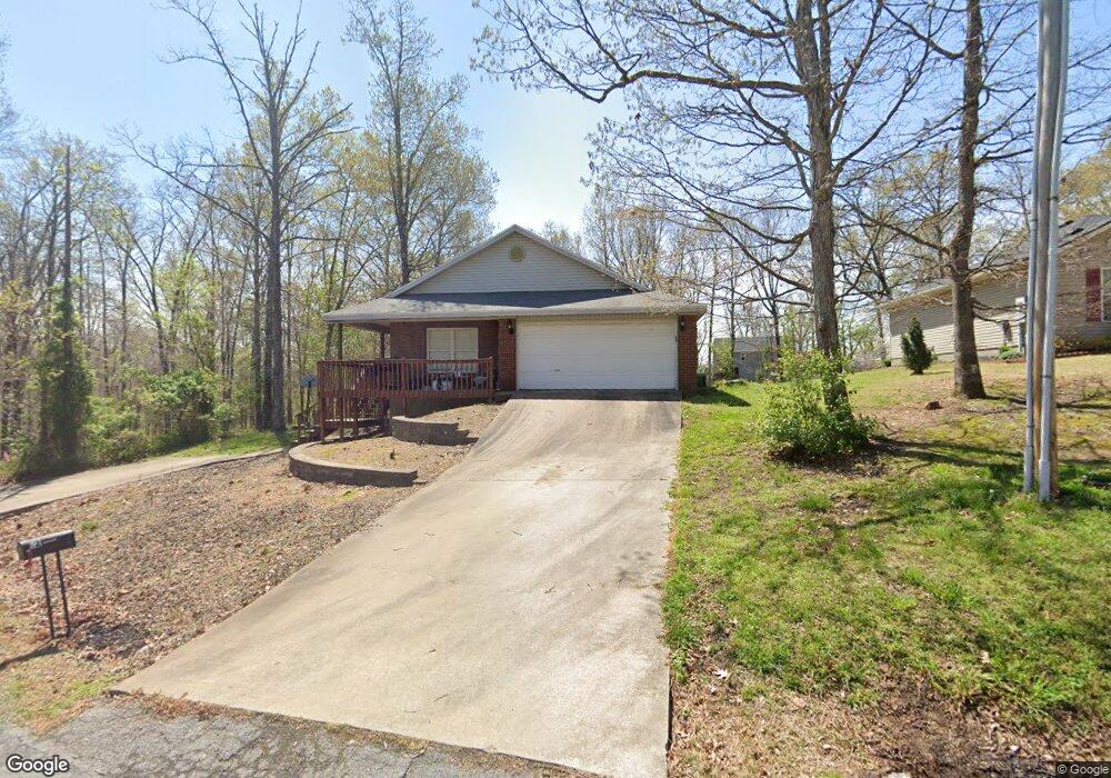
12 Slaggford Ln Bella Vista, AR 72714
Estimated Value: $303,418 - $369,000
--
Bed
2
Baths
1,648
Sq Ft
$203/Sq Ft
Est. Value
About This Home
This home is located at 12 Slaggford Ln, Bella Vista, AR 72714 and is currently estimated at $334,105, approximately $202 per square foot. 12 Slaggford Ln is a home located in Benton County with nearby schools including Sugar Creek Elementary School, Ruth Barker Middle School, and Washington Junior High School.
Ownership History
Date
Name
Owned For
Owner Type
Purchase Details
Closed on
Aug 5, 2004
Bought by
Lafferty
Current Estimated Value
Purchase Details
Closed on
Jul 30, 2004
Bought by
Lafferty
Purchase Details
Closed on
Jul 22, 2003
Bought by
Allen
Purchase Details
Closed on
Feb 22, 2002
Bought by
Hazelwood
Purchase Details
Closed on
Feb 14, 2001
Bought by
Carey
Purchase Details
Closed on
Sep 20, 1996
Bought by
Kenneth Peterson
Purchase Details
Closed on
Jul 22, 1976
Bought by
Peterson
Create a Home Valuation Report for This Property
The Home Valuation Report is an in-depth analysis detailing your home's value as well as a comparison with similar homes in the area
Home Values in the Area
Average Home Value in this Area
Purchase History
| Date | Buyer | Sale Price | Title Company |
|---|---|---|---|
| Lafferty | $150,000 | -- | |
| Lafferty | $150,000 | -- | |
| Allen | $130,000 | -- | |
| Monogram | -- | -- | |
| Hazelwood | $1,000 | -- | |
| Carey | -- | -- | |
| Kenneth Peterson | -- | -- | |
| Peterson | $7,000 | -- |
Source: Public Records
Tax History Compared to Growth
Tax History
| Year | Tax Paid | Tax Assessment Tax Assessment Total Assessment is a certain percentage of the fair market value that is determined by local assessors to be the total taxable value of land and additions on the property. | Land | Improvement |
|---|---|---|---|---|
| 2025 | $2,125 | $49,607 | $1,600 | $48,007 |
| 2024 | $2,008 | $49,607 | $1,600 | $48,007 |
| 2023 | $1,912 | $32,250 | $800 | $31,450 |
| 2022 | $1,512 | $32,250 | $800 | $31,450 |
| 2021 | $1,422 | $32,250 | $800 | $31,450 |
| 2020 | $1,352 | $27,110 | $600 | $26,510 |
| 2019 | $1,352 | $27,110 | $600 | $26,510 |
| 2018 | $1,377 | $27,110 | $600 | $26,510 |
| 2017 | $1,312 | $27,110 | $600 | $26,510 |
| 2016 | $1,312 | $27,110 | $600 | $26,510 |
| 2015 | $1,565 | $25,950 | $1,000 | $24,950 |
| 2014 | $1,215 | $25,950 | $1,000 | $24,950 |
Source: Public Records
Map
Nearby Homes
- 0 Rettendon Ln
- 0 Rillington Dr Unit 1316259
- Lot 10 of Block 6 Rillington Dr
- 127 Rillington Dr
- 8442 E McNelly Rd
- 3 Brougham Ln
- 5 Ettington Ln
- 44 Cresswell Dr
- 40 Merritt Dr
- 16 Blizzen Ln
- 75 Melanie Dr
- 0 Allendale Dr
- 63 Merritt Dr
- 12 Sunderland Dr
- 37 & 39 Allendale Dr
- 20 Melanie Cir
- 2 Canova Ln
- 25 Metfield Dr
- 2 Eleanor Ln
- 29 Lunsford Ln
- 8 Slaggford Ln
- 16 Slaggford Ln
- 17 Rettendon Ln
- 19 Rettendon Ln
- 11 Slaggford Ln
- 13 Rettendon Ln
- 0 Slaggford Ln
- 2 Stortford Ln
- 15 Rettendon Ln
- Lot 9 Slaggford Ln
- 29 Rettendon Ln
- 7 Slaggford Ln
- 24 Rettendon Ln
- 2 Slaggford Ln
- 24 Rettendon Ln
- 1 Stortford Ln
- 12 Bewcastle Ln
- 0 Stortford Ln Unit 1150680
- 0 Stortford Ln Unit 1195080
- 0 Stortford Ln Unit 1113646