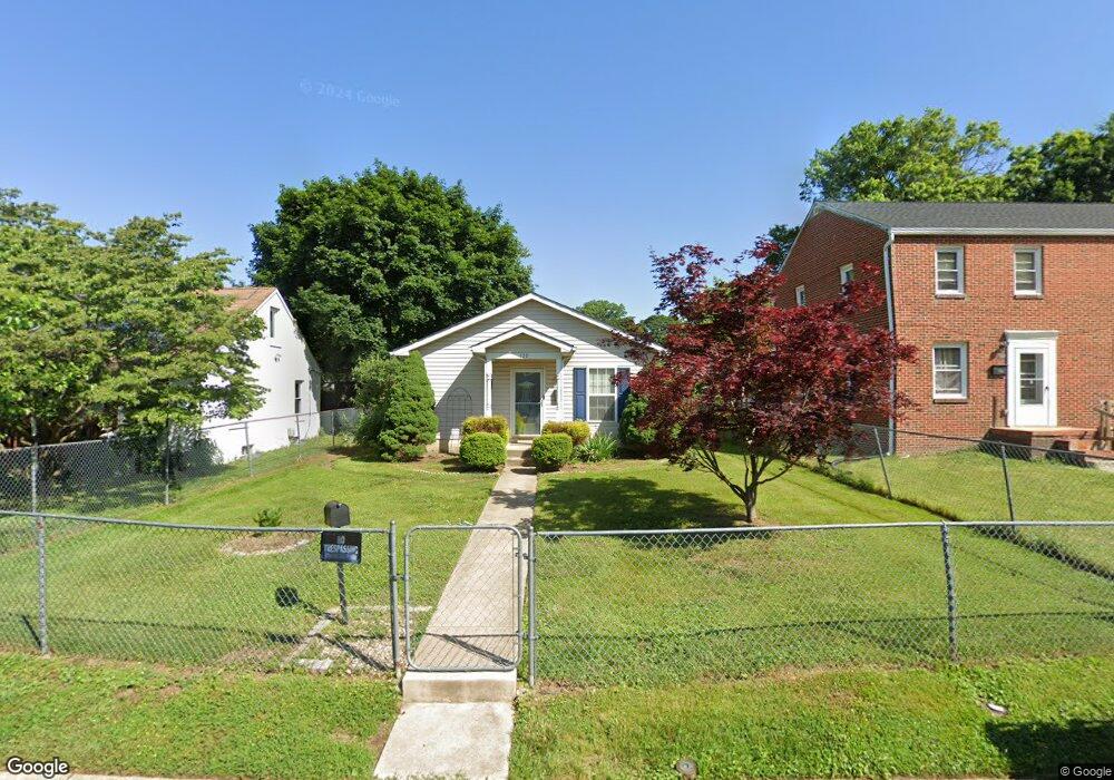
120 Brannan Rd Aberdeen, MD 21001
Estimated Value: $243,442 - $270,000
--
Bed
2
Baths
1,008
Sq Ft
$252/Sq Ft
Est. Value
About This Home
This home is located at 120 Brannan Rd, Aberdeen, MD 21001 and is currently estimated at $254,361, approximately $252 per square foot. 120 Brannan Rd is a home located in Harford County with nearby schools including Halls Cross Roads Elementary School, Aberdeen Middle School, and Aberdeen High School.
Ownership History
Date
Name
Owned For
Owner Type
Purchase Details
Closed on
Aug 16, 2006
Sold by
Harford Habitat For Humanity Inc
Bought by
Fax Rhovonda D
Current Estimated Value
Home Financials for this Owner
Home Financials are based on the most recent Mortgage that was taken out on this home.
Original Mortgage
$82,472
Outstanding Balance
$6,651
Interest Rate
6.71%
Mortgage Type
Stand Alone Second
Estimated Equity
$247,710
Purchase Details
Closed on
Jun 30, 2006
Sold by
Harford Habitat For Humanity Inc
Bought by
Fax Rhovonda D
Home Financials for this Owner
Home Financials are based on the most recent Mortgage that was taken out on this home.
Original Mortgage
$82,472
Outstanding Balance
$6,651
Interest Rate
6.71%
Mortgage Type
Stand Alone Second
Estimated Equity
$247,710
Purchase Details
Closed on
Sep 8, 1989
Sold by
Haut John T and Haut Wf
Bought by
Bundrick Asbury F
Create a Home Valuation Report for This Property
The Home Valuation Report is an in-depth analysis detailing your home's value as well as a comparison with similar homes in the area
Home Values in the Area
Average Home Value in this Area
Purchase History
| Date | Buyer | Sale Price | Title Company |
|---|---|---|---|
| Fax Rhovonda D | $156,000 | -- | |
| Fax Rhovonda D | $156,000 | -- | |
| Bundrick Asbury F | $65,000 | -- |
Source: Public Records
Mortgage History
| Date | Status | Borrower | Loan Amount |
|---|---|---|---|
| Open | Fax Rhovonda D | $82,472 | |
| Closed | Fax Rhovonda D | $65,000 | |
| Closed | Fax Rhovonda D | $82,472 | |
| Previous Owner | Fax Rhovonda D | $65,000 |
Source: Public Records
Tax History Compared to Growth
Tax History
| Year | Tax Paid | Tax Assessment Tax Assessment Total Assessment is a certain percentage of the fair market value that is determined by local assessors to be the total taxable value of land and additions on the property. | Land | Improvement |
|---|---|---|---|---|
| 2025 | $1,530 | $173,167 | $0 | $0 |
| 2024 | $1,530 | $162,833 | $0 | $0 |
| 2023 | $1,454 | $152,500 | $45,900 | $106,600 |
| 2022 | $1,446 | $151,667 | $0 | $0 |
| 2021 | $1,509 | $150,833 | $0 | $0 |
| 2020 | $1,509 | $150,000 | $45,900 | $104,100 |
| 2019 | $1,483 | $147,467 | $0 | $0 |
| 2018 | $1,445 | $144,933 | $0 | $0 |
| 2017 | $1,419 | $142,400 | $0 | $0 |
| 2016 | -- | $142,400 | $0 | $0 |
| 2015 | $926 | $142,400 | $0 | $0 |
| 2014 | $926 | $150,400 | $0 | $0 |
Source: Public Records
Map
Nearby Homes
- 116 Brannan Rd
- 126 Brannan Rd
- 134 Brannan Rd
- 108 Brannan Rd
- 121 Osborne Rd
- 117 Osborne Rd
- 129 Osborne Rd
- 113 Osborne Rd
- 125 Osborne Rd
- 125 Brannan Rd
- 138 Brannan Rd
- 109 Osborne Rd
- 133 Osborne Rd
- 133 Osborn Rd
- 109 Osborn Rd
- 105 Osborne Rd
- 137 Osborne Rd
- 103 E Bel Air Ave
- 133 Brannan Rd
- 118 New County Rd