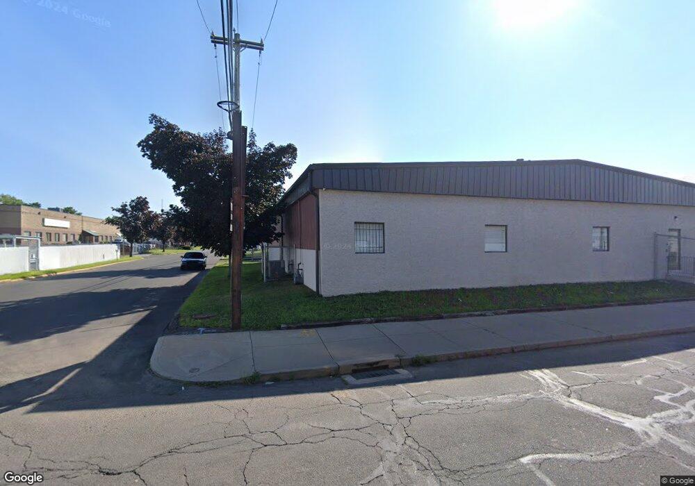
120 River St Bridgeport, CT 06604
Reservoir-Whiskey Hill NeighborhoodEstimated Value: $6,680,807
--
Bed
--
Bath
--
Sq Ft
5.46
Acres
About This Home
This home is located at 120 River St, Bridgeport, CT 06604 and is currently estimated at $6,680,807. 120 River St is a home located in Fairfield County with nearby schools including Read School, Harding High School, and Achievement First Bridgeport Academy Elementary School.
Ownership History
Date
Name
Owned For
Owner Type
Purchase Details
Closed on
Jun 27, 1996
Sold by
Moutinho Manuel
Bought by
Envirotest Systems
Current Estimated Value
Create a Home Valuation Report for This Property
The Home Valuation Report is an in-depth analysis detailing your home's value as well as a comparison with similar homes in the area
Home Values in the Area
Average Home Value in this Area
Purchase History
| Date | Buyer | Sale Price | Title Company |
|---|---|---|---|
| Envirotest Systems | $1,700,000 | -- | |
| Envirotest Systems | $1,700,000 | -- |
Source: Public Records
Mortgage History
| Date | Status | Borrower | Loan Amount |
|---|---|---|---|
| Closed | Envirotest Systems | $5,000,000 | |
| Previous Owner | Envirotest Systems | $425,000 |
Source: Public Records
Tax History Compared to Growth
Tax History
| Year | Tax Paid | Tax Assessment Tax Assessment Total Assessment is a certain percentage of the fair market value that is determined by local assessors to be the total taxable value of land and additions on the property. | Land | Improvement |
|---|---|---|---|---|
| 2025 | $112,318 | $2,585,000 | $725,550 | $1,859,450 |
| 2024 | $112,318 | $2,585,000 | $725,550 | $1,859,450 |
| 2023 | $112,318 | $2,585,000 | $725,550 | $1,859,450 |
| 2022 | $112,318 | $2,585,000 | $725,550 | $1,859,450 |
| 2021 | $112,318 | $2,585,000 | $725,550 | $1,859,450 |
| 2020 | $118,681 | $2,198,200 | $580,440 | $1,617,760 |
| 2019 | $118,681 | $2,198,200 | $580,440 | $1,617,760 |
| 2018 | $119,516 | $2,198,200 | $580,440 | $1,617,760 |
| 2017 | $119,516 | $2,198,200 | $580,440 | $1,617,760 |
| 2016 | $119,516 | $2,198,200 | $580,440 | $1,617,760 |
| 2015 | $103,877 | $2,461,550 | $580,440 | $1,881,110 |
| 2014 | $103,877 | $2,461,550 | $580,440 | $1,881,110 |
Source: Public Records
Map
Nearby Homes
- 142 River St
- 95 River St
- 73 River St
- 7 Island Brook Ave Unit 4
- 7 Island Brook Ave Unit 4&5
- 7 Island Brook Ave Unit 5
- 7 Island Brook Ave Unit 1
- 7 Island Brook Ave
- 215 Merriam St Unit 217
- 215 Merriam St Unit 2ND F
- 56 Ives Ct Unit 58
- 1 1/2 Island Brook Ave Unit B
- 3 Island Brook Ave
- 3 Island Brook Ave Unit 5
- 3 Island Brook Ave Unit d-5
- 3 Island Brook Ave Unit d 1
- 3 Island Brook Ave Unit C
- 3 Island Brook Ave Unit 2
- 52 Ives Ct Unit 54
- 270 River St