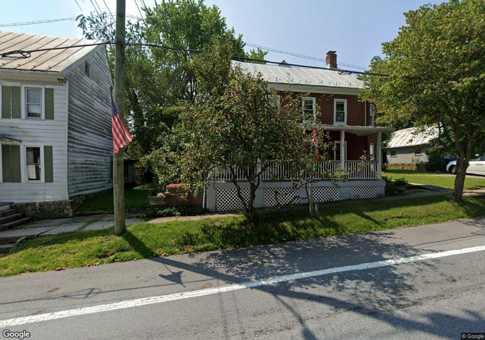
12009 Main St Libertytown, MD 21762
Estimated Value: $386,000 - $399,861
--
Bed
--
Bath
2,680
Sq Ft
$146/Sq Ft
Est. Value
About This Home
This home is located at 12009 Main St, Libertytown, MD 21762 and is currently estimated at $392,215, approximately $146 per square foot. 12009 Main St is a home located in Frederick County with nearby schools including Liberty Elementary School, New Market Middle School, and Linganore High School.
Ownership History
Date
Name
Owned For
Owner Type
Purchase Details
Closed on
Sep 17, 2014
Sold by
Howard Michael Thomas and Howard Catherine H
Bought by
Howard Michael Thomas and Howard Catherine H
Current Estimated Value
Home Financials for this Owner
Home Financials are based on the most recent Mortgage that was taken out on this home.
Original Mortgage
$76,750
Interest Rate
4.11%
Mortgage Type
New Conventional
Purchase Details
Closed on
Aug 24, 1993
Sold by
Riordan Mary P
Bought by
Howard Michael Thomas
Home Financials for this Owner
Home Financials are based on the most recent Mortgage that was taken out on this home.
Original Mortgage
$100,000
Interest Rate
7.1%
Create a Home Valuation Report for This Property
The Home Valuation Report is an in-depth analysis detailing your home's value as well as a comparison with similar homes in the area
Home Values in the Area
Average Home Value in this Area
Purchase History
| Date | Buyer | Sale Price | Title Company |
|---|---|---|---|
| Howard Michael Thomas | -- | Unisource | |
| Howard Michael Thomas | $112,000 | -- |
Source: Public Records
Mortgage History
| Date | Status | Borrower | Loan Amount |
|---|---|---|---|
| Closed | Howard Michael Thomas | $76,750 | |
| Closed | Howard Michael Thomas | $100,000 |
Source: Public Records
Tax History Compared to Growth
Tax History
| Year | Tax Paid | Tax Assessment Tax Assessment Total Assessment is a certain percentage of the fair market value that is determined by local assessors to be the total taxable value of land and additions on the property. | Land | Improvement |
|---|---|---|---|---|
| 2025 | $3,633 | $325,300 | $139,000 | $186,300 |
| 2024 | $3,633 | $303,867 | $0 | $0 |
| 2023 | $3,338 | $282,433 | $0 | $0 |
| 2022 | $3,173 | $261,000 | $92,900 | $168,100 |
| 2021 | $3,096 | $258,200 | $0 | $0 |
| 2020 | $3,107 | $255,400 | $0 | $0 |
| 2019 | $3,054 | $252,600 | $88,900 | $163,700 |
| 2018 | $2,957 | $252,300 | $0 | $0 |
| 2017 | $3,044 | $252,600 | $0 | $0 |
| 2016 | $2,534 | $251,700 | $0 | $0 |
| 2015 | $2,534 | $248,833 | $0 | $0 |
| 2014 | $2,534 | $245,967 | $0 | $0 |
Source: Public Records
Map
Nearby Homes
- 11623 Daysville Rd
- 11584 Liberty Oak Dr
- 11911 Main St
- 8625 Chestnut Grove Rd
- 11940 Main St
- 11035 Bennie Duncan Rd
- 12061 & 12059 Main St
- 12109 Liberty Rd
- 10027 Pine Tree Rd
- 9130 Liberty Village Way
- 10028A Pine Tree Rd
- 10334 Harp Rd
- 10242 Daysville Rd
- 10236 Daysville Rd
- 10230 Daysville Rd
- 8008 Dustin Dr
- 11023 Horseshoe Dr
- 1096 Holden Rd
- 324 Braeburn Ct
- 10543 Woodsboro Rd
- 11307 Daysville Rd
- 11421 Daysville Rd
- 11313 Daysville Rd
- 11303 Daysville Rd
- 11301 Daysville Rd
- 11299 Daysville Rd
- 11302 Daysville Rd
- 11217 Daysville Rd
- 11308 Daysville Rd
- 11530B Liberty Rd
- 11230 Daysville Rd
- 11402 Daysville Rd
- 11318 Daysville Rd
- 11408 Daysville Rd
- 11412 Daysville Rd
- 11306 Daysville Rd
- 11306 Daysville Rd
- 11304 Daysville Rd
- 11340 Daysville Rd
- 11205 Daysville Rd