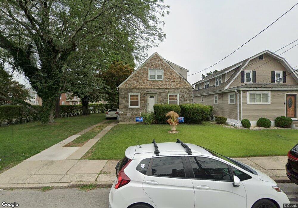
1201 Angora Dr Lansdowne, PA 19050
Estimated Value: $245,000 - $306,000
3
Beds
2
Baths
1,527
Sq Ft
$179/Sq Ft
Est. Value
About This Home
This home is located at 1201 Angora Dr, Lansdowne, PA 19050 and is currently estimated at $273,529, approximately $179 per square foot. 1201 Angora Dr is a home located in Delaware County with nearby schools including Evans Elementary School, Penn Wood Middle School, and Penn Wood High School - Cypress Street Campus.
Ownership History
Date
Name
Owned For
Owner Type
Purchase Details
Closed on
May 15, 2018
Sold by
U S Bank Na
Bought by
Perlick Zachary
Current Estimated Value
Purchase Details
Closed on
May 18, 2016
Sold by
Taylor Rita and Bank Of America National Assoc
Bought by
Us Bank National Association
Purchase Details
Closed on
Nov 3, 2006
Sold by
Jones Ricardo R
Bought by
Taylor Rita
Home Financials for this Owner
Home Financials are based on the most recent Mortgage that was taken out on this home.
Original Mortgage
$128,700
Interest Rate
6.31%
Mortgage Type
Purchase Money Mortgage
Purchase Details
Closed on
May 8, 2006
Sold by
Jones Ricardo and Connally Rosanna Mellerson
Bought by
Jones Ricardo
Create a Home Valuation Report for This Property
The Home Valuation Report is an in-depth analysis detailing your home's value as well as a comparison with similar homes in the area
Home Values in the Area
Average Home Value in this Area
Purchase History
| Date | Buyer | Sale Price | Title Company |
|---|---|---|---|
| Perlick Zachary | $82,901 | None Available | |
| Us Bank National Association | -- | None Available | |
| Taylor Rita | $143,000 | None Available | |
| Jones Ricardo | -- | Commonwealth Land Title |
Source: Public Records
Mortgage History
| Date | Status | Borrower | Loan Amount |
|---|---|---|---|
| Previous Owner | Taylor Rita | $128,700 |
Source: Public Records
Tax History Compared to Growth
Tax History
| Year | Tax Paid | Tax Assessment Tax Assessment Total Assessment is a certain percentage of the fair market value that is determined by local assessors to be the total taxable value of land and additions on the property. | Land | Improvement |
|---|---|---|---|---|
| 2025 | $5,446 | $127,540 | $51,270 | $76,270 |
| 2024 | $5,446 | $127,540 | $51,270 | $76,270 |
| 2023 | $4,946 | $127,540 | $51,270 | $76,270 |
| 2022 | $4,716 | $127,540 | $51,270 | $76,270 |
| 2021 | $7,132 | $127,540 | $51,270 | $76,270 |
| 2020 | $6,145 | $98,400 | $31,710 | $66,690 |
| 2019 | $6,037 | $98,400 | $31,710 | $66,690 |
| 2018 | $5,953 | $98,400 | $0 | $0 |
| 2017 | $5,828 | $98,400 | $0 | $0 |
| 2016 | $540 | $98,400 | $0 | $0 |
| 2015 | $540 | $98,400 | $0 | $0 |
| 2014 | $540 | $98,400 | $0 | $0 |
Source: Public Records
Map
Nearby Homes
- 1016 Whitby Ave
- 813 Arbor Rd
- 536 Cypress St
- 825 Laurel Rd
- 740 Church Ln
- 711 Yeadon Ave Unit 1
- 702 Cedar Ave
- 800 Bullock Ave
- 722 Yeadon Ave
- 6030 Cedarhurst St
- 1046 Cobbs Creek Pkwy
- 1048 Cobbs Creek Pkwy
- 6026 Baltimore Ave
- 6005 Cedarhurst St
- 1781 S 65th St
- 6013 Baltimore Ave
- 1214 S 60th St
- 5859 Willows Ave
- 314 S 60th St
- 5843 Ashland Ave
- 1209 Angora Dr
- 1211 Angora Dr
- 1113 Angora Dr
- 1210 Whitby Ave
- 1111 Angora Dr
- 1212 Whitby Ave
- 1200 Whitby Ave
- 1109 Angora Dr
- 1130 Whitby Ave
- 1219 Angora Dr
- 1202 Angora Dr
- 1204 Angora Dr
- 1216 Whitby Ave
- 1200 Angora Dr
- 1206 Angora Dr
- 1107 Angora Ave
- 1126 Angora Dr
- 1214 Angora Dr
- 1126 Whitby Ave
- 1124 Angora Dr