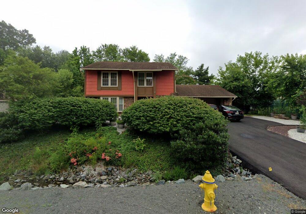
12029 Pierce Rd Waldorf, MD 20601
Estimated Value: $359,617 - $422,000
--
Bed
3
Baths
1,516
Sq Ft
$267/Sq Ft
Est. Value
About This Home
This home is located at 12029 Pierce Rd, Waldorf, MD 20601 and is currently estimated at $404,154, approximately $266 per square foot. 12029 Pierce Rd is a home located in Charles County with nearby schools including C. Paul Barnhart Elementary School, Mattawoman Middle School, and Thomas Stone High School.
Ownership History
Date
Name
Owned For
Owner Type
Purchase Details
Closed on
May 6, 2013
Sold by
Khoury Salim N and Khoury Sheila A
Bought by
Khoury Salim N and Khoury Sheila A
Current Estimated Value
Purchase Details
Closed on
Apr 12, 1983
Sold by
Presutti Ralph M
Bought by
Khoury Salim N and Khoury Sheila R
Home Financials for this Owner
Home Financials are based on the most recent Mortgage that was taken out on this home.
Original Mortgage
$71,550
Interest Rate
12.82%
Purchase Details
Closed on
May 3, 1982
Sold by
First Federal Savings & Loan
Bought by
Presutti Ralph M
Home Financials for this Owner
Home Financials are based on the most recent Mortgage that was taken out on this home.
Original Mortgage
$68,400
Interest Rate
16.81%
Create a Home Valuation Report for This Property
The Home Valuation Report is an in-depth analysis detailing your home's value as well as a comparison with similar homes in the area
Home Values in the Area
Average Home Value in this Area
Purchase History
| Date | Buyer | Sale Price | Title Company |
|---|---|---|---|
| Khoury Salim N | -- | None Available | |
| Khoury Salim N | $79,500 | -- | |
| Presutti Ralph M | $72,000 | -- |
Source: Public Records
Mortgage History
| Date | Status | Borrower | Loan Amount |
|---|---|---|---|
| Closed | Khoury Salim N | $71,550 | |
| Previous Owner | Presutti Ralph M | $68,400 |
Source: Public Records
Tax History Compared to Growth
Tax History
| Year | Tax Paid | Tax Assessment Tax Assessment Total Assessment is a certain percentage of the fair market value that is determined by local assessors to be the total taxable value of land and additions on the property. | Land | Improvement |
|---|---|---|---|---|
| 2025 | -- | $305,700 | -- | -- |
| 2024 | $1,927 | $292,600 | $126,500 | $166,100 |
| 2023 | $3,934 | $275,267 | $0 | $0 |
| 2022 | $3,659 | $257,933 | $0 | $0 |
| 2021 | $3,229 | $240,600 | $96,500 | $144,100 |
| 2020 | $3,229 | $228,233 | $0 | $0 |
| 2019 | $3,049 | $215,867 | $0 | $0 |
| 2018 | $2,847 | $203,500 | $90,500 | $113,000 |
| 2017 | $2,839 | $203,500 | $0 | $0 |
| 2016 | -- | $203,500 | $0 | $0 |
| 2015 | -- | $204,500 | $0 | $0 |
| 2014 | -- | $204,500 | $0 | $0 |
Source: Public Records
Map
Nearby Homes
- 12061 Pierce Rd
- 12276 Wendy Ln
- 12288 Wendy Ln
- 12113 Farrar Place
- 2031 Tanglewood Dr
- 2002 English Oak Ct
- 2204 Holly Oak Ct
- 2073 Tanglewood Dr
- 11748 Torcello Ct
- 2704 Tred Avon Ct
- 2712 Tred Avon Ct
- 11565 Timberbrook Dr
- HAYDEN Plan at Acton Park
- 2522 Regal Place
- 16659 Green Glade Dr
- 16655 Green Glade Dr
- 7505 Silver Thread Way
- 7513 Silver Thread Way
- 11616 Kipling Dr
- 231 Westdale Dr
- 12033 Pierce Rd
- 2170 Kay Hill Dr
- 2174 Kay Hill Dr
- 12058 Mustard Seed Ct
- 12037 Pierce Rd
- 12054 Mustard Seed Ct
- 12062 Mustard Seed Ct
- 12028 Pierce Rd
- 12032 Pierce Rd
- 12024 Pierce Rd
- Kay Hill Dr
- Kay Hill Dr
- Kay Hill Dr
- 12041 Pierce Rd
- 12036 Pierce Rd
- 2184 Kay Hill Dr
- 12051 Mustard Seed Ct
- 12066 Mustard Seed Ct
- 12046 Mustard Seed Ct
- 12047 Pierce Rd