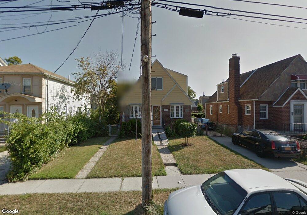
12037 196th St Saint Albans, NY 11412
Saint Albans NeighborhoodEstimated Value: $737,477 - $838,000
--
Bed
--
Bath
1,099
Sq Ft
$730/Sq Ft
Est. Value
About This Home
This home is located at 12037 196th St, Saint Albans, NY 11412 and is currently estimated at $802,119, approximately $729 per square foot. 12037 196th St is a home located in Queens County with nearby schools including P.S. 15 Jackie Robinson, Is 59 Springfield Gardens, and Success Academy Springfield Gardens.
Ownership History
Date
Name
Owned For
Owner Type
Purchase Details
Closed on
May 1, 2008
Sold by
Mouzon Heidi E and Mouzon William S
Bought by
Phillip Carl and Phillip Gregory
Current Estimated Value
Home Financials for this Owner
Home Financials are based on the most recent Mortgage that was taken out on this home.
Original Mortgage
$461,753
Outstanding Balance
$290,279
Interest Rate
5.91%
Mortgage Type
Purchase Money Mortgage
Estimated Equity
$511,840
Create a Home Valuation Report for This Property
The Home Valuation Report is an in-depth analysis detailing your home's value as well as a comparison with similar homes in the area
Home Values in the Area
Average Home Value in this Area
Purchase History
| Date | Buyer | Sale Price | Title Company |
|---|---|---|---|
| Phillip Carl | $469,000 | -- | |
| Phillip Carl | $469,000 | -- |
Source: Public Records
Mortgage History
| Date | Status | Borrower | Loan Amount |
|---|---|---|---|
| Open | Phillip Carl | $461,753 | |
| Closed | Phillip Carl | $461,753 |
Source: Public Records
Tax History Compared to Growth
Tax History
| Year | Tax Paid | Tax Assessment Tax Assessment Total Assessment is a certain percentage of the fair market value that is determined by local assessors to be the total taxable value of land and additions on the property. | Land | Improvement |
|---|---|---|---|---|
| 2025 | $6,397 | $33,760 | $10,556 | $23,204 |
| 2024 | $6,397 | $31,849 | $9,918 | $21,931 |
| 2023 | $6,145 | $30,594 | $9,111 | $21,483 |
| 2022 | $5,762 | $45,780 | $13,920 | $31,860 |
| 2021 | $6,074 | $39,420 | $13,920 | $25,500 |
| 2020 | $5,955 | $37,860 | $13,920 | $23,940 |
| 2019 | $5,552 | $33,240 | $13,920 | $19,320 |
| 2018 | $5,197 | $25,495 | $10,163 | $15,332 |
| 2017 | $4,903 | $24,052 | $12,318 | $11,734 |
| 2016 | $4,808 | $24,052 | $12,318 | $11,734 |
| 2015 | $2,517 | $23,444 | $14,717 | $8,727 |
| 2014 | $2,517 | $22,118 | $12,542 | $9,576 |
Source: Public Records
Map
Nearby Homes
- 12105 196th St
- 121-17 196th St
- 121-9 195th St
- 121-11 195th St
- 121-16 198th St
- 120-15 196th St
- 12043 194th St
- 194-09 122nd Ave
- 120-46 199th St
- 12054 194th St
- 120-20 194th St
- 19415 120th Ave
- 19401 Nashville Blvd
- 194-01 Nashville Blvd
- 120-60 200th St
- 122-52 Springfield Blvd
- 13024 Springfield Blvd
- 19332 Williamson Ave
- 120-44 192nd St
- 192-17 Williamson Ave
- 12033 196th St
- 12041 196th St
- 12029 196th St
- 12040 197th St
- 12047 196th St
- 12044 197th St
- 120-40 197th St
- 12034 197th St
- 12034 197th St Unit 2
- 12034 197th St
- 12034 197th St Unit 1
- 12034 197th St Unit 1
- 120-34 197th St
- 12048 197th St
- 12025 196th St
- 12038 196th St
- 12040 196th St
- 12040 196th St
- 12028 197th St
- 12038 196th St