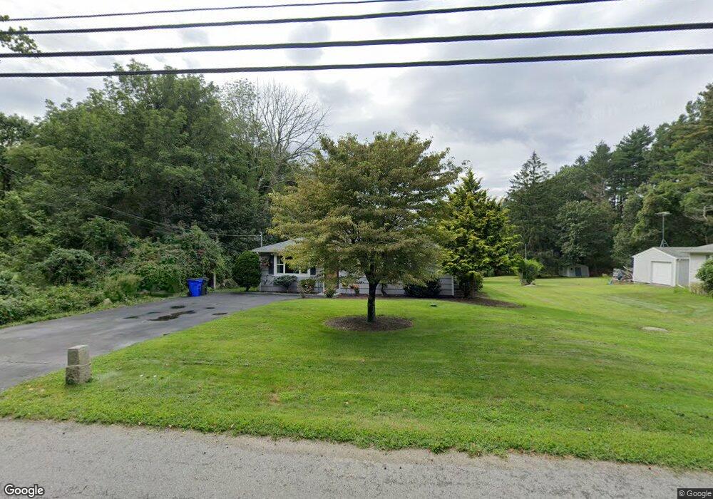
1204 Blossom Rd Westport, MA 02790
Estimated Value: $445,000 - $641,000
3
Beds
2
Baths
1,616
Sq Ft
$338/Sq Ft
Est. Value
About This Home
This home is located at 1204 Blossom Rd, Westport, MA 02790 and is currently estimated at $546,224, approximately $338 per square foot. 1204 Blossom Rd is a home with nearby schools including North End Elementary School, Talbot Innovation School, and B M C Durfee High School.
Ownership History
Date
Name
Owned For
Owner Type
Purchase Details
Closed on
Oct 17, 2022
Sold by
Bellevue Thomas W and Bellevue Deborah A
Bought by
Bellevue Irt
Current Estimated Value
Purchase Details
Closed on
Sep 29, 1981
Bought by
Blanchette Elizabeth
Create a Home Valuation Report for This Property
The Home Valuation Report is an in-depth analysis detailing your home's value as well as a comparison with similar homes in the area
Home Values in the Area
Average Home Value in this Area
Purchase History
| Date | Buyer | Sale Price | Title Company |
|---|---|---|---|
| Bellevue Irt | -- | None Available | |
| Blanchette Elizabeth | $41,000 | -- |
Source: Public Records
Mortgage History
| Date | Status | Borrower | Loan Amount |
|---|---|---|---|
| Previous Owner | Blanchette Elizabeth | $70,000 | |
| Previous Owner | Blanchette Elizabeth | $55,000 | |
| Previous Owner | Blanchette Elizabeth | $93,600 |
Source: Public Records
Tax History Compared to Growth
Tax History
| Year | Tax Paid | Tax Assessment Tax Assessment Total Assessment is a certain percentage of the fair market value that is determined by local assessors to be the total taxable value of land and additions on the property. | Land | Improvement |
|---|---|---|---|---|
| 2025 | $5,082 | $443,800 | $157,600 | $286,200 |
| 2024 | $4,759 | $414,200 | $151,500 | $262,700 |
| 2023 | $4,503 | $367,000 | $131,000 | $236,000 |
| 2022 | $3,979 | $315,300 | $122,500 | $192,800 |
| 2021 | $3,936 | $284,600 | $122,900 | $161,700 |
| 2020 | $3,881 | $268,600 | $123,200 | $145,400 |
| 2019 | $3,805 | $261,000 | $125,100 | $135,900 |
| 2018 | $3,757 | $257,000 | $125,100 | $131,900 |
| 2017 | $2,685 | $191,800 | $114,800 | $77,000 |
| 2016 | $2,556 | $187,500 | $114,800 | $72,700 |
| 2015 | $2,453 | $187,500 | $114,800 | $72,700 |
| 2014 | $2,261 | $179,700 | $107,000 | $72,700 |
Source: Public Records
Map
Nearby Homes
- 128 Old Bedford Rd
- 3 Diane Way
- 125 Angell St
- 85 Reney St
- 0 Rich St
- 89 Lafayette St
- 44 Fenmore St
- 219 Earle St Unit 3
- 217 Earle St Unit 2
- 215 Earle St Unit 1
- 168 Windsor St
- 34 Alsop St
- 1796 Locust St
- 172 Earle St
- 37 Eaton St
- 33 William St
- 1792 Pleasant St Unit 1808
- 6 Beaulieu St
- 200 David St
- 25 Beaulieu St
- 1204 Blossom Rd
- 1228 Blossom Rd
- 1205 Blossom Rd
- 1135 Blossom Rd
- 1105 Blossom Rd
- 1187 Blossom Rd
- 1053 Blossom Rd
- 1025 Blossom Rd
- 1000 Blossom Rd
- 995 Blossom Rd
- Lot Blossom Rd
- 982 Blossom Rd
- 0 Indian Town Rd Unit 72085037
- 192 Blossom Hill Dr
- 214 Blossom Hill Rd
- 193 Blossom Hill Dr
- 193 Blossom Hill Dr
- 193 Blossom Hill Dr Unit 1
- 215 Blossom Hill Dr
- 937 Blossom Rd