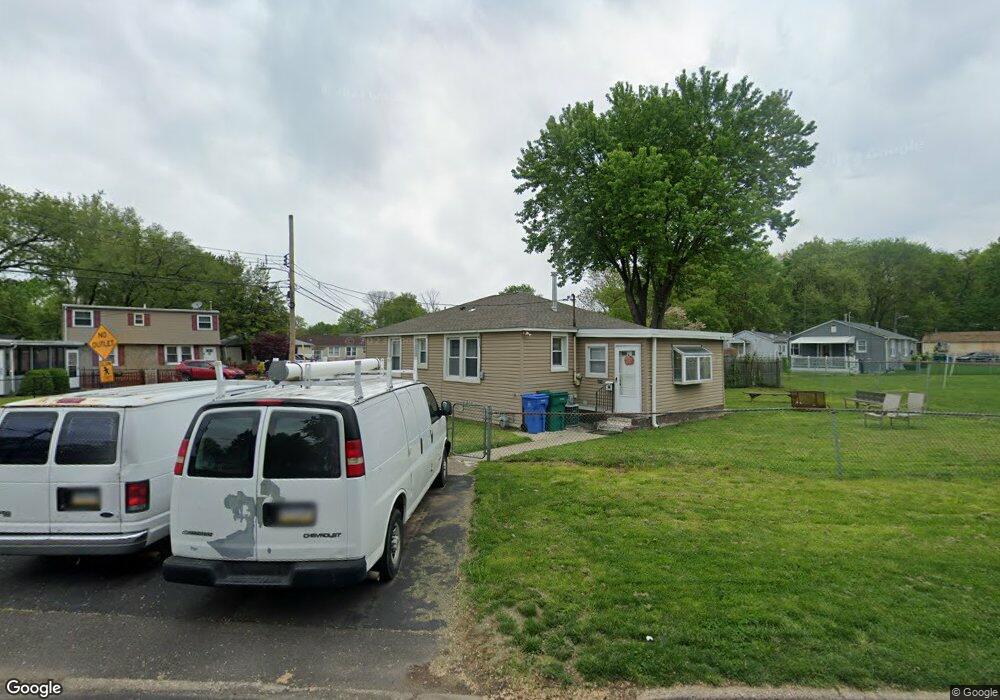
1206 Schumacher Dr Bristol, PA 19007
Estimated Value: $178,000 - $227,683
2
Beds
1
Bath
775
Sq Ft
$262/Sq Ft
Est. Value
About This Home
This home is located at 1206 Schumacher Dr, Bristol, PA 19007 and is currently estimated at $203,228, approximately $262 per square foot. 1206 Schumacher Dr is a home located in Bucks County with nearby schools including Truman Senior High School, St. Mark Elementary School, and Isabet Academy.
Ownership History
Date
Name
Owned For
Owner Type
Purchase Details
Closed on
Sep 30, 2011
Sold by
Herndon Fred E and Herndon Carrie M
Bought by
Rampershaud Jay Paul and Rampersaud Renata
Current Estimated Value
Home Financials for this Owner
Home Financials are based on the most recent Mortgage that was taken out on this home.
Original Mortgage
$65,280
Outstanding Balance
$44,631
Interest Rate
4.15%
Mortgage Type
New Conventional
Estimated Equity
$158,597
Purchase Details
Closed on
Nov 21, 1994
Sold by
Va
Bought by
Herndon Fred E and Herndon Carrie M
Create a Home Valuation Report for This Property
The Home Valuation Report is an in-depth analysis detailing your home's value as well as a comparison with similar homes in the area
Home Values in the Area
Average Home Value in this Area
Purchase History
| Date | Buyer | Sale Price | Title Company |
|---|---|---|---|
| Rampershaud Jay Paul | $81,600 | None Available | |
| Herndon Fred E | $15,000 | -- |
Source: Public Records
Mortgage History
| Date | Status | Borrower | Loan Amount |
|---|---|---|---|
| Open | Rampershaud Jay Paul | $65,280 |
Source: Public Records
Tax History Compared to Growth
Tax History
| Year | Tax Paid | Tax Assessment Tax Assessment Total Assessment is a certain percentage of the fair market value that is determined by local assessors to be the total taxable value of land and additions on the property. | Land | Improvement |
|---|---|---|---|---|
| 2025 | $2,064 | $7,600 | $1,960 | $5,640 |
| 2024 | $2,064 | $7,600 | $1,960 | $5,640 |
| 2023 | $2,049 | $7,600 | $1,960 | $5,640 |
| 2022 | $2,049 | $7,600 | $1,960 | $5,640 |
| 2021 | $2,049 | $7,600 | $1,960 | $5,640 |
| 2020 | $2,049 | $7,600 | $1,960 | $5,640 |
| 2019 | $2,041 | $7,600 | $1,960 | $5,640 |
| 2018 | $2,008 | $7,600 | $1,960 | $5,640 |
| 2017 | $1,978 | $7,600 | $1,960 | $5,640 |
| 2016 | $1,978 | $7,600 | $1,960 | $5,640 |
| 2015 | $1,534 | $7,600 | $1,960 | $5,640 |
| 2014 | $1,534 | $7,600 | $1,960 | $5,640 |
Source: Public Records
Map
Nearby Homes
- 5605 Toga St
- 5517 Schumacher Dr
- 5617 Beaver Dam Rd
- 1515 Lakeland Ave
- 5 Green Ln
- 1201 Pacific Ave
- 314 Railroad Ave
- 5604 Fleetwing Dr
- 2205 Liberator St
- 61 Green Ln
- 221 Cleveland St
- 5711 Mustang St
- 905 Garden St
- 243 Monroe St
- 6419 Radcliffe St
- 2296 Seabird Dr Unit 1
- 2285 Seabird Dr Unit 14
- 903 New Chestnut St
- 16434 River View Cir
- 16442 River View Cir
- 5600 Truman St
- 5601 Truman St
- 5602 Truman St
- 5601 Tremont St
- 5603 Truman St
- 5529 Schumacher Dr
- 5603 Tremont St
- 5605 Truman St
- 1229 Schumacher Dr Unit 1231
- 1210 Schumacher Dr
- 5604 Truman St
- 5607 Tremont St
- 1227 Schumacher Dr
- 1221 Schumacher Dr
- 1225 Schumacher Dr
- 1217 Schumacher Dr Unit 19
- 5609 Tremont St
- 5607 Truman St
- 1247 Marie Lowe Dr
- 1247 Marie Lowe Dr