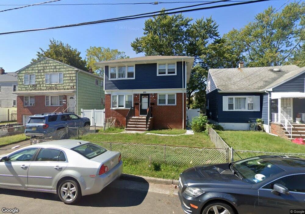
1215 Middlesex St Linden, NJ 07036
Estimated Value: $454,000 - $712,000
--
Bed
--
Bath
962
Sq Ft
$583/Sq Ft
Est. Value
About This Home
This home is located at 1215 Middlesex St, Linden, NJ 07036 and is currently estimated at $560,470, approximately $582 per square foot. 1215 Middlesex St is a home located in Union County with nearby schools including Dr Charles C Polk School, Grace Wilday Junior High School, and Leonard V. Moore Middle School.
Ownership History
Date
Name
Owned For
Owner Type
Purchase Details
Closed on
Apr 22, 2010
Sold by
Wade Joseph and Ambrose Marjorie
Bought by
Muhammadi Yasin T and Wilkerson Lashawnda
Current Estimated Value
Home Financials for this Owner
Home Financials are based on the most recent Mortgage that was taken out on this home.
Original Mortgage
$5,000
Outstanding Balance
$3,341
Interest Rate
4.99%
Mortgage Type
Unknown
Estimated Equity
$557,129
Purchase Details
Closed on
Sep 18, 2003
Sold by
Singley Marlease
Bought by
Wade Joseph
Home Financials for this Owner
Home Financials are based on the most recent Mortgage that was taken out on this home.
Original Mortgage
$207,200
Interest Rate
6.25%
Create a Home Valuation Report for This Property
The Home Valuation Report is an in-depth analysis detailing your home's value as well as a comparison with similar homes in the area
Home Values in the Area
Average Home Value in this Area
Purchase History
| Date | Buyer | Sale Price | Title Company |
|---|---|---|---|
| Muhammadi Yasin T | $270,000 | First American Title Ins Co | |
| Wade Joseph | $259,000 | -- |
Source: Public Records
Mortgage History
| Date | Status | Borrower | Loan Amount |
|---|---|---|---|
| Open | Muhammadi Yasin T | $5,000 | |
| Open | Muhammadi Yasin T | $265,109 | |
| Previous Owner | Wade Joseph | $207,200 |
Source: Public Records
Tax History Compared to Growth
Tax History
| Year | Tax Paid | Tax Assessment Tax Assessment Total Assessment is a certain percentage of the fair market value that is determined by local assessors to be the total taxable value of land and additions on the property. | Land | Improvement |
|---|---|---|---|---|
| 2025 | $11,715 | $166,600 | $41,800 | $124,800 |
| 2024 | $11,459 | $166,600 | $41,800 | $124,800 |
| 2023 | $11,459 | $166,600 | $41,800 | $124,800 |
| 2022 | $11,519 | $166,600 | $41,800 | $124,800 |
| 2021 | $11,577 | $166,600 | $41,800 | $124,800 |
| 2020 | $11,515 | $166,600 | $41,800 | $124,800 |
| 2019 | $11,477 | $166,600 | $41,800 | $124,800 |
| 2018 | $11,474 | $166,600 | $41,800 | $124,800 |
| 2017 | $11,226 | $166,600 | $41,800 | $124,800 |
| 2016 | $10,872 | $166,600 | $41,800 | $124,800 |
| 2015 | $10,457 | $166,600 | $41,800 | $124,800 |
| 2014 | $10,254 | $166,600 | $41,800 | $124,800 |
Source: Public Records
Map
Nearby Homes
- 1107 Drake Ave
- 1121 Frank St
- 1105 Dill Ave
- 1115 Frank St
- 1116 Dill Ave
- 1005 Nora Dr
- 807 Carnegie St
- 1120 Morris St
- 1112 Morris St
- 1204 Warren St
- 1202 Warren St
- 930 Drake Ave
- 1206 Morris St
- 916 Harrison Ave
- 1220 Lincoln St
- 812 Lincoln St
- 1129 Spruce St
- 407 E 10th Ave
- 410 Morris Place
- 13 Carolyn Terrace Unit A
- 1221 Middlesex St
- 1211 Middlesex St
- 1225 Middlesex St
- 1224 Union St
- 1220 Union St
- 1004 Chandler Ave
- 1002 Chandler Ave
- 1002 Chandler Ave Unit 2R
- 1002 Chandler Ave
- 1229 Middlesex St
- 1008 Chandler Ave Unit 1010
- 1216 Union St
- 1214 Middlesex St
- 1214 Middlesex St Unit 1
- 1214 Middlesex St Unit 2
- 1233 Middlesex St
- 1210 Middlesex St Unit 1
- 1210 Middlesex St
- 1220 Middlesex St
- 1226 Middlesex St