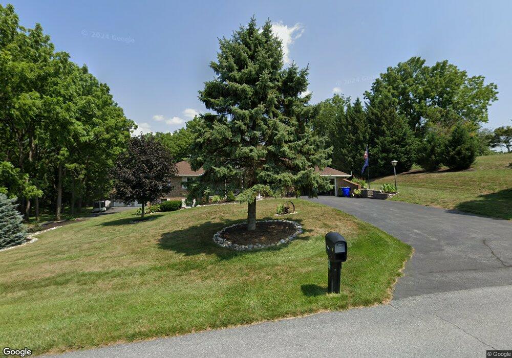
12150 Rosswood Dr Monrovia, MD 21770
Estimated Value: $557,925 - $698,000
--
Bed
2
Baths
1,742
Sq Ft
$357/Sq Ft
Est. Value
About This Home
This home is located at 12150 Rosswood Dr, Monrovia, MD 21770 and is currently estimated at $622,481, approximately $357 per square foot. 12150 Rosswood Dr is a home located in Frederick County with nearby schools including Green Valley Elementary School, Windsor Knolls Middle School, and Linganore High School.
Ownership History
Date
Name
Owned For
Owner Type
Purchase Details
Closed on
Aug 18, 2003
Sold by
Schwartzbeck Cecil L and Schwartzbeck Bettye B
Bought by
Markovich Joseph P and Markovich Linda J
Current Estimated Value
Purchase Details
Closed on
Mar 30, 1990
Sold by
Connor George J and Connor Suehonor H
Bought by
Schwartzbeck Cecil L and Schwartzbeck Bettye B
Home Financials for this Owner
Home Financials are based on the most recent Mortgage that was taken out on this home.
Original Mortgage
$200,000
Interest Rate
10.22%
Purchase Details
Closed on
Sep 6, 1989
Sold by
Hilton Robert
Bought by
Connor George J and Connor Suehonor H
Home Financials for this Owner
Home Financials are based on the most recent Mortgage that was taken out on this home.
Original Mortgage
$177,450
Interest Rate
10.22%
Create a Home Valuation Report for This Property
The Home Valuation Report is an in-depth analysis detailing your home's value as well as a comparison with similar homes in the area
Home Values in the Area
Average Home Value in this Area
Purchase History
| Date | Buyer | Sale Price | Title Company |
|---|---|---|---|
| Markovich Joseph P | $300,000 | -- | |
| Schwartzbeck Cecil L | $195,000 | -- | |
| Connor George J | $186,800 | -- |
Source: Public Records
Mortgage History
| Date | Status | Borrower | Loan Amount |
|---|---|---|---|
| Previous Owner | Schwartzbeck Cecil L | $200,000 | |
| Previous Owner | Connor George J | $177,450 | |
| Closed | Markovich Joseph P | -- |
Source: Public Records
Tax History Compared to Growth
Tax History
| Year | Tax Paid | Tax Assessment Tax Assessment Total Assessment is a certain percentage of the fair market value that is determined by local assessors to be the total taxable value of land and additions on the property. | Land | Improvement |
|---|---|---|---|---|
| 2025 | $5,578 | $491,433 | -- | -- |
| 2024 | $5,578 | $463,200 | $146,800 | $316,400 |
| 2023 | $5,150 | $437,500 | $0 | $0 |
| 2022 | $4,864 | $411,800 | $0 | $0 |
| 2021 | $4,614 | $386,100 | $121,400 | $264,700 |
| 2020 | $4,614 | $384,533 | $0 | $0 |
| 2019 | $4,596 | $382,967 | $0 | $0 |
| 2018 | $4,618 | $381,400 | $121,400 | $260,000 |
| 2017 | $4,493 | $381,400 | $0 | $0 |
| 2016 | $4,635 | $366,867 | $0 | $0 |
| 2015 | $4,635 | $359,600 | $0 | $0 |
| 2014 | $4,635 | $359,600 | $0 | $0 |
Source: Public Records
Map
Nearby Homes
- 12396 Lee Hill Dr
- 4799 Mid Lynn Ct
- 4786 Mid County Ct
- 4997 Tall Oaks Dr
- 5613 Bobolink Trail
- 4560 Lynn Burke Rd
- 308 E Wainscot Dr
- 25 W Main St
- 4936D Green Valley Rd
- 11705 Weller Rd
- 11397 Weller Rd
- 4920 Ed Mcclain Rd
- 4308 Moxley Valley Dr
- 11128 Worchester Dr
- 5633 Tessie Ct
- 4807 Railway Cir
- 12775 Barnett Dr
- 4105 Lynn Burke Rd
- 5518 Roy Ct
- 12192 Overlook Dr
- 12140 Rosswood Dr
- 12160 Rosswood Dr
- 12159 Rosswood Dr
- 12170 Rosswood Dr
- 0 Detrick Rd Unit 1006356802
- 1 Detrick Rd
- 0 Detrick Rd Unit 1007808870
- 0 Detrick Rd Unit 1001196059
- 0 Detrick Rd Unit 1009560962
- 0 Detrick Rd Unit 1004019504
- 12179 Rosswood Dr
- 12139 Rosswood Dr
- 12130 Rosswood Dr
- 12180 Rosswood Dr
- 12199 Rosswood Dr
- 12035 Greystone Dr
- 12027 Greystone Dr
- 12200 Rosswood Dr
- 12190 Rosswood Dr
- 12210 Rosswood Dr