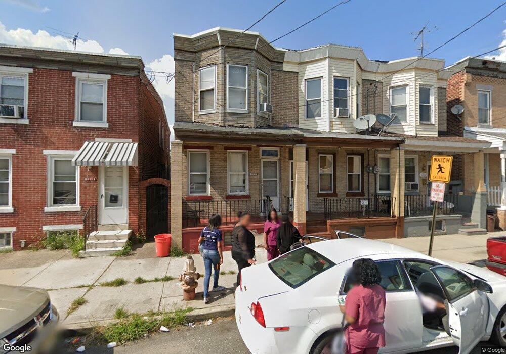
1217 1/2 Liberty St Camden, NJ 08104
Gateway NeighborhoodEstimated Value: $95,262 - $128,000
--
Bed
--
Bath
1,179
Sq Ft
$91/Sq Ft
Est. Value
About This Home
This home is located at 1217 1/2 Liberty St, Camden, NJ 08104 and is currently estimated at $107,754, approximately $91 per square foot. 1217 1/2 Liberty St is a home located in Camden County with nearby schools including Camden High School and Freedom Prep Charter School.
Ownership History
Date
Name
Owned For
Owner Type
Purchase Details
Closed on
Apr 28, 2000
Sold by
Dean Isaac L
Bought by
Goodwin Kevin L
Current Estimated Value
Home Financials for this Owner
Home Financials are based on the most recent Mortgage that was taken out on this home.
Original Mortgage
$38,139
Outstanding Balance
$13,223
Interest Rate
8.19%
Mortgage Type
FHA
Estimated Equity
$94,531
Create a Home Valuation Report for This Property
The Home Valuation Report is an in-depth analysis detailing your home's value as well as a comparison with similar homes in the area
Home Values in the Area
Average Home Value in this Area
Purchase History
| Date | Buyer | Sale Price | Title Company |
|---|---|---|---|
| Goodwin Kevin L | $38,500 | -- |
Source: Public Records
Mortgage History
| Date | Status | Borrower | Loan Amount |
|---|---|---|---|
| Open | Goodwin Kevin L | $38,139 |
Source: Public Records
Tax History Compared to Growth
Tax History
| Year | Tax Paid | Tax Assessment Tax Assessment Total Assessment is a certain percentage of the fair market value that is determined by local assessors to be the total taxable value of land and additions on the property. | Land | Improvement |
|---|---|---|---|---|
| 2025 | $1,382 | $39,000 | $5,600 | $33,400 |
| 2024 | $1,336 | $39,000 | $5,600 | $33,400 |
| 2023 | $1,336 | $39,000 | $5,600 | $33,400 |
| 2022 | $1,311 | $39,000 | $5,600 | $33,400 |
| 2021 | $1,306 | $39,000 | $5,600 | $33,400 |
| 2020 | $1,240 | $39,000 | $5,600 | $33,400 |
| 2019 | $1,188 | $39,000 | $5,600 | $33,400 |
| 2018 | $1,181 | $39,000 | $5,600 | $33,400 |
| 2017 | $1,152 | $39,000 | $5,600 | $33,400 |
| 2016 | $1,116 | $39,000 | $5,600 | $33,400 |
| 2015 | $1,074 | $39,000 | $5,600 | $33,400 |
| 2014 | $1,048 | $39,000 | $5,600 | $33,400 |
Source: Public Records
Map
Nearby Homes
- 1238 Haddon Ave
- 1218 1/2 Atlantic Ave
- 1224 Chestnut St
- 1140 Kaighn Ave
- 1169 Lansdowne Ave
- 1167 Lansdowne Ave
- 1165 Lansdowne Ave
- 1249 Kenwood Ave
- 1261 Kenwood Ave
- 1137 Sycamore St
- 1361 Kaighns Ave
- 1386 Haddon Ave
- 1268 Kenwood Ave
- 1327 Lansdowne Ave
- 1326 Princess Ave
- 1367 Kenwood Ave
- 1275 Everett St
- 1138 Langham Ave
- 1433 Haddon Ave
- 1476 Mount Ephraim Ave Unit 3
- 1217 Liberty St
- 1219 Liberty St
- 1215 Liberty St
- 1221 Liberty St
- 1213 Liberty St
- 1211 Liberty St
- 1225 Liberty St
- 1209 Liberty St
- 1227 Liberty St
- 1207 Liberty St
- 1229 Liberty St
- 1205 Liberty St
- 1233 Liberty St
- 1203 Liberty St
- 1218 Liberty St
- 1214 Liberty St
- 1208 Liberty St
- 1201 Liberty St
- 1212 Liberty St
- 1235 Liberty St