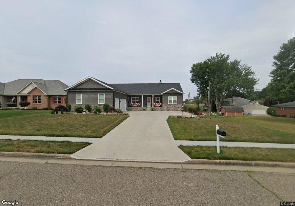
1217 S Marion Ave Louisville, OH 44641
Estimated Value: $352,000 - $436,000
3
Beds
3
Baths
2,328
Sq Ft
$169/Sq Ft
Est. Value
About This Home
This home is located at 1217 S Marion Ave, Louisville, OH 44641 and is currently estimated at $393,588, approximately $169 per square foot. 1217 S Marion Ave is a home with nearby schools including Louisville High School and St. Thomas Aquinas High School & Middle School.
Ownership History
Date
Name
Owned For
Owner Type
Purchase Details
Closed on
Jan 6, 2020
Sold by
Duplain Louis C and Duplain Polly A
Bought by
Kolbi Matthew J and Sylvester Alexiss L
Current Estimated Value
Purchase Details
Closed on
Feb 2, 2007
Sold by
Miranoma Inc
Bought by
Duplain Louis C and Duplain Polly A
Create a Home Valuation Report for This Property
The Home Valuation Report is an in-depth analysis detailing your home's value as well as a comparison with similar homes in the area
Home Values in the Area
Average Home Value in this Area
Purchase History
| Date | Buyer | Sale Price | Title Company |
|---|---|---|---|
| Kolbi Matthew J | $36,500 | None Available | |
| Duplain Louis C | $35,000 | Attorney |
Source: Public Records
Tax History Compared to Growth
Tax History
| Year | Tax Paid | Tax Assessment Tax Assessment Total Assessment is a certain percentage of the fair market value that is determined by local assessors to be the total taxable value of land and additions on the property. | Land | Improvement |
|---|---|---|---|---|
| 2025 | -- | $139,650 | $19,740 | $119,910 |
| 2024 | -- | $139,650 | $19,740 | $119,910 |
| 2023 | $5,043 | $117,390 | $18,620 | $98,770 |
| 2022 | $5,050 | $117,390 | $18,620 | $98,770 |
| 2021 | $5,026 | $117,390 | $18,620 | $98,770 |
| 2020 | $348 | $8,400 | $8,400 | $0 |
| 2019 | $555 | $13,410 | $13,410 | $0 |
| 2018 | $553 | $13,410 | $13,410 | $0 |
| 2017 | $505 | $11,800 | $11,800 | $0 |
| 2016 | $515 | $11,800 | $11,800 | $0 |
| 2015 | $517 | $11,800 | $11,800 | $0 |
| 2014 | $480 | $10,190 | $10,190 | $0 |
| 2013 | $243 | $10,190 | $10,190 | $0 |
Source: Public Records
Map
Nearby Homes
- 2110 Edmar St
- 1715 High St
- 1812 E Broad St
- 641 S Nickelplate St
- 908 Sand Lot Cir
- 3390 Meese Rd NE
- 520 S Silver St
- 308 Superior St
- 728 E Broad St
- 2015 E Main St
- 0 Michigan Blvd
- 510 S Bauman Ct
- 204 E Broad St
- 8225 Georgetown St
- 107 E Broad St
- 1702 View Pointe Ave
- 325 Lincoln Ave
- 1639 Horizon Dr
- 1170 Winding Ridge Ave
- 910 Crosswyck Cir
- 1227 S Marion Ave
- 1728 Edmar St
- 1718 Edmar St
- 1218 S Marion Ave
- 1708 Edmar St
- 1237 S Marion Ave
- 1804 Edmar St
- 1228 S Marion Ave
- 1638 Edmar St
- 1731 Edmar St
- 1635 Presidents Square Unit 48
- 1641 Presidents Square Unit 49
- 1719 Edmar St
- 1247 S Marion Ave
- 1647 Presidents Square Unit 50
- 1816 Edmar St
- 1709 Edmar St
- 1805 Edmar St
- 1244 S Marion Ave
- 1628 Edmar St