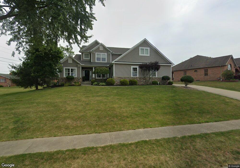
1218 S Marion Ave Louisville, OH 44641
Estimated Value: $356,000 - $493,000
4
Beds
3
Baths
3,079
Sq Ft
$146/Sq Ft
Est. Value
About This Home
This home is located at 1218 S Marion Ave, Louisville, OH 44641 and is currently estimated at $449,807, approximately $146 per square foot. 1218 S Marion Ave is a home located in Stark County with nearby schools including Louisville High School and St. Thomas Aquinas High School & Middle School.
Ownership History
Date
Name
Owned For
Owner Type
Purchase Details
Closed on
Mar 16, 2007
Sold by
Miranoma Inc
Bought by
Roberts Robert C and Roberts Amanda K
Current Estimated Value
Home Financials for this Owner
Home Financials are based on the most recent Mortgage that was taken out on this home.
Original Mortgage
$29,750
Interest Rate
6.4%
Mortgage Type
Purchase Money Mortgage
Create a Home Valuation Report for This Property
The Home Valuation Report is an in-depth analysis detailing your home's value as well as a comparison with similar homes in the area
Home Values in the Area
Average Home Value in this Area
Purchase History
| Date | Buyer | Sale Price | Title Company |
|---|---|---|---|
| Roberts Robert C | $35,000 | Attorney |
Source: Public Records
Mortgage History
| Date | Status | Borrower | Loan Amount |
|---|---|---|---|
| Closed | Roberts Robert C | $29,750 |
Source: Public Records
Tax History Compared to Growth
Tax History
| Year | Tax Paid | Tax Assessment Tax Assessment Total Assessment is a certain percentage of the fair market value that is determined by local assessors to be the total taxable value of land and additions on the property. | Land | Improvement |
|---|---|---|---|---|
| 2025 | -- | $164,260 | $21,250 | $143,010 |
| 2024 | -- | $164,260 | $21,250 | $143,010 |
| 2023 | $5,154 | $119,990 | $20,060 | $99,930 |
| 2022 | $5,162 | $119,990 | $20,060 | $99,930 |
| 2021 | $5,177 | $119,990 | $20,060 | $99,930 |
| 2020 | $4,435 | $111,690 | $18,060 | $93,630 |
| 2019 | $4,702 | $117,920 | $18,060 | $99,860 |
| 2018 | $4,684 | $117,920 | $18,060 | $99,860 |
| 2017 | $4,460 | $108,360 | $15,890 | $92,470 |
| 2016 | $4,552 | $108,360 | $15,890 | $92,470 |
| 2015 | $4,565 | $108,360 | $15,890 | $92,470 |
| 2014 | $244 | $93,660 | $13,720 | $79,940 |
| 2013 | $2,127 | $93,660 | $13,720 | $79,940 |
Source: Public Records
Map
Nearby Homes
- 2110 Edmar St
- 1715 High St
- 1812 E Broad St
- 641 S Nickelplate St
- 908 Sand Lot Cir
- 3390 Meese Rd NE
- 520 S Silver St
- 308 Superior St
- 728 E Broad St
- 2015 E Main St
- 0 Michigan Blvd
- 510 S Bauman Ct
- 204 E Broad St
- 8225 Georgetown St
- 107 E Broad St
- 1702 View Pointe Ave
- 325 Lincoln Ave
- 1639 Horizon Dr
- 1170 Winding Ridge Ave
- 910 Crosswyck Cir
- 1228 S Marion Ave
- 1804 Edmar St
- 1728 Edmar St
- 1217 S Marion Ave
- 1816 Edmar St
- 1227 S Marion Ave
- 1244 S Marion Ave
- 1237 S Marion Ave
- 1718 Edmar St
- 1805 Edmar St
- 1247 S Marion Ave
- 1731 Edmar St
- 1817 Edmar St
- 1819 Hillocke St
- 1708 Edmar St
- 1836 Edmar St
- 1719 Edmar St
- 1827 Edmar St
- 1301 S Marion Ave
- 1804 Opal St